Slept well last night and woke about 8. We wondered why we have been “sleeping in” since we started this trip and then it dawned on us. Firstly, we’re a hour ahead so really it’s 7.00am GMT which is our normal time to wake up and secondly, the large hound who sleeps with us has stopped setting her alarm to ungodly hour and booping us for breakfast.
Today, we have a plan. First on the agenda is to do some laundry so I lugged our bag for the far side of the site (of course it would be), got some tokens, bunged the whole lot in the washer (coloured and whites so hope nothing runs) and pressed start. The washer whirred into life and flashed 45 mins on its little display. I waddled back to The Van where hubby was giving it a bit of a deep clean and put a timer on. Another waddle back to the laundry to put it in the dryer (the whites were still white, but now hoping nothing shrunk) and headed back for another 45 minutes. Basically it took all morning, I think I nearly did my daily quota of 10,000 steps, but at least we had clean clothes for another week and mission accomplished.
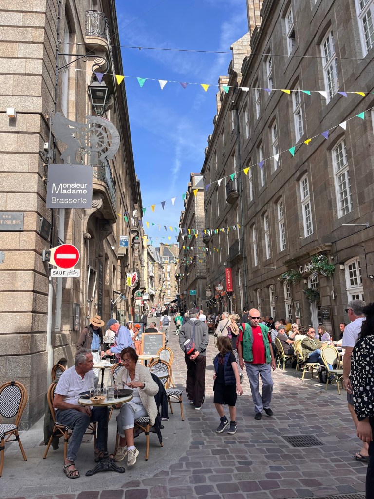
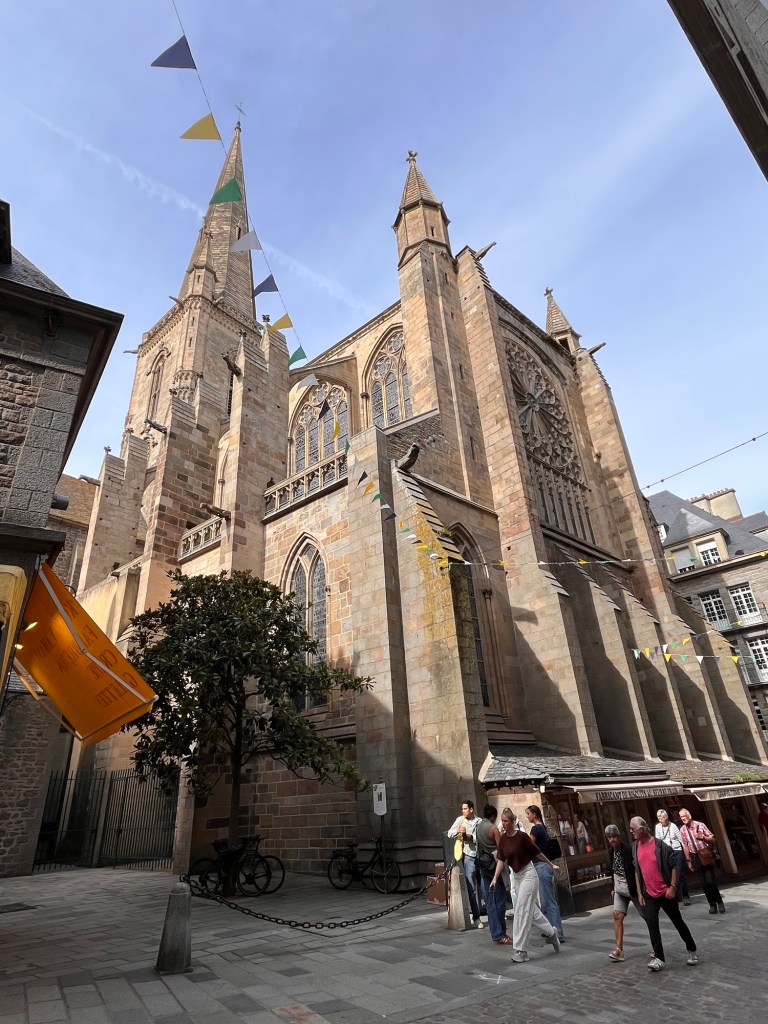
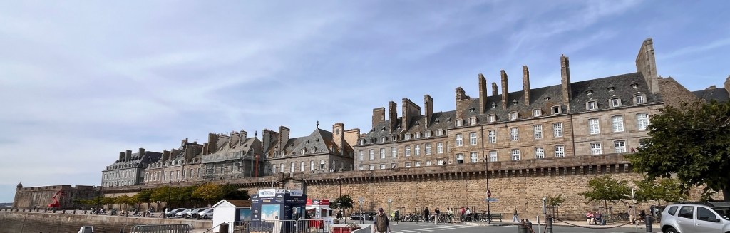
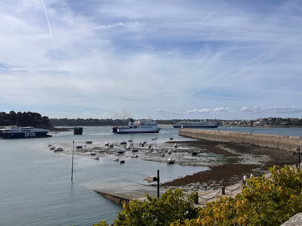
We decided to walk to the Intra-Muros, or the Old Town of St Malo, some 20 minutes away. We walked through the marina, skirted the little beach, negotiated the port entrance and finally ended up in front of the walled city. There was an archway that led into the streets, but we turned and took the steps up, so we could wander along the top of the walls and appreciate the splendid views across the bay. Various ships were crossing the estuary of the River Rance – catamarans, small sailing boats, a huge cruise ship, schooners, a DFDS ferry followed by a Brittany Ferry car ferry – it was very busy and they all had to negotiate the many outcrops of rocks and islands scattered around in the bay. We peered over the ramparts and watched people on the beach below – there didn’t seem to be any dogs, so The Pup was denied again. We wandered most of the way round, before we had to go down steps and back to the street level. Here it was very busy with restaurants and bars – their tables and chairs spilling out on the wide street. We stopped at one and ordered two beers which came with some peanuts and little biscuits and a pot of fish paste, relaxed in the sunshine and did a spot of people watching. The architecture was beautiful – it dates back to the 17th century, so there’s a lot of history. We carried on through the ancient streets, full of high end clothes shops, gift shops, patisseries, restaurants and much more. After a wander we came across a creperie and asked for a table for two. We ended up with a lemon and sugar crepe and a banana and chocolate washed down with coffee – again we sat outside and watched people. It was another fine day, weatherwise and quite warm. We had another little wander around and decided to head back to the campsite, but needed to visit a supermarket for food for The Pup. So we walked down the road into a small neighbourhood with a lovely little High Street, where we found a Carrefour City mini supermarket and bobbed in there. Then we wandered through the back streets back to the seafront -it was nice to see a local area rather than a tourist area – and sauntered back to the site. We checked out a couple of restaurants for a possible evening meal too.
Once back at the Van, we plopped into our chairs and enjoyed the late afternoon sun – so much that some of us had a little nap. Our little plan of walking back down the road and eating out didn’t seem so exciting now we were comfy, so we decided to cook in the Van – very glamourous: fish fingers, homegrown potatoes and a tin of baked beans. We know how to live it up!
A cat tried its chances and one of its nine lives, by sauntering past our Van’s side door, not realising there was 25kg of canine lying inside. The cat jumped and The Pup went to chase – heck! We shouted at Pup to stop and bless her, she did and I grabbed her collar, though I felt her pull a couple of times. A little bit of excitement! Thank goodness, The Pup is so obedient!
After tea and a cuppa, and the night closing in at 8:30, we shut up shop. We’re binge watching a TV series at the moment, so it’s nice to curl up. Tomorrow we plan to catch the ferry over to Dinard, across the River Rance, and spend the day over there.
I’ve eaten too much and drunk too much wine and now my stomach is churning! Urgh!
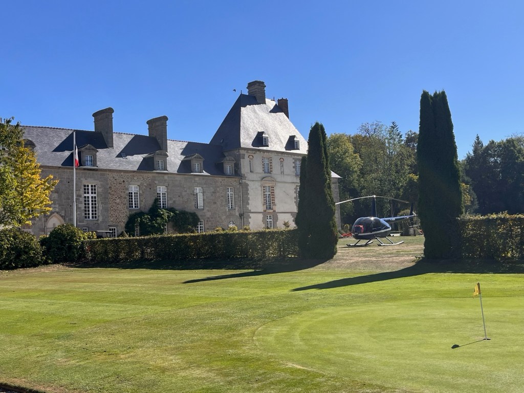
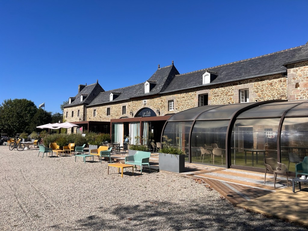
So we got up slowly and sat in the early morning sun – it was quite warm already. Our friend dropped by with croissants and a baguette for our breakfast and we promised to meet them later. So we sat quietly until noon, when we packed away and drove The Van to our friend’s little cabin – we then wandered to the golf club and had a coffee on the terrace. Just across the grass was the owner’s chateau and his helicopter parked in his front/back garden. Whoa!
After our coffee, we realised that we needed to drop off the key fob that reception had given us yesterday. We didn’t want to incur any more charges, so the boys went back to The Van to retrieve it and headed to reception while us ladies sat down and had a bit of a natter, and the dogs sunned themselves on the patio.
The boys returned and we had a nice picky lunch together. It was soon mid afternoon and we really needed to be heading off to our next campsite in St Malo, so we said our goodbyes, gave their dog a final belly scratch and headed off. We only had about 38 kms to go – about half an hour and soon we were in St Malo, the satnav taking us down some really narrow streets (the times it takes off us the main road, down through many back streets and bobs us out the other end, when sticking to the main road would be such a better idea. Maybe it shaves ten metres off the route or saves 30 seconds, we’re not really sure, but its logic is certainly questionable). We ended up at the Cite d’Alet Municipal campsite, on a peninsular overlooking the River Rance and the English Channel and very close to the Old Town. It was a perfect spot. We managed to secure a fabulous little pitch, in a little corner where we could see the sea, so we wouldn’t have any traffic passing. It was a bit tight to get in and we needed the blocks under the tyres to level us out, but apart from that, it was just right.
We chilled, fed the very hungry hound, had a cuppa and checked out the facilities. We were going to stay here for three nights and had a bit of a plan. Do the laundry (top priority as we had only bought a weeks’ worth of clothes with us), a wander into town with lunch, maybe get some provisions and see where we end up and on the following day, catch the ferry across to Dinan and spend the day there (the ferry allows dogs of any size – whoop whoop, a win!)
We had unwound the Van’s awning and sat outside and then as darkness fell, we video called family back home to catch up on any gossip. The wind had got up and we could the awning whipping outside. Eeek! We wound it back in and moved the table – just had visions of stuff being blown over and hitting the Van. We retreated indoors and made ourselves a cuppa, looking forward to tomorrow and having a wander around town.
We’re back on the road today heading towards Brittany.
We skipped breakfast and packed up the Van. L’Hydro is a nice campsite – it’s only fault that there’s no loo paper in the cubicles, not even a loo roll holder, so need to take your own. All a bit weird. Perhaps people have been pinching it.
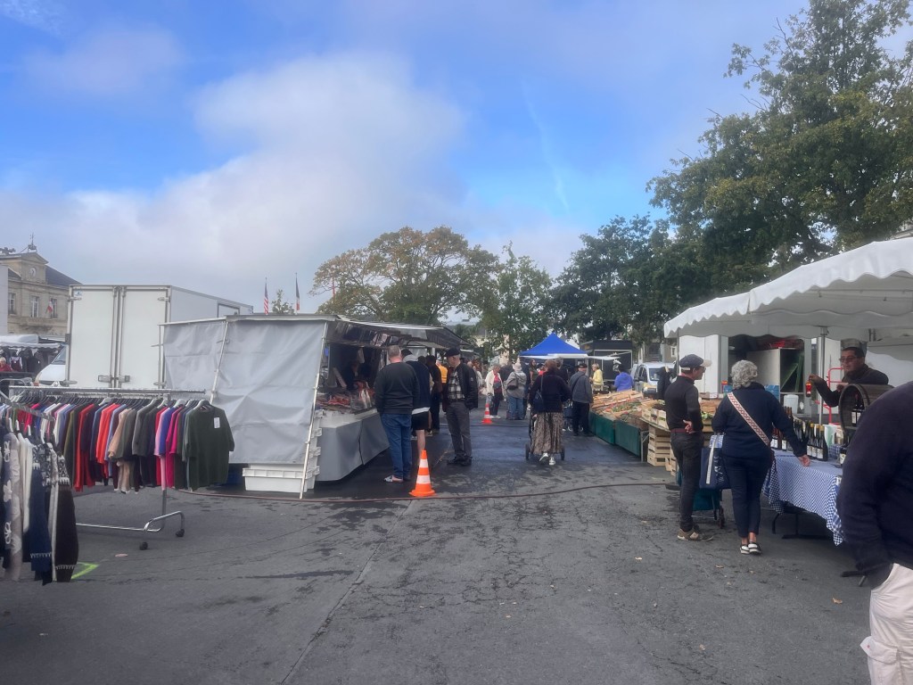
So we headed off, it’s very misty with a hazy sunshine and heavy dew – very autumnal. It makes the countryside very magical. The satnav has decided to take us down some tiny little roads, just to test our width I presume. There’s a little bit of stopping to let cars pass, but not too much drama. We passed through the little town of Le Molay Littry and much to our delight, they had a street market. A quick google search for car parks and we soon squeezed ourselves into a space in the car park. We strolled over to the first stall selling live chickens and turkeys, all stuffed in crates, clucking furiously – I felt very sorry for them. (you want to buy them all and open a bird sanctuary – it doesn’t help that our daughter’s solitary chicken rules the roost at our house and is almost a pet. A very cheeky character!)
We continued our sauntering around the market, mainly vegetable stalls and clothing. We wanted to get some veggies, but only had a €100 note! We knew the stall holders wouldn’t take it, so we went to a bank to try and change it into smaller dominations. The bank had no cashiers, just a couple of staff in offices to talk about all your financial matters except offer an actual banking service. Well, at least it’s happening in Europe too and not just the UK – we should have been thankful the town had a branch!
So we wandered back to the Van wishing we had a vibrant little market like this and headed towards Brittany. A lot of dual carriageway driving got us to the coast and Mont St Michel hoved into view. It looked magnificent and we decided to check it out. We ended up in a vast car park with designated areas for various vehicles and found P8 for motorhomes and campers (or as the French say “camping cars”. Fabulous).
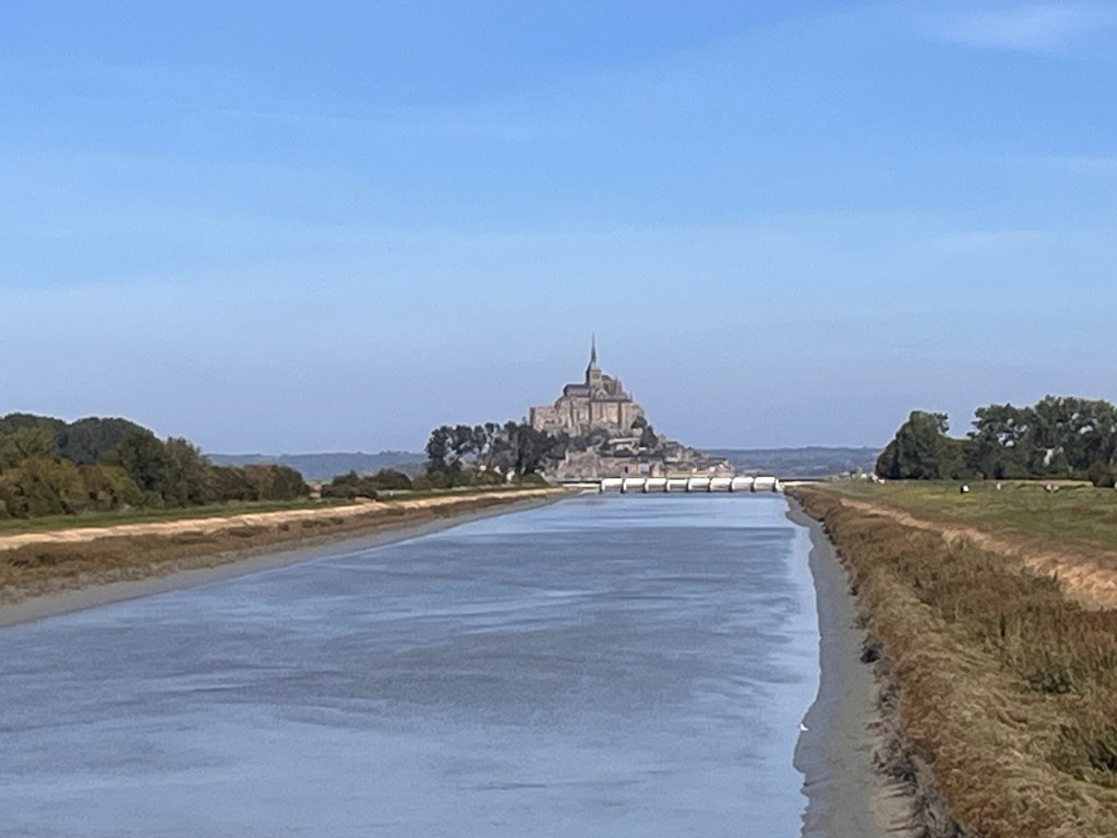
There was a barrier to enter and at this point, we decided to abandon going in and do a bit of research before we committed. Just down the road there was a huge biscuit shop – we parked in their ample parking area, bought some biscuits and put the kettle on. While we supped our cups of tea, we googled Mont St Michel. Parking there with a camper was €19.00 for three hours and a 45 minute walk to the Mont. There was a free shuttle bus, but guess what – no dogs unless you had a Yorkshire Terrier sized mutt. We concluded that Mont St Michel needed a bit of forward planning and a whole day for a visit. Maybe another time. We pulled out of the car park and within a mile crossed a bridge over a canal which had a little lay-by and a view of the Mont. Typical! Would have been so much nicer for our brew stop.
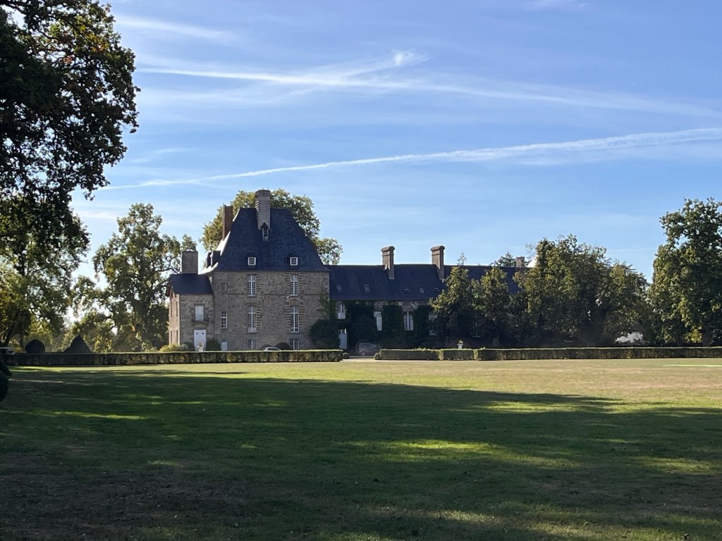
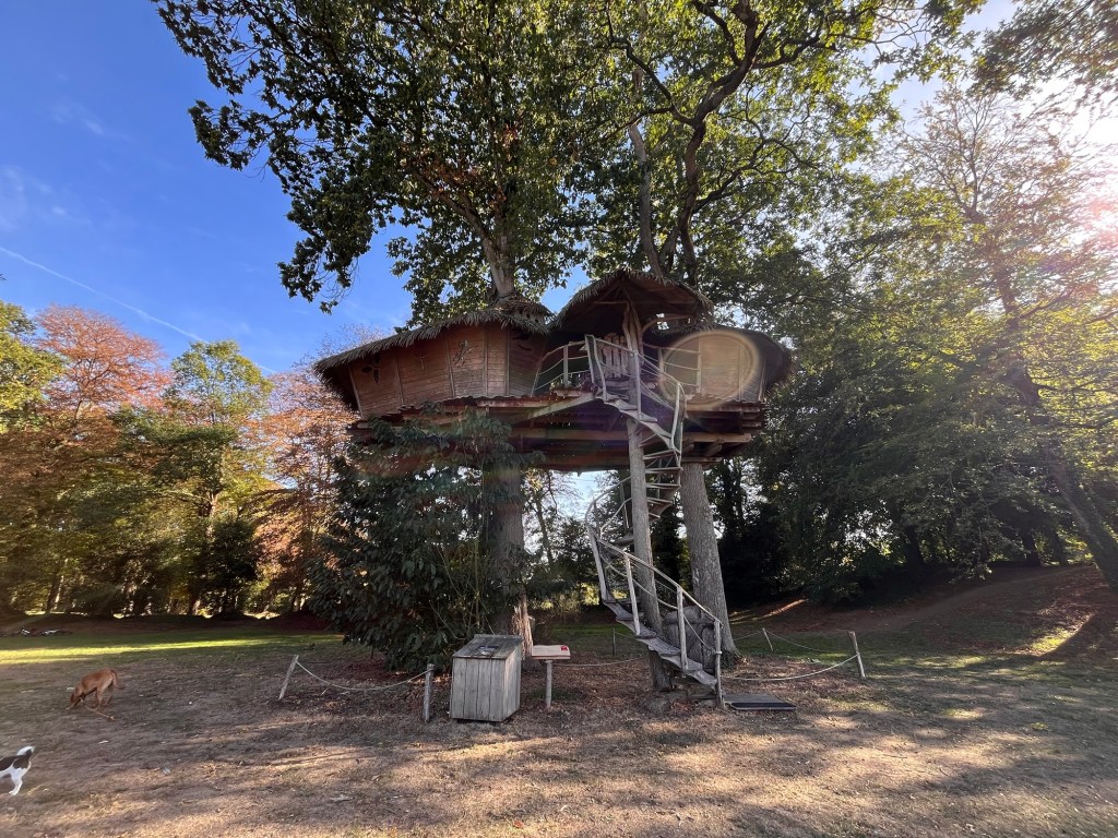
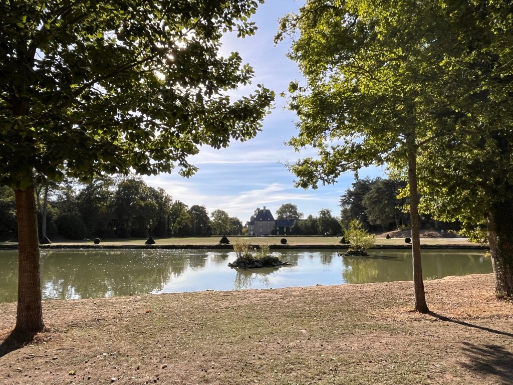
We headed to Les Ormes Domain and Resort where our friends were staying and pulled in. It’s quite expensive to stay here, but, as the title suggests, it is a resort. Think Centre Parcs and you won’t be far off. After catching up with our friends, we had a little wander around. There are cabins, motorhomes, thatched cabins (think the shires out of The Hobbit stories), treehouses (yes you read that right- tree houses high up in the trees – try getting your luggage up there and one had a rope ladder!) and Safari tents. It was very interesting – apparently it’s family owned and very well organised. There was a shopping area with a supermarket (very well stocked), restaurants, swimming pools, play areas and a Go Ape. It also had a fishing lake and a golf course. Wow.
We had a little chill outside the Van and then met up with our friends again for an evening meal which was very nice. It had been very hot today and as we walked back at 10pm, it was still quite warm. Not complaining about this weather. We sorted ourselves out and snuggled down to sleep.
Another nice day forecast, so we get ourselves organised. We plan to drive west, up the coast for a few kilometres and look at the various D-Day installations.
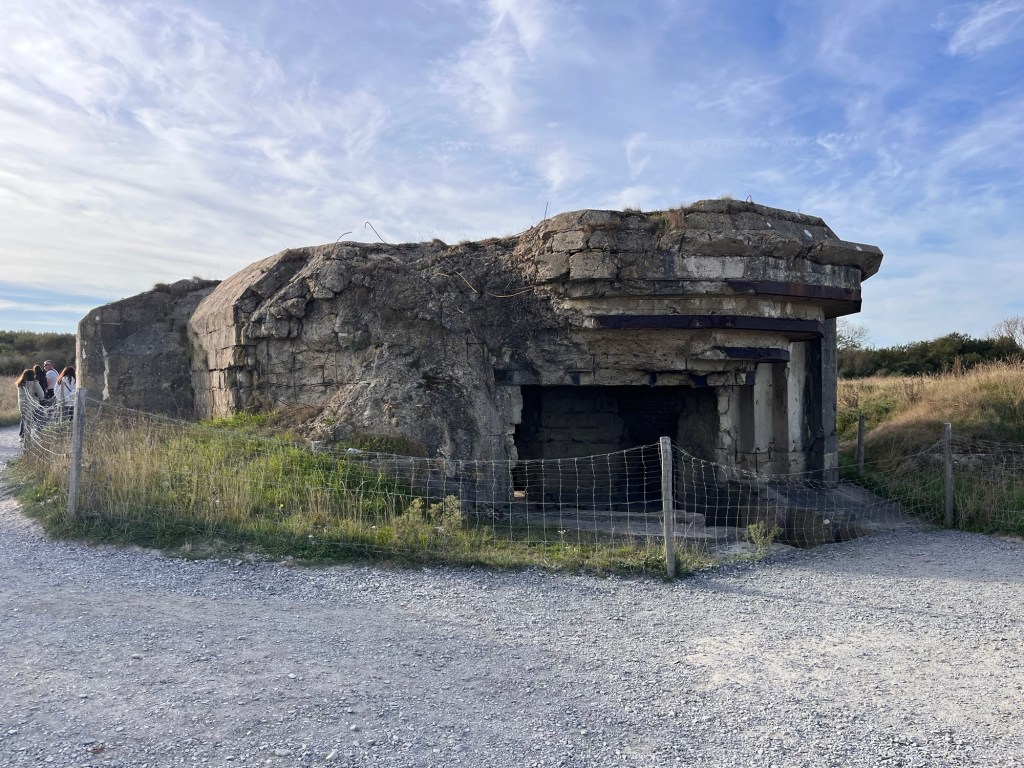
Our first port of call was the Pointe du Hoc, off the main road and leading to a generous car park with an area set aside for motorhomes and campervans. We parked up and tossed a coin of who would go first as dogs are not allowed on the site. Our last two attempts to leave The Pup in the Van while we had a wander around, have resulted in the alarm going off (we were shown, in the giddiness of picking up the Van, how to activate this particular sensor, but with one hundred other bits of important information to absorb, it didn’t quite stick) so we took it in turns to visit the site until we worked it out. I wandered down first, along a gravelly track with many other people and came across about six information boards with the stories of American servicemen who lost their lives trying to attack the German battery here. Apparently the Rangers scaled up the cliff in awful weather and under German fire to attack and miraculously managed to overcome the enemy, losing quite a few of their men in the process. A 23 year old losing his life on his 3rd wedding anniversary and a 17 year old – so tragic.
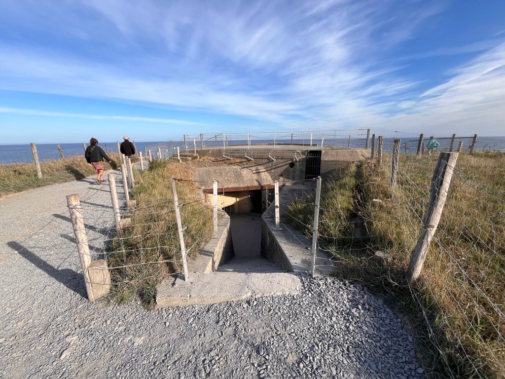
The Pointe du Hoc was strategic for the Germans as it covered both the Utah and Omaha beaches – the Allies knew that they would have to destroy it before D-Day for the mission to be successful. What’s left of Pointe du Hoc are numerous bomb craters and the remnants of the battery buildings, two of which are still standing and you are able to enter. Inside these things, there is no natural light, with low ceilings and concrete walls – it was quite eerie even with people wandering around, so to imagine being stationed here. I overheard a tourist guide that they think that German bodies still lie under the destroyed ones. As there are still live armaments and unexploded bombs scattered in the vicinity, you follow a fenced path passing craters and destroyed battery placements right up to the cliff edge where there is an intact battery, overlooking the sea through a concrete slit.
I wandered back just as huge tourist coaches disgorged their passengers, greeted by tourist guides and taken around the site. There were also smaller private minibuses with a couple of passengers aboard who were also escorted around Pointe du Hoc. It was interesting to watch all the human activity and the variety of vehicles entering. The Pup sat in the passenger seat and received a lot of waves and smiles from passing tourists.
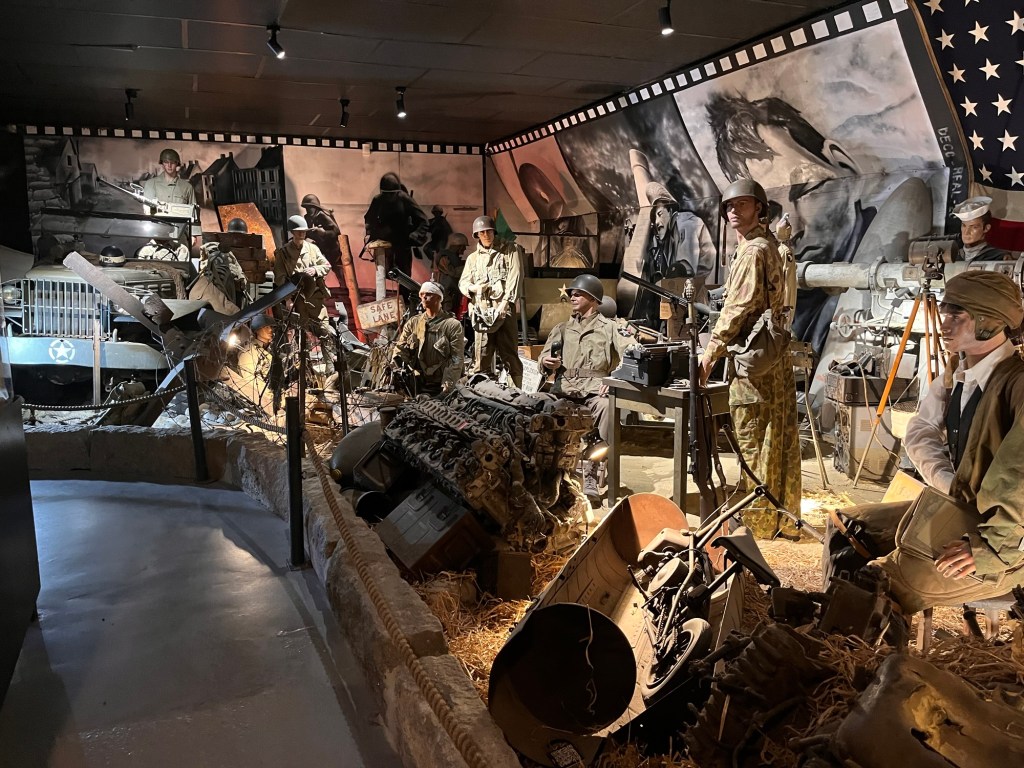
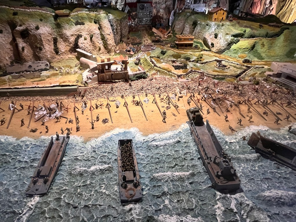
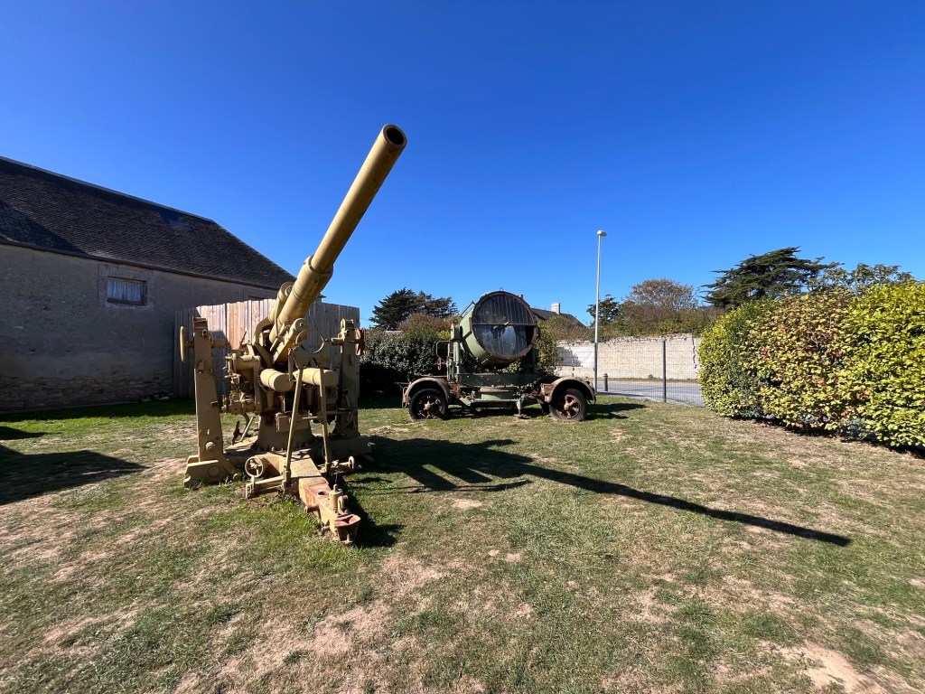
Our next stop was the D-Day Museum as we worked our way back east. On the main road, just east of Saint Laurent sur Mer, it’s a family run affair with an enormous array of World War Two artefacts and memorabilia, from artillery guns rescued from frigates, jeeps, searchlights to uniforms, ammunition and so much more. There was so much that you couldn’t really take it all in. You could also watch a film, but we declined that, happy to just wander around and read the information boards, sauntering outside to find out about the unsung heroes like the Resistance before deciding to have a spot of lunch at their cafe. We ordered a veggie Croc Monsieur with frites and a couple of coffees – it wasn’t exactly haute cuisine, but it filled a hole. Having exhausted everything that the museum could offer, we headed back onto the road and our next stop.
The family run D-Day Museum
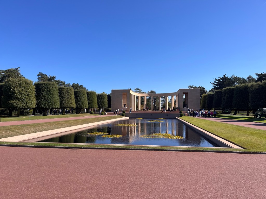
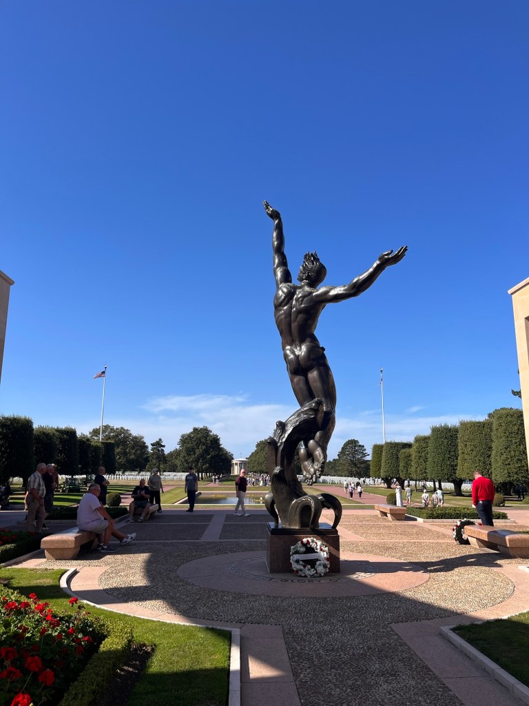
We passed the bigger Overlord museum, a huge grey monolithic building sat by a roundabout and headed to the Normandy American Cemetery in Colleville sur Mer – again turning off left down to its entrance. This was a major tourist spot with the landscaped car park split into three areas for coaches, campervans and cars. Again, we took turns as no dogs were allowed into the cemetery, so I wandered down, past an elegant grey futuristic visitor centre and a beautiful infinity pool overlooking the sea. Following the path round, there was a overhang where people were gathering and looking down onto Omaha beach, where we walked along yesterday. Opposite was a pathway leading to a beautiful sandstone memorial, surrounding a stunning sculpture. On the walls of the memorial were military operation maps and turning to look down the cemetery, a beautiful reflection pool and beyond the gravestones of over 9,000 American servicemen.
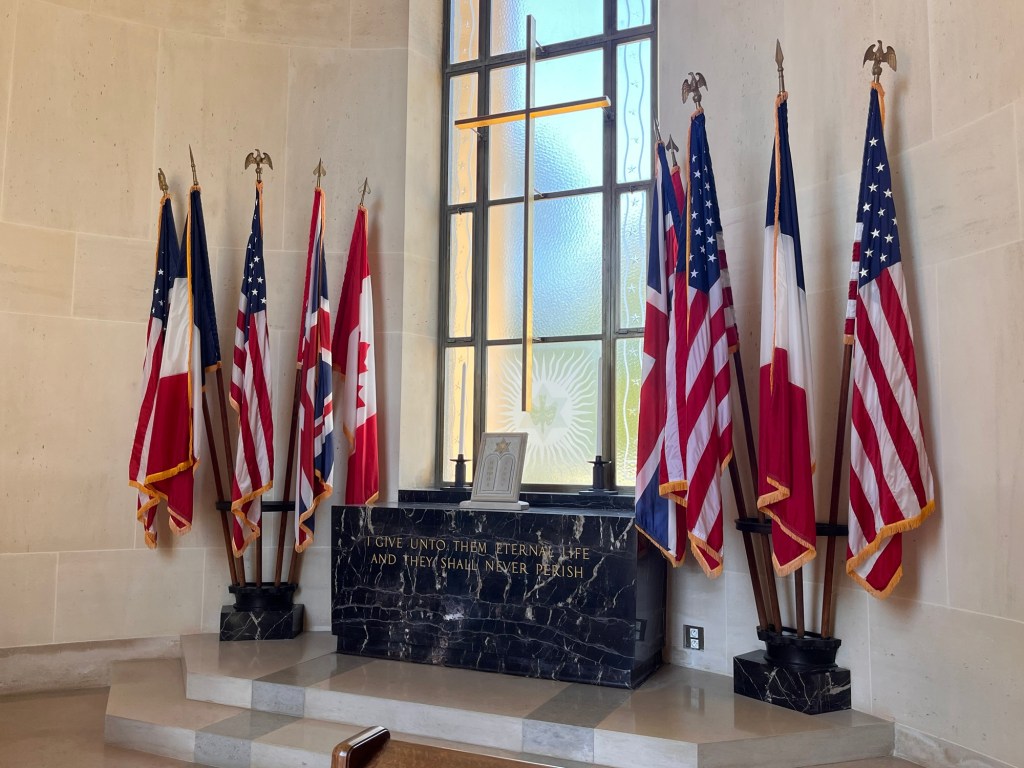
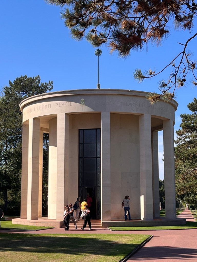
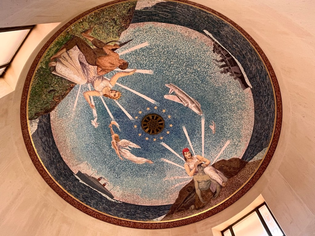
I wandered down towards the circular chapel and went inside, a quiet reverence hung in the air. The flags of America, Canada, Great Britain and France hung in front of us underneath a beautiful fresco ceiling. Though it was an American cemetery and we had no family connection to it, it was still very moving – these were men who never made it back home, like thousands and thousands of other military personnel, cut down in the most appalling situation possible and in the prime of their lives.
The Memorial
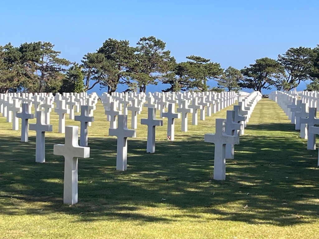
I strolled back up, looking at the gravestones all lined up in regimental rows, overlooking the English Channel and wondered how many of these men died on the beach below. In amongst the thousands of white crosses, there was the occasional Star of David which I found very pleasing, a nod to the Jewish servicemen. It was a very beautiful, extraordinary place and as I wandered back to the Van, I shook my head that we hadn’t learnt any lessons from two world wars and that America, in particular, had become embroiled in many conflicts since 1945.
Inside the circular chapelThe ChapelThe fresco ceiling
We left, deep in thought, and headed to the village of Port en Bessin Happain, dropping down into the town centre. We followed the campervan signs (getting the hang of this now) and pulled up at a barrier. It was actually a camping aire with spaces for 25 campers and was basically a gravelly car park with campervan facilities. We ended up paying 11 Euros (including a cheeky local tax) to get in, but incredibly cheap for an overnight stay. (you could stay for up to 72 hours). We parked up and waddled into town – it’s a working fishing village, so there was a harbour, a fish market and numerous fishing boats waiting for the tide to come in. We wandered around the shops, finding a nice little restaurant bar for a cheeky pint, sitting under an awning and people watching. There seemed to be just one waitress, efficiently delivering menus, taking orders and dropping off food and drink to the relevant tables – and doing a fantastic job. The Pup got made a fuss of by some Americans and the passing public too, admiring her beautiful colouring. A few French people have struck up conversation with me, obviously talking about our Pup which is lovely, but behind my smile, I’m thinking “I can’t understand a word you’re saying” – it’s always been my biggest Achilles heel with languages, my inability to pick up the spoken word. My first line of defence is to smile and declare that I am English and I’m rubbish at French, (though I will still have a go at speaking the language albeit badly). They are usually asking what breed she is (or as one man asked today “her race” which made me smile) so I have learnt to say what breed she is, her age and she’s very laidback in French. Feeling chuffed with myself, the French then usually revert into English. 🙈. (I suppose we all need to practice).
After a bit more shuffling around town, we decided we wanted to eat here, but we were far too early. So we headed back to The Van and chilled for an hour or so, made ourselves look presentable and sauntered back to a small intimate fish restaurant we had found. We had no table reservation, but they slotted us and The Pup at a table by the window (perfect) and presented us with menu and wine list. We enjoyed a seafood platter and a pile of mussels with a couple of glasses of wine while The Pup slept by our feet. We fell into conversation with an American couple at the next table who made a great fuss of Pup before The Pup heard a low whistle from a fellow diner and headed off to another table for more adulation. We managed to stop her doing a full tour of the restaurant.
We bade goodbye to our fellow diners and the maitre d’ before walking up the darkened street to the van park. We had a slight panic when we approached the barrier and it refused to rise up and let us out – we’re we stuck in here for the night? I jumped out to the ticket machine which had instructions on how to escape – a few taps on the screen, the barrier rose and we were free.
We drove back along dark roads to the campsite and parked up. We had new neighbours. We sat for a while before finally retiring to bed. Tomorrow we head down towards St Malo and Mont St Michel before staying with some friends.
We’re going to have a quiet day today. No driving, maybe a walk, just some downtime.
It’s a glorious morning, so we sat outside The Van after yet another breakfast of croissants and pain du chocolats (oops) washed down with a cuppa, soaking up the warm sunshine. Somehow we frittered the morning away without really doing anything which actually was very nice. We decided, about lunchtime, to go for a walk on the beach, some 20 minutes walk away as The Pup deserved a beach after being so cruelly denied yesterday. She’s a fantastic travelling companion, sleeping on her mat when we’re driving and no hassle. She was overdue a big reward.
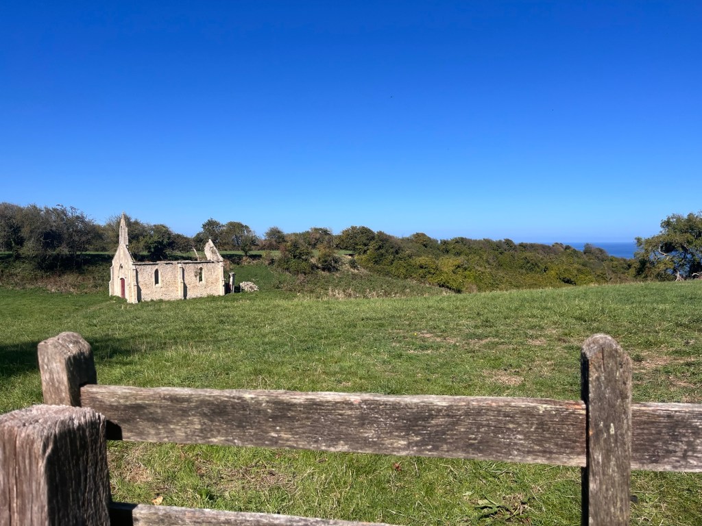
St Simeon church
So we set off down the road that runs down the side of our campsite and followed it until we came to a gravel car park. We passed the roofless St Simeon Church sat forlornly in a field and wondered if it was a casualty of the Landings (the information board didn’t say) We walked through the car park and forked left down a gravelly track through woodland and dappled sunshine. We popped out between two little houses which overlooked the English Channel and onto a little clifftop – we spent a couple of minutes looking for a suitable path that led us onto the beach and then we unleashed The Pup.
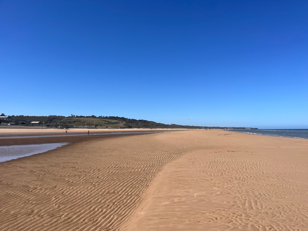
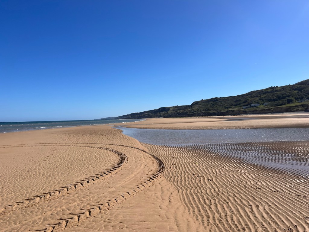
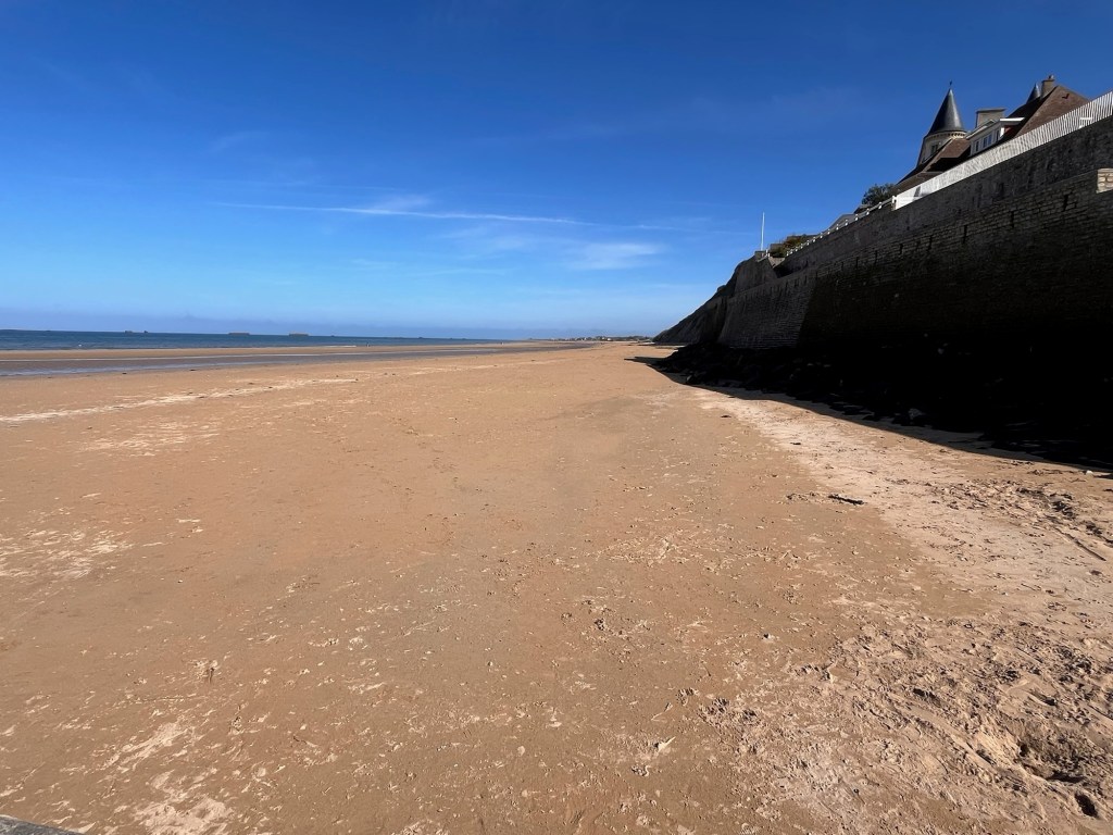
One of the great things about owning a dog is being part of their sheer delight on running free on a big wide open beach with the sea crashing in. She had the biggest grin on her face as she gambolled around so happily. This was Omaha Beach, again one of the 1944 D-Day beaches along this coastline. It was absolutely stunning – soft golden sand as far as the eye could see – and with the sun shining, it looked fabulous.
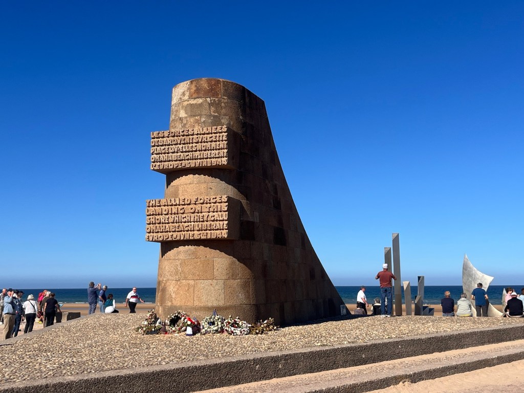
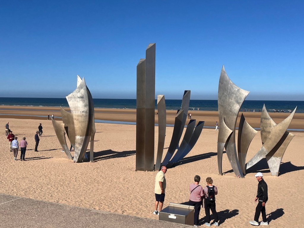
We took our shoes and socks off and followed The Pup into the shallow surf and sauntered along. We walked past a large sports complex with sand yachts sitting on the sand and spotting a small village in the distance, decided to walk there hoping there would be a cafe for a late lunch. It seemed to take ages to get there, but finally we walked up the slipway and found ourselves on the busy seafront of Saint Laurent sur Mer, dominated by a large stone monument (Monument Signal d’Omaha Beach) and a steel sculpture (Les Braves) embedded in the sand, dedicated to the fallen D-Day soldiers. Set back were about four or five large coaches disgorging many tourists who made an immediate beeline to these two structures. We just wanted something to eat and headed to The D-Day House restaurant where we sat outside under a parasol and tortured the waiting staff with our French.
Les Braves
The Pup sunk two bowls of water before collapsing on the sun drenched grass to recharge while we did our own sinking of a pint and two rather large burgers and fries. Suitably replenished, we joined the hordes of coach tourists to admire the two sculptures and heard a lot of American accents – Omaha was the responsibility of the Americans as part of the D-Day Landings. We didn’t linger long as Saint Laurent is just a quiet village by the sea and we had a long walk back – we had walked over 3.5 miles to get here. So we wandered back down onto the beach trying to imagine being a soldier landing here on this open expanse of sand ,where now people wandered leisurely, enjoying the late afternoon sun. We had a lot to thank them for.
The Pup was running out of steam, walking rather running madly, ignoring the seabirds. We found our little gap to get us back up to our little track and walked steadily back. The Pup sunk another two bowls of water and scoffed her dinner, before retiring on our bed in the back of the Van. We enjoyed the early evening sun until it started getting chilly and we headed indoors for a light tea. We had walked over 7.5 miles, The Pup probably double that including being chased by a greyhound – no wonder she was sound asleep. We wouldn’t be far behind.
Tomorrow, we have a few places to check out around here, so back in the Van. It looks like another hot day too.
Woke up a bit later than usual and was a tad bit laid back this morning. We had a bit of a jump over towards Bayeux today.
I went to have a shower and was a bit alarmed to find the showers and toilets were both unisex. Camping washrooms aren’t my favourite places at the best of times, so I recoiled slightly. It wasn’t busy so I had the room to myself which was a relief – the shower did finally warm up, though its jet was so strong, it flooded the cubicle and my Crocs!
Our first job of the day was to head back to a nearby caravan showroom before we continued our trip – we are in need of a folding step to get into bed easier, (it’s a big high up and not easy to launch into) a stiff brush to remove The Pup’s ginger fur off the carpet and a hose to fill our water tank. All these new niggly issues thrown up with a new camper, though you will be pleased to hear that we’ve finally stopped re-arranging and moving things, happy where everything is though we still have occasional moments of “where is the ……….” or “what box is the ………” followed by a bit of rummaging.
Anyway, the caravan place was shut on Mondays, so with a Gaelic shrug of the shoulders, we retraced our steps back towards the campsite so that satnav would pick the original plumbed in route and we wouldn’t fall foul of Rouen’s ZFE emissions zone. We finally decided not to go into the city centre -whatever plan we thought of was either too much hassle or just impossible with a large van, the ZFE and a pooch in the equation. (I won’t bore you with the finer details). So we headed west towards Bayeux, avoiding the motorways and taking the more scenic route.
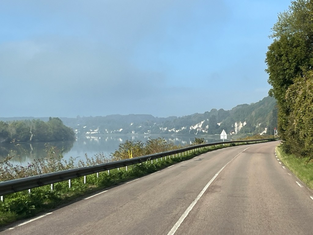
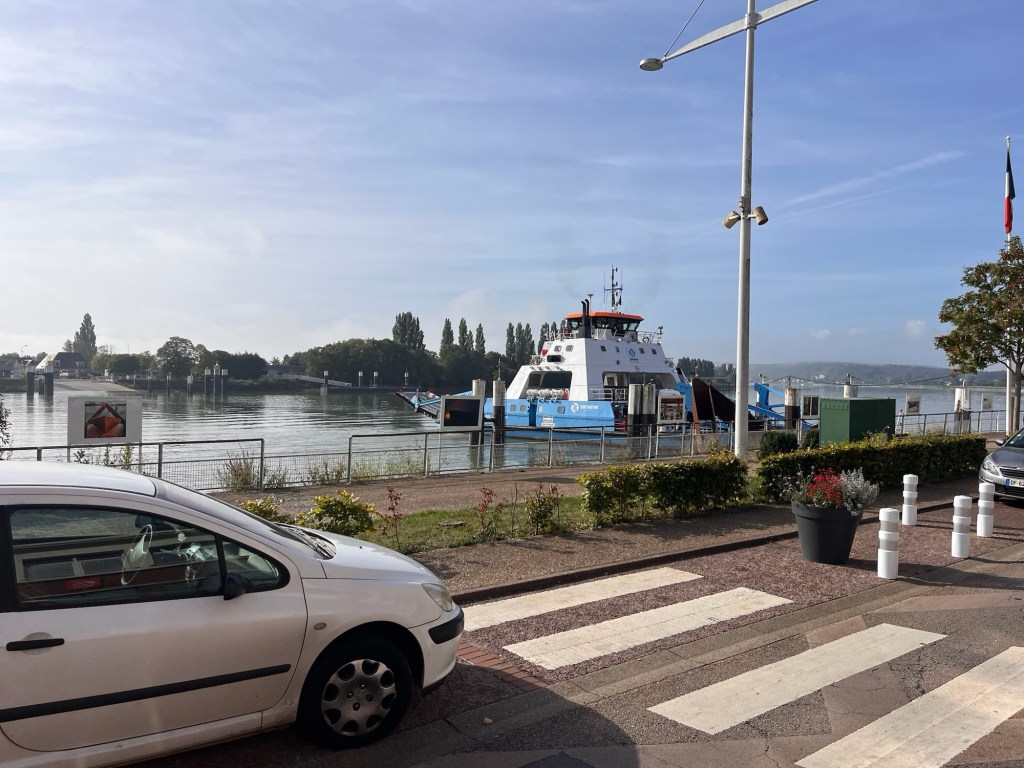
We hadn’t gone far when we came across the banks of the River Seine with houses backing onto chalky cliffs. It was all very pretty with an early morning mist lingering. It was a typical September morning – hazy sunshine and the trees just starting to turn. We passed through Duclair village with the ferry chugging across the Seine connecting the village to the south bank – it was well used with cars, HGV’s and a tractor tugging a trailer piled high with potatoes coming off the ferry as we sat at the traffic lights watching!
We crossed the fabulous Bridge of Botonne a little further along, a magnificent structure that reminded us of the Dartford Crossing Bridge, but surrounded by autumnal fields and woods rather heavy industry. The rest of journey was through pretty countryside, woodlands and deep valleys, pulling out onto high plateaus of industrial sized fields. There were quite a few half timbered houses, some even thatched. A few had fallen into disrepair which was a shame – they were very pretty.
We went through a couple of busy towns that we were tempted to stop at, but wimped out of them both – the traffic was heavy and trying to find a car park that would accommodate our Beastie (we still a little nervous of getting ourselves stuck somewhere or hitting something). The second town was quite attractive and had a long busy high street which was very tempting to have a stroll along, but with every motorist on a mission to snaffle the merest hint of a gap on the roadside, caused our slow cruise through the town to be quite exciting and slightly nerve racking. Cars seemed to be coming at all angles, pulling out, reversing in sharply, stopping abruptly, parked at crazy angles and that wasn’t taking into account, the pedestrians and busy shoppers nipping in, out and between all of this mayhem. Just negotiating this single strip of tarmac gave us the jitters (and a headache) so we abandoned and continued back out into the safety of the countryside.
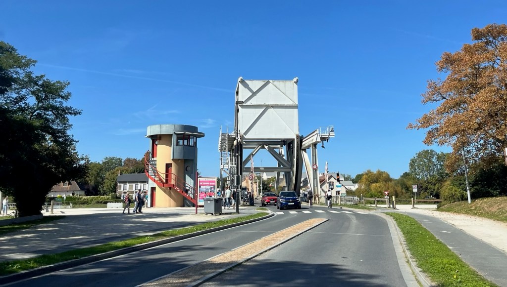
We hit the outskirts of Caen and seemed to have an extended tour of its industrial heartlands before we were suddenly burped out into countryside. Just up the road we came across the Pegasus Bridge, which the Allied Forces captured in June 1944. As we approached the bridge, we spotted a sign for parking on the right and quickly dived down it, as we fancied a wander. We quickly realised that they seemed to be rebuilding the museum there, with fenced off areas and had shut everything down for the time being. We did a U turn and went to look for a parking spot, but it was quite busy and the car parks that we saw were quite small. We managed to pull over into a roadside parking space (30 mins only) to figure out what to do, suddenly realising that we had conveniently parked just outside a sandwich shop. We suddenly realised we needed sustenance more than anything else at this point and quickly dashed inside.
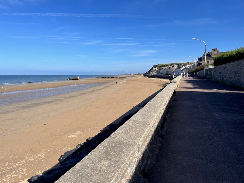
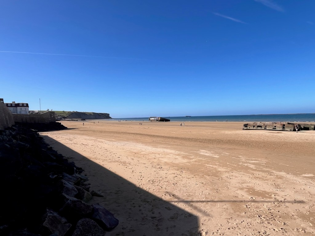
Our next mission was to find a place to eat the said goodies. We googled nearby Aires and picnic parks, but there didn’t seem to have parking so we headed out of town and onto a main road hoping to find a nice lay-by or picnic area. Instead we ended up in a grotty lay by on a dual carriageway as we were so hungry and gasping for a drink. It would do – we just needed to eat. We had a quick cuppa and ate our baguette sandwich and half a cake before carrying on. The weather was lovely – sunny and the Van claiming it was a pleasant 22 degrees outside. We dropped down into the little town of Arromanches where its beaches were part of the D-Day invasion. We drove around town looking for car parking, dismayed by height barriers until we spotted the roofs of many motorhomes and realised that the sign that we initially dismissed as we arrived – parking buses – meant us van owners. (Another lesson learnt). We found it easily, paid for a ticket and headed into town. The shops catered for the tourists wandering around, but we headed to the broad sandy beach, named Gold in 1944, and admired the beautiful coastline. Large concrete barriers sat in the sea, the legacy of the invasion and there was a museum on a wide courtyard with information boards placed on the promenade. It was all very lovely and well thought out. The Pup was itching to get on the beach, but there were signs saying no dogs – though several people had defied this signage, walking on the beach with their furry friend. We double checked with the museum people who confirmed “No Dogs”, so we wandered along the seafront instead with a very disappointed hound. With the absence of the usual seaside tat – amusement arcades, tacky gift shops and fast food vendors, Arromanches had an air of quiet respectability and serenity which was only right in such a place.
We spent a long time just standing at various points trying to imagine the scenario way back in 1944, landing on those beaches under heavy fire and see comrades fall. It was quite incredible that the Allies achieved the success that they did.
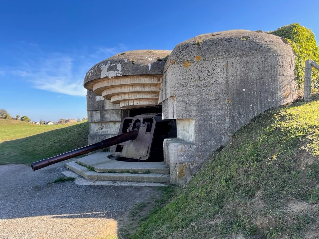
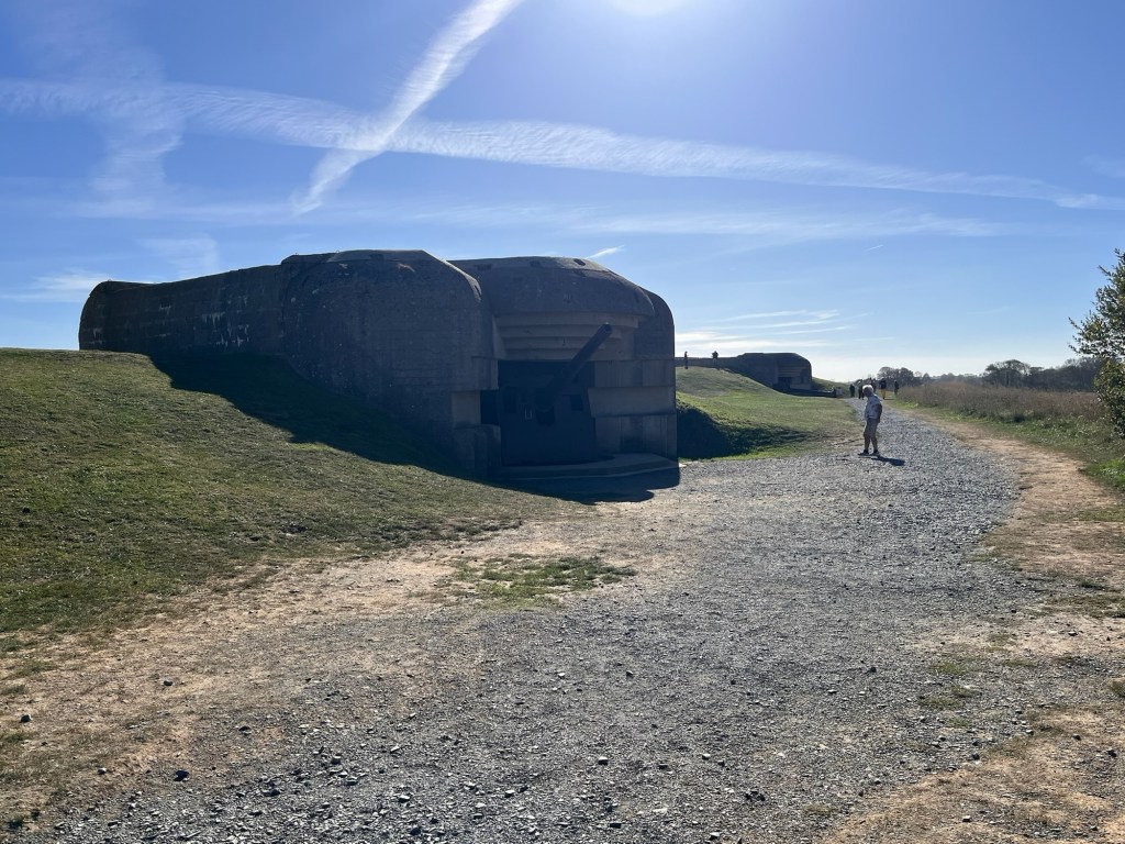
We jumped back into the Van and headed off to Longues sur Mer next, just up the road and to the Batterie de Longues. We wheedled our way down a narrow residential road and came across a large car park overlooking the English Channel. A short walk took us a row of German artillery batteries complete with their guns pointing out to sea. Set well back from the edge of the cliffs and partially submerged, it was an eerie reminder of World War II warfare. These things could fire shells 17 kms out to sea. You could actually go inside the battery and walk around the gun and the rear of the concrete structure – again trying to imagine what life was like in such places.
It was now getting late and we decided to call it a day. We waddled back and popped into the little sunken Brutalist building acting as the tourist information. We picked up some leaflets and a book about D-Day to learn the more intricate details of the mission. We jumped into the Van and headed to our next campsite, L’Hypo camping at Aure sur Mer, some 10km up the coast. We checked in and was able to chose our pitch – so we did a little tour and chose No.39. We then did a little bit of fluffing around trying to park in it, much to the amusement of the Danish couple next door. We set up shop and settled down to a pasta tea and a glass of good French wine. This will be our base for the next three nights – a chance to investigate the area more and to savour a little bit of downtime. We’ve stuffed a lot in in these last few days – we just can’t help ourselves sometimes…………
We’re having some good night’s sleep despite sharing the bed with a 25kg Labrador who thinks the bed is her own and is like a sack of potatoes. Will not budge even when you physically relocate her! Out for the count!
We got up slowly and did a few Campervan ablutions – the novelty of emptying grey water and sorting out the loo, all new to us after our recent upgrade! We are quite a team when packing away, having our own little duties to carry out. Skipping breakfast we headed out onto the road again, this time towards the city of Rouen.
We were soon out on open countryside and it seemed to be the Potato Central – lots of little smallholdings selling off their spuds on the roadside. With no need to stock up with tubers, we carried on, travelling through more wooded countryside and smaller fields – it was still crops with the odd pasture with cows chewing the cud. We’ve seen quite a few birds of prey too which is always amazing. The further we travelled west, we saw more Tudor/half timbered style cottages in the villages we went through which was interesting. The satnav had taken us on a seemingly magical mystery tour, determined to visit every industrial looking town with low business parks and car showrooms on the outskirts! The countryside was more rolling now and we dropped in and out of wooded valleys – it was certainly varied.
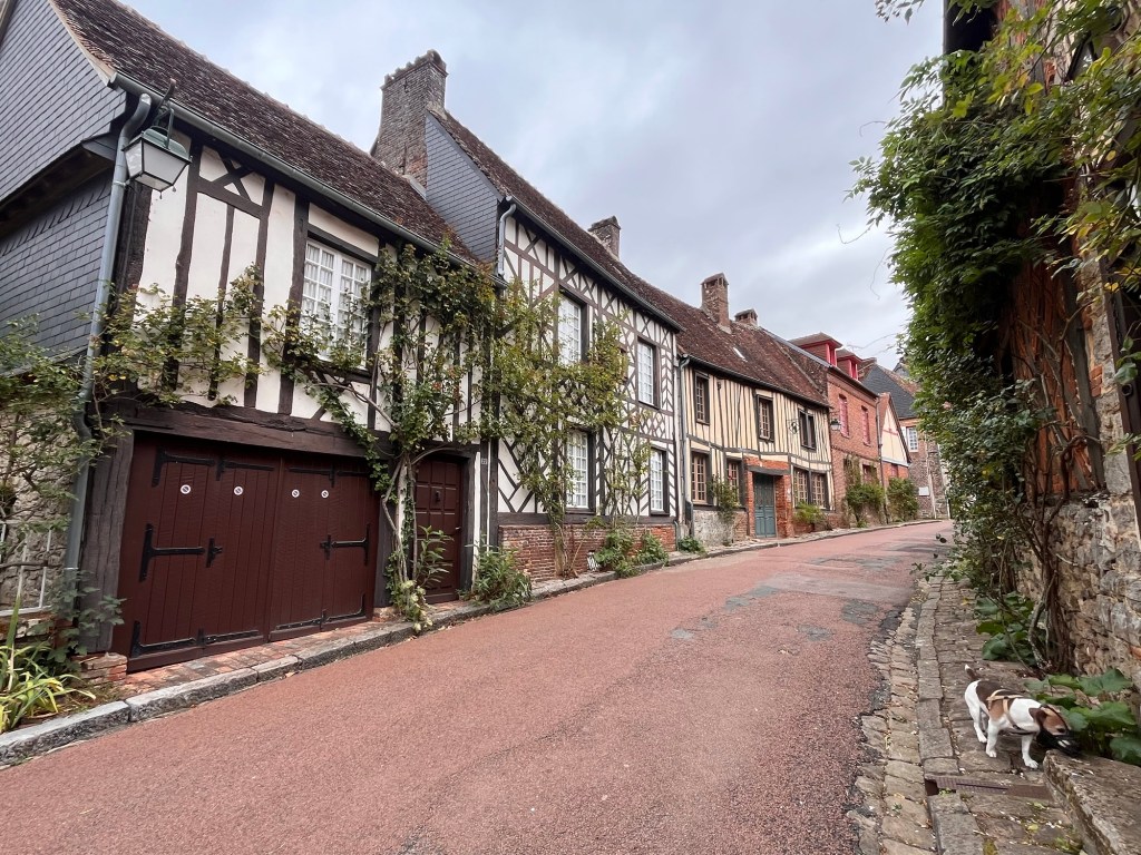
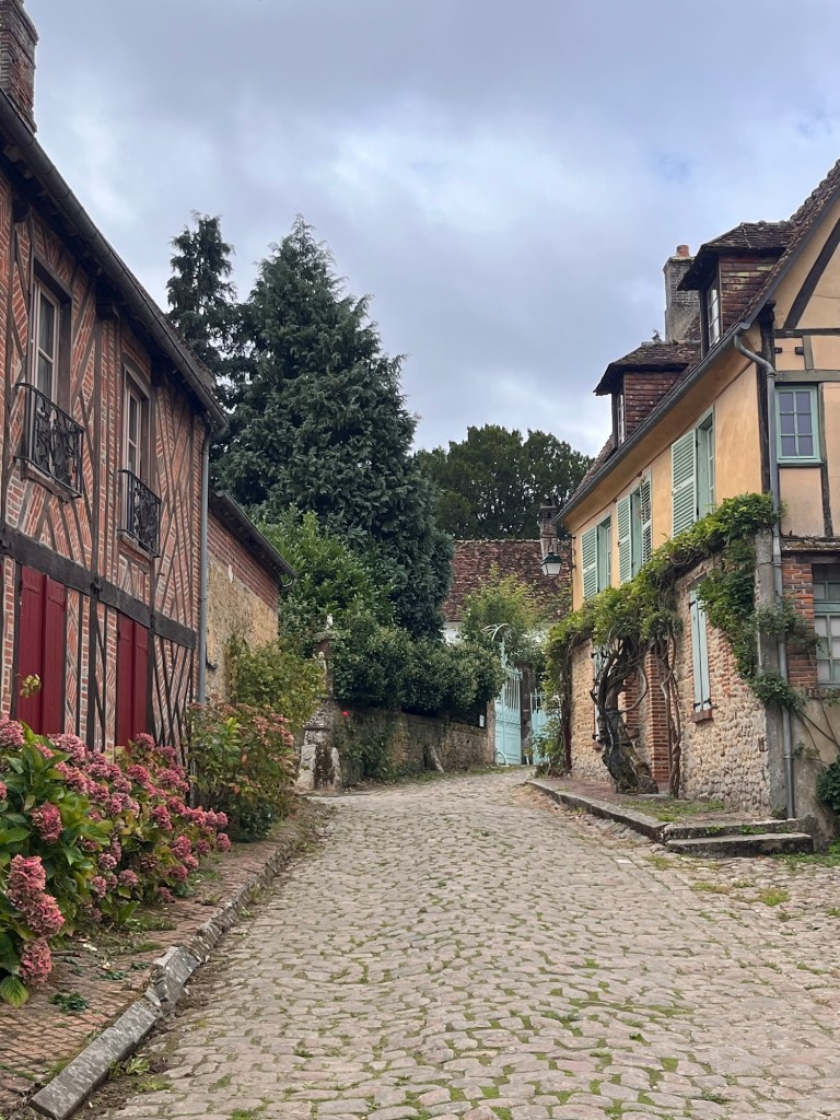
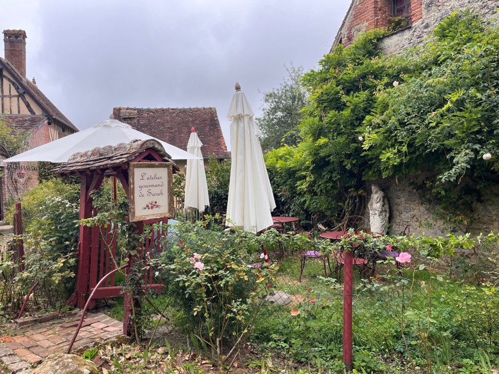
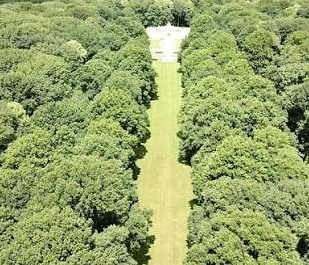
Hubby had done some research last night and discovered a little village and restaurant to head towards for Sunday Lunch, so we aimed for Gerberoy. We came off the main road and followed a little country lane – initially we stopped at a gorgeous little hamlet of half timbered houses, before we realised we had to drive a little further. Every single house in Gerberoy was also half timbered and was a totally chocolate box village. It was stunning. We found a large and generous car park on the edge of the village and began to investigate the little community, wandering down its little lanes. We were quite hungry by now and found our restaurant that we had emailed last night. We had sent quite a quirky little message to them and they replied, saying how much they were looking forward to meeting The Pup. They greeted us like old friends and had prepared a table in the little garden opposite the restaurant, surrounded by flowers. We were the only ones in the garden, but it was lovely. They were excellent hosts and looked after us well. The sky was thinking about raining and there was dampness in the air. Luckily it held off while we ate and then a little drizzle appeared as we paid our bill. We wandered up to the church and back down into the village before finding a tree lined avenue on the edge of the village and waddled back to the Van. What a beautiful little place.
Very happy, we joined the main road again and headed towards Rouen and our campsite for the night, some 15km north west of the city. We discovered last night that Rouen has a Low Emission Scheme which you need a sticker to enter or face a fine if you take a vehicle within the zone, which we didn’t have. Though there was a bus not far from the campsite, French buses don’t allow dogs of more than 10kg onboard. If we had a chihuahua we would be okay as long as we stuffed it in a handbag or other suitable receptacle. We spent the evening with ChatGPT, trying to figure a way in – driving to the nearest rail station brought its own set of questions: was there ample parking for a campervan, was there height restrictions? Park and Ride? We tried everything. The Pup would need to be muzzled on the train and all this for about 4 hours in Rouen. We heard it was a beautiful city with stunning architecture, but was it worth all the hassle?
Camping Les Nenuphars, Roumare, nr Rouen.
To avoid the Low Emissions (or ZFE) we took a convoluted route to our campsite – we had to override the Satnav as she would have happily skimmed northern Rouen and got us a fine. We found our campsite not far from the lovely looking town of Montville, and checked in. Again we had a little pitch enclosed on three sides by hedges and tucked under trees. There were three other Brit campers here which was nice to see – we got chatting to our next door neighbours. We had a nibbly tea washed down with some wine and watched the sun go down. We’re still making minor adjustments to our living quarters and making little improvements, making our campervan lives easier. Tomorrow we will make a decision on Rouen, but ultimately we heading to the town of Bayeux. Yes and we know the Tapestry is currently in London 🙈.
Another good night’s sleep, though I awoke with The Pup laying across my legs, looking out of the back window. It was so cute, but my legs had gone numb.
We had pre-ordered pain au raisins and some fresh bread yesterday for breakfast (going to have to nip this habit in the bud or we’ll become a pair of blimps) so we went and picked them up. I went for a shower and endured (in my opinion) a tepid pouring of water with one of those wretched automatic buttons you need to press constantly. We weren’t the earliest people today to be honest, so presume all the other lady campers had beaten me to it and pinched all the hot water. Anyway, it did the job and I sauntered back to The Van.
Today, we were heading south to the little town of Neuilly St Front where my grandfather’s brother is buried. He fought in the early days of World War One and died of his wounds in September 1914 aged just 26. He left a pregnant wife back home in England. He is buried in the town’s communal cemetery together with two other British servicemen – we think that he died before he could be evacuated and possibly buried on a temporary basis, but ultimately never moved.
We left our campsite and headed out – we ended up on a toll road which saw me leaning out of the passenger window to retrieve a ticket at one toll booth and lean out again when we exited the motorway, hoping I wouldn’t drop said ticket or my debit card. We are also learning how close we can get with the new van, so these situations are a touch tense. Anyway, it worked and with a sigh of relief we stayed on A roads for the rest of the journey.
The countryside was a bit like yesterday. We were now in the Aisne Departmente, another arena of World War One. Big harvested wheat fields across a flat and featureless landscape apart from distance woodlands. There were no hedgerows or stone walls. Wind turbines were abundant here and for good reason – there was nothing to stop the wind! Then suddenly we would drop into a valley where pretty villages and towns nestled, surrounded by woods before heaving back up onto the sprawling plateaus of fields. Here, you could clearly imagine the trench warfare of World War One and how both sides spent months shelling each other to gain a few feet of territory or to secure a piece of woodland. Total madness.
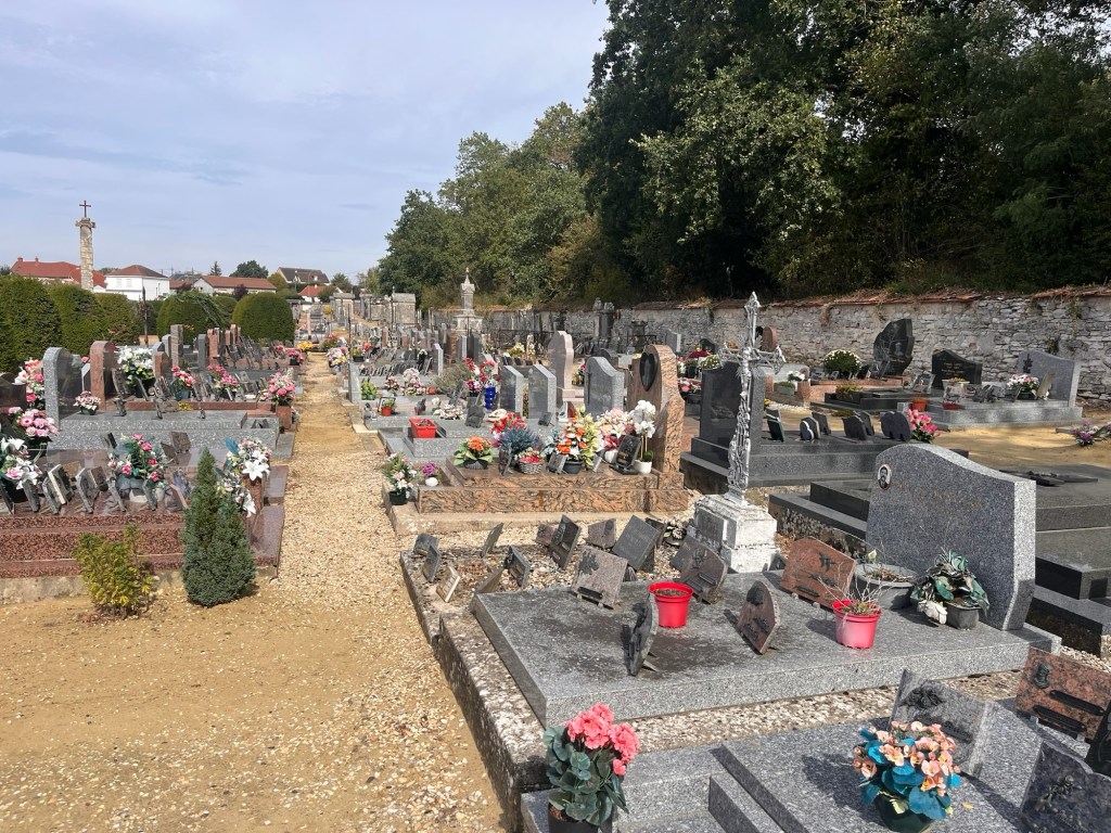
After nearly two hours, we dropped into Neuilly St Front passing another military cemetery on the outskirts. We found the cemetery easily and parked up nearby. It was the town’s cemetery, still being used and full of headstones of various sizes and grandeur. I had a vague idea of where Franklin was, down the far end on the left, but as I got nearer to the bottom, I was beginning to lose faith. There was a young man tending a grave and asked if he spoke English. “Non” was the resounding reply and my heart sank. How do I ask about Franklin. Somehow in very broken French, I mentioned “trois Anglais” “premiere guerre” and an “ici?” – bless him, he launched into conversation, all in French, leading me to the three headstones, less than 20 foot away. I could of kissed him.
I spent many minutes, like yesterday, staring at Franklin’s headstone and wondering about his last few days and what was his wartime experiences were like. I wondered who else visited his graveside – I was pleased that all three were tidy and looked after. I felt a lump in my throat again as I thought about him and Ernest losing their young lives like they did. And for what?
I patted his headstone and left the little cemetery, full of local French people and three Englishmen and headed back to the Van. Hubby went to have a look at the gravestone and then we had a cup of tea. Neuilly St Front was very quiet, hardly anybody around and it didn’t seem to have shops, or at least opened ones. So we decided to head to Soissons where we had booked a campsite, some 20km north.
We came into the outskirts of Soissons, needing a supermarket to stock up on some food. We pulled into one large car park thinking it was a supermarket, but it turned out to be a large bed showroom, but next door was a Lidl. We managed to slip across into their car park, but it was a bit shabby and there seemed to be homeless people hanging around. We found it a bit unsettling, so abandoned that plan and continued onto our campsite – we passed by the town centre which looked lovely, full of outdoor seating and lots of people. As we approached our campsite, we realised there was another Lidl just up the road, so we took a quick diversion and did a quick shop. We retraced our steps back to the campsite, asking ourselves why we always shopped in Lidl while abroad, but never at home (we tend to shop locally). Maybe it was knowing what we were dealing with a well known and familiar brand name and it was quick and convenient. We promised ourselves to try and shop more locally for the rest of the trip.
We found our campsite easily, the Camping Municipale Soissons and set up home. It was quite warm, so we had some lunch outside and chilled for the afternoon.
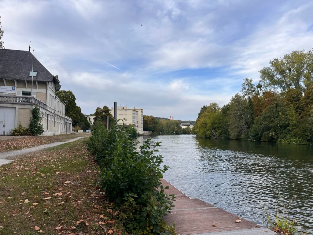
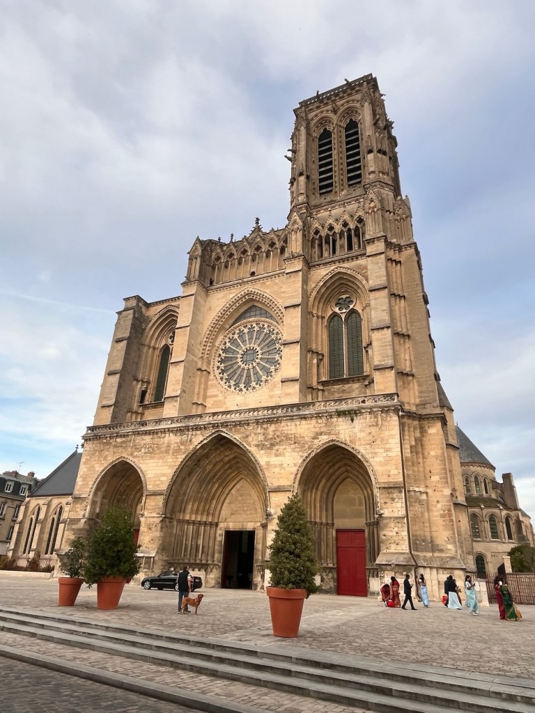
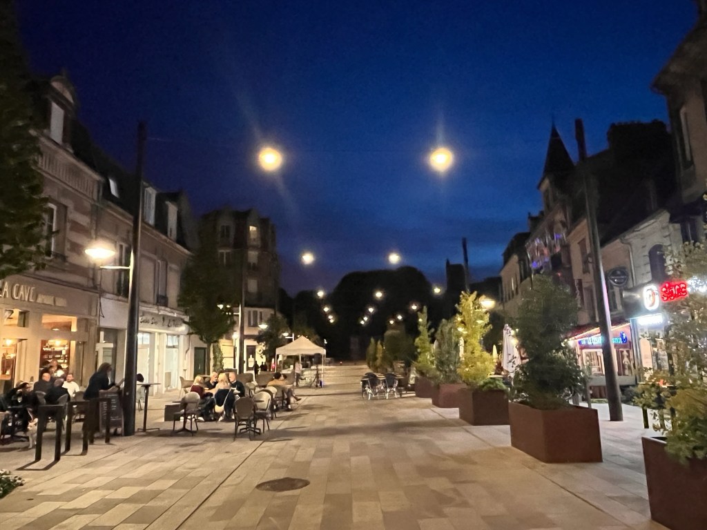
After feeding The Pup, we walked into town along the River Aisne under the shade of trees. It was very pleasant with parkland across the street with people playing tennis. We came up to a bridge and looking right, there was the street we saw, full of street tables, eateries and a woman singing under a gazebo. We decided to have a wander around town, up to the magnificent cathedral and through the shopping area. All the shops were shut, so we dived down a side street and came to the front of the cathedral where an Indian wedding was just coming out. Guests in all their refinery and ladies in their colourful saris, taking photos of each other. They soon jumped into their cars and headed to carry on with their celebrations. We wandered up to the huge double doors of the cathedral and peered inside, the warden telling us broken English that they do tours tomorrow, but now it was shut.
There was another tall spire of a church in the distance, surrounded by scaffolding and we headed towards that, but after a while of wandering quiet residential streets, we dropped that idea and headed back towards the centre.
We found the busy eating area and found a place offering wine and tapas. We sat outside in the warm evening and enjoyed our meal, people watching and listening to the singer.
Supping the last of our wine and with darkness fallen, we wandered back towards the Van and got ready for bed. Tomorrow we were heading to Rouen and the west coast of France.
We all slept well in the new campervan, despite The Pup pinching the duvet.
We awoke to a chilly September morning, but the sun was starting to shine. After tea in bed, we waddled down with The Pup to the village Patisserie/Boulangerie for croissants and a French stick which we brought back to the Van for a leisurely breakfast. Out in the sun, it was quite warm, but everything dripped with dew.
We started to pack everything away, ready for our day. Doing my family history over the years, I discovered that two of my grandparent’s brothers lost their lives during World War One and knew where they were buried. Today, I was going to visit my grand uncle Ernest’s grave in Delville Wood Cemetery in the Somme.
We had a choice of zipping down there by motorway in an hour and a half or taking the more scenic route. We decided to drive on the country roads and enjoyed some fabulous scenery. It was more undulating countryside, with vast fields and far ranging views with pretty little villages. It then became more rolling with little communities huddled in the valleys – their red pantiles and red brick walls bright against the green fields and woodlands.
As we approached the Somme Department, the countryside returned to the vast fields and big skies before we arrived at the little village of Longueval and parked at the Delville Wood Cemetery. On one side of the road is the South African National Memorial to the fallen South Africans – a huge commemorative memorial housing the museum and on the opposite side, the Delville Wood Cemetery, with lines of regimented headstones of mainly British soldiers. We soon found Ernest’s headstone and spent a long time there, thinking about him, his family, the futility of war and what this area looked like 110 years ago. It must of been horrific. We wandered back, saddened to see headstones for unknown soldiers and wondered how many still laid out in the fields, lost forever.
The actual Delville Wood that surrounds the South African Memorial was devastated as the Germans fought hard to hold onto this strategic stronghold, the trees hiding their position. The tall trees now were no more than a hundred years old, as the whole wood was replanted. We had a quick walk through these woods, comtemplating the life of a soldier during these barbaric times. It sent shivers down our spines.
Delville Wood in 1916
Delville Wood today
We walked back and decided to visit the bar/cafe we had seen on the way in for lunch. Sadly, our timing was bad – they had just shut. So we wandered back to The Van and made ourselves a brew and finished off the breakfast baguette while we researched more about the war in this area. We discovered that Ernest’s regiment, the Kings Royal Rifle Corps actually attacked a nearby wood, called High Wood which again the Germans occupied, so we drove over there to find out more. We couldn’t enter the wood as it was privately owned, but stood outside and see its value to any army that seized it. It commanded long distance views across vast open fields with little way of cover for almost 360 degrees so the Germans could see any advancing regiment quite easily. The Allies were sitting ducks really which resulted in high casualty numbers. But the powers above continued to send in troops and in the September of 1916, the Germans finally surrendered the woodland. It was here, quite likely, where Ernest was killed in action in July 1916 aged 21.
The day had left us deep in thought, emotional and thinking how futile wars were and yet a hundred years on, the human race is still fighting each other. We headed off, passing numerous little brick walled cemeteries filled with headstones, neatly in rows and standing to attention, often in the middle of fields. It made you realise how many men died during the Battle of the Somme and how many just in this area alone. Just awful.
Our campsite wasn’t too far away in the small village of Feuilleres. Luckily we had pre-booked before we had left the UK and thank goodness we had as the place was full. We checked in and found our pitch – a private corner surrounded by hedges, which didn’t make it easy to get The Van in. After a lot of backwards and forwards, we parked it sideways and put the kettle on, sunning ourselves. After our cuppa, we checked out the facilities and went for a walk along the adjacent canal to stretch our legs including The Pup’s. It was a very pleasant sunny evening. On the way back, we called in on the campsite’s bar and ordered a couple of beers and a bag of crisps – the beer went straight to our heads, so we headed back to The Van and raided our limited larder and mustered up a sandwich. (We had basically emptied our rundown fridge and larder from home when we left yesterday with a vague plan to stock up with a supermarket visit…………..it hasn’t happened yet). It worked, but a supermarket is defintely on the agenda for tomorrow.
The night closed in as we began to research Franklin, another grand uncle lost in WW1 which we plan to visit tomorrow.
We’re off again! This time heading south through France and down towards Spain with no real plan or timeline. Just see how far we get before we have to turn around.
We were rudely awoken by our alarm, diligently set for 4am, for a 5am departure. It was tipping it down with rain as we bundled the last of our bits in our Van, got The Pup settled and headed down the lane in the pitch darkness. A bit of a shock not having a glowing dawn breaking over the hills, but it is September. We jumped onto the M6 and headed south, the motorway heavy with traffic even at this hour of the morning. The rain was incessant – easing off, then a deluge – not easy in the dark. Lorries threw up spray and it was hard work. Dawn finally broke and with the rain petering out, we pulled into Norton Canes services for a Costa breakfast and a welcomed cup of coffee.
Suitably refreshed, we hit the road again. The satnav wanted to take us around the M25 anti-clockwise to avoid a perceived 45 minute delay. Checking other apps, we defied her wisdom and headed to the Dartford Crossing (after all I had already paid the £3.50 toll!) and had a pleasant and uninterrupted journey to the Bridge. We picked up the M20 and before we knew it, we were at Le Shuttle at Ashford and the sun had come out. Fabulous.
We had to self check in which involved me hanging out of the passenger window and pressing buttons which seemed quite obstinate. It wasn’t easy, but it finally worked. The couple before us, almost ended up in divorce, as they spent ages trying to find booking references on their phone and then trying to get the machine to recognise them – they were so long that a driver behind us got out to find out what was causing the hold-up. But, finally, they had success, the traffic light went green and the barrier let them through!
We had to go to Pet Reception first to get The Pup authorised which went smoothly. A couple appeared with four dogs in tow and asked them if they had taken out a small mortgage to take them abroad. There is no Pet Passport per se – just a 9 page cluster of paper which costs well over £100 and is one use only. Yep, every time you go abroad, you have to visit your vet to fill out the Animal Health Certificate and each time it costs over £100. It’s probably cheaper than kennels, but still eye watering.
We feasted on a Burger King (and wished we hadn’t) and hung around. Our 3.15 train was pushed back to 3.46 (some technical hitch earlier – last time, they had lost trains………don’t ask). We crossed our fingers and hoped that we wouldn’t be seriously delayed after our slot came up with “more information in 23 minutes” on the information board, but we got called to go to Border Control which was glacial (passport control for both British and French) and finally we headed down the ramp and boarded Le Shuttle! We’ve just upgraded to a bigger campervan and are a touch precious about it at the moment – the train crew get the vehicles really up close and personal (we must almost kiss bumpers) which is quite disconcerting. We just hoped the guy in front is good on hill starts and doesn’t roll back………..
We took the chance to get a quick 40 winks in as the train gently rocked us through the Channel Tunnel and feeling a bit more refreshed, we hit the French roads to the village of Gandspette for our first campsite. We had spent our final night there on our Polish trip and decided to return as it was only 40 minutes from Calais and is a very nice campsite. Set in woodland with a small chateau, it has a swimming pool, tennis courts and a little bar/restaurant with chickens just sauntering around. Really sweet. We checked in and found our pitch, spending many minutes trying to get the Van onto blocks to get it level. The blocks kept sliding as we reversed onto them so we gave up and headed off for a well earned and celebratory pint. Only later, did our addled brains landed on the idea of actually driving onto them…….doh.
We enjoyed our beer and ordered some food. It definitely isn’t Michelin starred and mainly leans towards to carnivores, but being a veggie I managed to get an aubergine crumble and frites ordered. It was adequate and filled a hole. The Pup munched on the Bonio biscuit the reception guy gave her.
We wandered back to The Van as the night drew in and settled in – think we will be spending a week wondering where we have put stuff and possibly be doing a spot of re-arranging as we figure out our new campervan. Overall it all went rather smoothly today and it’s nice to be back on the road. We will sleep well tonight once we’ve shoved The Pup off our bed………..
Sorry, no photos today. The M6 and M25 aren’t particularly photogenic and Le Shuttle isn’t much better. I am the official co-pilot and after 7 hours plus of travelling and dealing with Le Shuttle, my main concern was getting us to the campsite safely and without incident (apart from the unexpected toll). Tomorrow will be more interesting, I promise.