St Cuthbert’s Walk – Arriving in Melrose – Day One.

It’s never a good idea to plan a trip during those dark winter nights, when you’re curled up in front of a roaring fire with a bottle of wine and nibbles………….

62.5 miles over 5 days, walking the St Cuthbert’s Way from Melrose to Lindisfarne, all our accommodation booked and luggage transferred, only a back pack required – it seemed so easy all that time ago. How difficult could it be – blimey, we were veterans of Hadrian’s Wall! But now, with a few weeks to go, Hubby, his Sister and I were starting to wonder what we were thinking way back in deepest January, as we started to receive information packs from the booking company. The first two days were around 15 miles each – one with the steepest part and the next, the highest. Gulp. It seemed all a bit over ambitious.

And so it was, departure day arrived and with encouraging words from the family, the three of us set off up the M6 motorway on a bright but cloudy day. The plan was to travel up to Carlisle, pick up the A69 and follow Hadrian’s Wall. There was a reason for this as Hubby’s Sis had walked it 4 years ago, and with her living in America, we thought we’d give her a trip down Memory Lane. However our Satnav (or as our daughter calls it – the Sat Nag) had different ideas. It suddenly decided that the A7 was a better route, so just after Brampton, while I was saying right at a roundabout, the SatNav said straight on and believing an app rather than his wife, the driver continued over. We ended up on a 20 minute scenic detour of the back lanes of the greater Brampton area to get back on the A69, which was, I must say was lovely. Successful, we headed towards the A68, passing Hadrian’s Wall and reminiscing all our adventures on our Walks.

We were starting to get peckish by this time and started to look out for cafes, but of course, when you want one, you can never find one. We drove through small villages and communities, all quiet and sleepy. We pulled up outside a pub, unsure if it was open or shut, but we decided that all we wanted, was a small cafe that served coffee and scones with lashings of cream and jam. We passed another pub with a sign “Last Pub In England” and wondered how far we would be driving before we got sustenance. But as we went round a bend, in the distance was a stone building with a huge banner on its side declaring it to be the “Last Cafe In England” and we instinctively pulled in and parked.

As we opened the door, we were a bit dubious – it looked rather old fashioned and there was just one customer. Mmmm, but we were hungry. We closed the door and turned left into another room and it was completely different – there was a counter heaving with cake and savouries, an excellent drinks menu, all very trendy and a lovely Northumbrian lady welcoming us in. We ordered 3 sausage sandwiches and coffee and sat in the conservatory watching a cockerel and hens scratching through the grass in the garden. The food arrived and we dived in, it was all very nice and more people came in – it was quietly popular. It was ticked the box with us. Later I went upstairs to use the loo decorated in decidedly 1970’s decor. Actually it probably hadn’t been decorated since 1970. The loo, basin and shower were all dusky pink, squeezed in a very narrow room. The shower was perched on top of steps and had seen better days and the rest of the bathroom, cladded in pine. It was a time warp. I had noticed two numbered doors. Can you imagine rocking up to this? That shared bathroom down the corridor? I got the distinct feeling that the place had new owners who had concentrated on the cafe downstairs first and would eventually bring the rest up to scratch. I wished them luck.

Fed and watered we carried on, crossing over into Scotland. We scooted around the edge of Jedburgh’s town centre which looked very nice. This would be tomorrow’s overnight stop. We drove through St Boswell and onto Melrose and on a long stretch of road, we got our first glimpse of the Eildon Hills, our challenge for tomorrow. They looked really high, rearing up from the rolling countryside – three massive hills. We spent the rest of the journey in awe and trepidation.
The Eildon Hills!

https://en.wikipedia.org/wiki/Melrose,_Scottish_Borders

https://en.wikipedia.org/wiki/Melrose_Abbey

We soon dropped down into Melrose, a small pretty town with a little High Street where our hotel was located. We parked the car at the rear where it would spend the next five days and checked in. There seemed to be just one member of staff on duty and after a little wait in the reception area, we finally tracked her down serving beers in the bar and taking food orders. She proffered her apologies, but we were happy to wait. Finally she scuttled to the reception area with us in tow and sorted out the keys before walking briskly back to the bar. We lugged our luggage up a flight of stairs and found our respective rooms. They weren’t particularly big, but they were clean, reasonably modern and didn’t lookout over the kitchen bins and the staff smoking area. The Eildon Hills poked their heads over the town and into our bedroom windows. After a while, we decided to check out the town and stretch the old legs. It was quite small and compact, but we headed down to the Abbey where Cuthbert, as a young man, felt a strong call to the ministry and become a monk and a prior. It’s owned by Historic Environment Scotland and there was a small charge for entrance. By now, the sun was out and it was lovely late afternoon so we had a wander around the grounds – the actual Abbey, half in ruins, had metal fencing around it as it needed some restoration work to secure loose stonework. We found the Museum and wandered inside, looking at pottery and other artefacts. Back outside we went to the other side of the Abbey to look for the stone pig playing bagpipes, high up near the roof, in amongst numerous gargoyles, dragons and other stone creatures. The Eildon Hills peeked into the grounds too – we realised that Melrose snuggled right up to the foot of these hills. We were trying to convince ourselves that they weren’t that steep at all, despite the guide book’s musings and figuring out where the path went.

The bagpiping pig!

https://en.wikipedia.org/wiki/Eildon_Hill

Having exhausted the Abbey – it was also nearing closing time anyway – we set off in search of a watering hole to celebrate our arrival in town. We had seen a place advertising cocktails, so we headed there. As soon as we walked in we knew it was a mistake – a solitary family of five huddled around a table for an early tea. We sat down and discovered that they weren’t serving cocktails that night either. It’s great having a relative who’s lived in the States for years as Sis just got up and left with us following slightly sheepishly (we would of probably stuck it out in there) and went off to find something a bit livelier. There were probably six establishments we visited – either devoid of customers, jam packed with Grand National punters watching the horse race on huge TV screens or the local where everybody stops drinking and gives you long and hard stares before whispering amongst themselves. We finally stopped in Burt’s Hotel, a cosy inn just up from our own hotel with a smattering of clientele, where we ordered three beers and toasted ourselves.

We loitered there for about 45 minutes before wandering up to the old railway station, now converted into an Italian restaurant for our evening meal that we had pre-booked. The Monte Casino was very busy and had a great atmosphere – we ordered pasta and a bottle of wine and toasted ourselves yet again. With full stomachs we took a convoluted route back to our hotel, and headed to our rooms. We started to organise for tomorrow morning, but spent a lot of time just shuffling stuff around and not really getting anywhere. Just a lot of debating whether to pack the waterproof trousers or not – total indecision. We gave up and jumped into bed for a fitful night’s sleep.

Serpentine Woods, Kendal

Banks. I had no intention of going to a town, but my bank had been testing my patience recently and knowing full well that I wouldn’t get anywhere by phoning, texting or emailing them, took the only other option open to me. To present myself in one of their branches.

Now, British banks don’t seem to like their customers and like closing a lot of their local branches. My nearest branches are some 15 miles away, so after some deliberation, plumped for the Kendal branch. Daughter had told me of this lovely little woodland on the outskirts of town, so I decided to kill two birds with one stone and combine it with a dog walk too. So off we set.

Kendal
Serpentine Wood (marked Kendal Fell)

The weather wasn’t brilliant. Overcast and threatening with rain. But this being Britain in March didn’t deter us until we reached the periphery of Kendal and the heavens opened. Yuk. I stopped at a small retail park to get some bits and by the time I came out, the rain had thankfully stopped. It might even brighten up. So confidently we drove into the town centre, through Kendal’s convoluted one way system and parked in a small pay and display car park opposite the bus station.

Kendal was quiet on this drizzly day as we wound our way through the streets on towards the Bank. I was prepared to unleash my pent up frustration, but the lad dealt with me quietly and efficiently, so I did another British thing and stayed quiet though I did leave a trail of dried mud from my walking boots, which made me feel embarrassed, but satisfied in equal measure. Light rain was in the air as we wheedled our way to Elephant Yard and using my digital OS map, found an alleyway at the side of Booths. (It is quite a maze of streets and dead end alleys here so can easily get lost or just end up wandering up and down the same paths, looking baffled). It was the start of quite a climb.

One of the many alleyways.
The huge houses

The Dog is never impressed with walks in a town centre, but thought she would perk up as we began to walk up away from the town, interested in where we were going. Instead she just dawdled behind me. The steady slope turned into flights of steps, which gave you a bit of a cardiac work out. Little stone terraced cottages and houses lined the route, with little alleyways and ginnels darting off at the side. It was quite fascinating. We crossed little back roads which gave a little respite from the steps and a chance to catch our breaths. The area had an air of bohemia/arts and crafts, of a tight knit community, hanging on the side of the hill. It must of been one of the oldest parts of Kendal and I wanted to have a good wander and nose later.

Towards the end of the steps, I sighed in despair. In amongst this pretty little corner, an atrocity had taken place. (well, in my opinion). Back in the 1960’s when everything had to be utilitarian, Kendal’s town planners had plonked a mini estate of white rendered modern and characterless housing right in the middle of this old part of town. It just so jarred. There had been no attempt to make it blend in at all.

Now this is where I struggle and have a real dilemma with this brutalist architecture. My first immediate thought is to order a couple of boxes of dynamite to which to blow these monstrosities up and replace with something more in keeping. Then, I think, they actually tell a story and are part of our heritage, whether we like it or not and are here to stay. We can’t erase a whole chunk of history just because it doesn’t fit into our expectations anymore ……….

And anyway they’re a good reminder to future planners how not to do it!

Entrance board to Serpentine Woods
One of the children’s play areas

https://www.visitcumbria.com/sl/kendal-serpentinewoods/

Finally we came to a road and opposite there was a sign welcoming us to Serpentine Wood. Yes, finally! It was not, alas, the end of the climb and we followed the path steadily up through the woodland. The Dog is still not impressed and I’m wondering whether to give up this endeavour, (there’s nothing worse than your dog dragging their feet and looking like they want to be elsewhere) but hey I’ve paid for 4 hours of parking and want my money’s worth! So we continued. Despite the weather, damp and sogginess, the wood retained a magical air – there were numerous paths darting off in every direction, all well defined. On the edge were large detached Victorian houses that now looked they had been turned into flats or a business premises. I wondered who had lived there before. The wild garlic was starting to sprout and the trees were tentatively budding, there was a hint of life. Now and again, there were wood carvings of animals and a maze made out of logs, little areas for the kids to investigate. A hexagonal building overlooking the town, another rectangular one with no obvious meaning. Trees had been felled by high winds and gales had been left where they had fallen, only touched to clear pathways and left for the wildlife. I was liking this wood very much.

Found in the little hexagonal building!
The fallen trees are just left in situ for the wildlife
Little wooden carvings can be found throughout the woods
The hexagonal building

We hit the back of the woodland. We could of climbed even further, crossing the golf course to the summit of Kendal Fell and beyond to the A591 road, but the weather was closing in and the rain heavier. I looked at The Dog – you could see she was just aching for a comfy bed and a blazing fire. I thought she would be excited for a new area to sniff in, but she looked unimpressed. So we followed the path and started to go downwards. A side path took my interest as it went out of the woods and onto a field that gave you a view of Kendal town. Daughter told me that the views were amazing up here, so off we went to check it out. There would of been an amazing view if there wasn’t low cloud, mist and heavy drizzle. It was like being in a plastic box. This would be a lovely spot for a picnic and watching the world below, but not today. We didn’t hang around and slithered through the mud, back into the woods. I was glad we didn’t go for the summit – it would of been pointless and thanked The Dog for her apathy.

Kendal’s out there somewhere!
Would be lovely on a sunny day!
Never figured out what this was!

We wandered back down, now getting quite damp, though we still turned left and right, taking various paths to see what there was. There were lots of birds flittering around – blue tits and finches and there was a cacophony of birdsong which was lovely to hear. We met a few diligent dog walkers, wrapped in waterproofs, their dogs damp and shaggy. This would be lovely in the summer and it deserved another visit, but on a grotty rainy day, it was still wonderful. Soon we were back on the little back road road. I wanted to walk further and investigate the local streets, but the weather wasn’t improving so we retraced our steps down and found another abomination. A little stone church surrounded and overwhelmed by modern utilitarian housing. My shoulders sagged at the sight.

The little church

We dropped onto the last road and on a whim, I decided to have a walk along it, just to look at the houses here. The Dog rolled her eyes, Gromit style and plodded on after me. An eclectic mix of period housing, cottages, terraces, a house dating from 1660’s, quirky buildings. It was fascinating, the higgle-piggly style punctuated by little alleys and roads. I could of wandered around these streets for ages, but feeling a drop of water working its way down the back of my neck, dampened my enthusiasm for investigation and The Dog wandered behind me with her head and tail down despondently, which didn’t help. Below us was a little park and we dropped down to this and walked back into town. Here I dithered. Did I want to find a cosy little cafe which let wet dogs and humans in, order a large latte and even larger piece of cake or just head home? It transpired that the car was nearer than a cafe and I didn’t fancy having to peel off wet coats and feeling damp and uncomfortable. Anyway I was trying to be good and not eat cake, so we went back to the car where The Dog enthusiastically jumped into and plopped down, looking rather bedraggled, but relieved. I pulled out of the car park and had a tour of Kendal courtesy of their meandering one way system before being burped out onto the road out of town, windscreen wipers on, lights on and steaming up slightly, headed for home.

Grizedale Forest and Ambleside, Lake District

After a few days of snow and sub zero temperatures, there was a chance of a day out in the Lake District albeit with high chance of rain later in the afternoon so Hubby, Daughter and Partner, The Dog and I grasped the window with both hands. After some procrastination and discussion, we decided to head to Grizedale Forest on the west side of Lake Windermere for a walk, then onto Ambleside for some light retail therapy and an evening meal. So we set off along the South Lakes Peninsula and the A590 before doing a right just past the Lakeland Motor Museum at Newby Bridge/Backbarrow and followed a narrow country lane up to Grizedale forest.

https://www.forestryengland.uk/grizedale

https://www.visitlakedistrict.com/things-to-do/grizedale-forest-and-visitor-centre-p1211031

Grizedale Forest

The route was pretty in the weak sunshine, with white washed cottages dotted here and there in between the more traditional slate. Some properties were high on the hillside and had fantastic views from picture windows. Past fields, valleys and woodlands, it was very interesting and the little hamlets like Slatterthwaite, huddled in this stunning valley. I saw little of the scenery as I drove carefully along the road – there were dry stone walls, oncoming traffic, potholes and even a wandering peacock to contend with!

Finally we arrived at the Visitor Centre at Grizedale Forest without further incident and parked up. The Forest comes under the jurisdiction of Forestry England (formerly The Forestry Commission) which allows their woodlands to be open to the public chiefly for walking and biking with a network of waymarked tracks throughout as well as hosting other activities. It is also a working landscape as Forestry England manages logging within the woodland, with large swathes given over to wood production.

The various waymarked routes
And more detail

We had a map of the various paths on offer which were of varying distances – some short strolls, others 10 mile hikes around the perimeter. We picked the Grizedale Tarn Trail as it was a nice 4 miles and perfect for our 15 year old dog without breaking her. We had to look out for wooden posts with a white strip on them, indicating the Tarn Walk and so followed the large arrows pointing to the beginning of our walk. However, we were stopped in our tracks before we had even started, as orange barriers barred our way down the path. A sign read “closed for maintenance work, follow the signs for Millwood Trail to connect with the Tarn Trail”. So we turned around and followed the signs for the Millwood Trail, which took us through the Visitor Centre, a clutch of Victorian buildings (it reminded me of the grand stable blocks that the Lord of Manor built for his prized ponies) housing artisan workshops, art gallery, a cafe and other facilities.

We popped out by the bike hire and the entrance of Go Ape, an adrenaline junkies and lovers of heights playground. Suspended high up in the treetops, a series of challenging high-level tree-top crossings wheedle their way through the canopy before dropping these mad people back to terra firma via a zip wire. I would love to have a go, but just know I would freeze at the first platform and would need rescuing while my family looked on, howling with laughter. You are all hooked on, but I still wouldn’t be happy. There would just be a lot of screaming on my part. There seemed to be quite a few adventurous souls up there, apart from an older lady looking rather petrified as she walked along a slatted walkway – she looked like someone’s granny who had been coaxed up there by a keen and excitable grandson who had now abandoned her as he was young, carefree and super confident. She looked like she would be more comfortable hugging a latte in the cafe! I was in admiration of her.

https://goape.co.uk/locations/grizedale

We followed the path by the side of Go Ape looking out for our white posts, but came to another parking area and found no other signs or diversions. We asked a passing Go Ape employee but he offered no useful information. Maybe it was on the road somewhere and so we set off on the lane, heading back towards the Visitor Centre keeping a beady eye out. We were practically back at the Centre when we spotted an A4 laminated sheet, on the other side of the road, nailed to a footpath sign in amongst another cluster of purple barriers!* Our path! We had done a complete loop for nothing!

* there seemed to be a lot of barriers and maintenance work being carried out around the car park and Visitor Centre. Presumed they were preparing for the summer season!

The Go Ape course

This path instantly went straight up an incline, so we were thankful that the loop had inadvertently given us chance to warm up. We walked steadily up on the stony path, stopping to admire the opening vista and one of the art installations which are dotted throughout the forest. As we stood there, a large family group passed us and we let them have some distance before we resumed the pull up.

We joined a broad logging road and continued upwards, though not so steep now. There was patches of snow still on the ground here and there, which instigated a brief snowball fight between us. A couple of filthy mountain bikers cycled past, blathered in mud, but thoroughly enjoying themselves. Finally we reached the ridge by the statue of a fox and we admired the long distance views of snow covered Lakeland fells.
The first art installation
On the ridge and distant views of the fells
The fox art installation

Spotting a white post to the right we followed the road and caught up with the large family. We passed them and dropped down a gravelly side path through coniferous and deciduous woodland, the path gently rising and dropping, us skipping over little streams while The Dog had a slurp of water. There were muddy spots, but not too many and easily negotiated. We stopped by a patch of grass and dug out our cake we had bought as a snack. The Dog got her treats but was also surreptitiously supplied with cake too. As we were finishing it off, we felt rain and put up our hoods. Onward bound!

We followed the white marker posts with ease – they were frequent and easily spotted. The rain wasn’t heavy and we were sheltered by the trees. We came across another road covered with snow – the Lakes had been covered by a thick layer of snow only a couple of days ago after an Arctic blast, but with the temperatures rising quickly again, there wasn’t much left of the white stuff. Stacks of logged wood lined the road here – evidence of the logging and management of the forest by Forestry England. Stern signs told us not to clamber on them!

A pretty path heading down.
Waterfall

We suddenly realised that we had permanently lost the large family we had been regularly overtaking. We carried on walking. We were starting to drop down again into the valley and it was getting prettier. Waterfalls, stone bridges, dry stone walls in amongst the bare native trees on the hillside. The pines trees huddled together nearby, their dark gloomy interiors groaning gently. We hoped to see a deer.

A pretty little bridge in the background

We started to come across blocked off paths again with diversion signs which we dutifully followed. We could see the car park far below through the trees. Suddenly our large family reappeared coming from the opposite direction, the adults looking baffled at their phones. When we met in the middle we exchanged pleasantries until one of them piped up. “Are you going back to the car park?” We said yes and that we had been dropping down. There was a flurry of groans and a lot of “we should of turned off back there”. They turned on their heels and followed us at a respectable distance. We came across a normal footpath sign and looking at our digital OS map realised it sliced off a hefty corner – we didn’t hesitate -we plunged down the path to a lovely little beck at the bottom. The large family followed. We carried on up the other side to a gate and was burped out into a field which we crossed. We spotted familiar landmarks and knew we weren’t far away now. The large family had obviously been distracted by the water and were no longer behind us. Over a wall stile and we were back on the steep track and a few hundred yards later, the visitor centre loomed up in front of us!
There were just certain areas of snow!

We headed to the cafe for a well earned coffee, bagging a window seat. This would be lovely in the summer with the courtyard and outdoor seating – probably quite a sun trap. Instead we watched people scuttle past in wet rain gear as we hugged our drinks. We wandered back to the car and paid the car parking fee. There must be an ANPR (automatic number plate recognition) system in operation as the machine asked for your registration plate. I had only entered the first two letters before my car reg popped up on the screen! Wow! I winced as I paid the fee – it’s expensive to park in the Lakes, but if it maintains a woodland like this, I am happy.

The visitor centre – it looks like it was once farm buildings or stables.

We got back to the car just in time as the heavens opened and the mist descended obliterating any views. We jumped back on the narrow lane heading towards Ambleside, having the added bonus of heavy rain to contend with, skirting past Hawkshead, a popular tourist village in the summer and meandered our way into Ambleside which we know fairly well.

Ambleside is a pretty town full of traditional Lakeland stone buildings, but is a tourist hotspot. In the summer it’s clogged with traffic and heaves with people with their holiday heads on but on a rainy Sunday afternoon in mid March, there were only a few brave souls dodging the puddles. We parked up, but the rain suddenly intensified and there was a reluctance to venture outside as it pounded on the car roof. As it eased, we jumped out, donned wet weather gear (including The Dog) and waddled quickly to the centre of town. We had two hours to kill before our restaurant reservation so we contented ourselves perusing in a nearby outdoor shop.

Ambleside, like many of the main towns in the Lakes is geared up for the tourist masses that regularly descend upon it throughout the year. It’s streets are full of outdoor shops, tea shops, high end clothing outlets, gift shops, pubs and anything else that attracts tourists in their hoards. We avoid it in the summer months – just too busy for our liking, but today was okay. I needed some new shoelaces for some boots and bought a little day rucksack too, but after two outdoor shops we were bored – there are only so many you can visit. The rain was now steady, but wasn’t conducive for wandering the streets or going further afield, so we went into the nearest pub, a large, but cosy affair done out in wood, found a suitable table and nursed pints of beer for an hour to kill the time.

At 5pm, we skipped through the unrelenting rain to Lucy’s On A Plate, an unassuming restaurant down a side road, slightly off the beaten track. We found this place with some friends a few years ago and is the place we always head to whenever in Ambleside. It’s simply decorated, no airs and graces, the staff attentive but serves the most amazing food. It’s a little gem. We settled at a table at the back, The Dog napping under the table and ordered our food after a lengthy deliberation. It all sounds delicious. We had been raving for ages about Lucy’s to our daughter and about how wonderful it was. Now she could see why. Every table is candlelit, a balloon is placed on the table if you’re celebrating and on the menu’s, there’s a write up telling diners who celebrating what or who’s just revisiting because they love Lucy’s. Simple little touches that make it that bit more special.

Lucy’s little write up’s.

Suitably stuffed and very happy, we prepared to face the wet weather again and walked quickly through the darkened streets of Ambleside, everyone now warm and cosy inside. Jumping in the car, everything gets turned on full whack – heater on full blast, the a/c to stop steaming up, rear heater, windscreen wipers, the lot. The car park has no lighting whatsoever, so we creep out back to the main road and head for home, driving slowly down the A591 past Windermere and Kendal, keeping an eye out for puddles spilling over across the road. We finally make it home, The Dog crashing on her mat, us on the sofa and all of us falling asleep. It had been a lovely and very enjoyable day.

We didn’t break The Dog, though she refused to move out of her pit from underneath the stairs the next morning. She could just about move her eyes. She had an extra hour in bed before moving to the fire where she stayed for most of the day. What a life.

Dent, Cumbria

The Hubby wanted to climb a big hill to touch a far flung trig point, but I wasn’t in the mood. The Dog was due a walk but she wouldn’t be able to do 6 miles up a 2,000 ft hill, so Daughter, me and The Dog took the low road, dropping him and Daughter’s partner off in the village of Barbon for their walk while we continued on up the valley of Barbondale before eventually dropping into Dentdale.

https://en.wikipedia.org/wiki/Dent,_Cumbria

https://www.visitcumbria.com/yd/dentdale/

The route!

We parked up in the main car park on the edge of the village of Dent, a charming huddle of stone cottages, paid for a ticket, wrapped up well and headed along the cobbled street, down a pathway through the churchyard and onto the road out on the other side. We walked down to the bridge and dropped down to the the riverside. We let The Dog off lead and began to follow the route we had plotted on our OS map.

Looking up the dale

Dentdale is probably my second favourite dale after Swaledale. It is just stunning – the pretty traditional village of Dent nestling at the bottom of a wide valley with farmhouses dotted all around, the fell sides rearing up on either side. It is just beautiful and so so quiet. Though it is in the county of Cumbria, it is part of the Yorkshire Dales National Park, after that organisation’s recent expansion and therefore comes under their protection. It really does confuse the tourists!

Looking back towards Dent
©️Lucy Hawkins photography

We hugged the river. The cloud was high and there was a hint of sunshine trying to push through. We wandered through gates and over stiles, across fields, spotting sheep and their young lambs. There was a definite a feeling of spring in the air and it was a lovely stroll through gorgeous countryside.

We found ourselves walking down a cobbled path that started to look more like an overflow for the river than a footpath, so much so that we wondered if we had taken a wrong path, but checking, we were on course. A bridge appeared and it looked like that we would waddle underneath it, but suddenly the path veered left and up and we ended up level with the bridge! Rather relieved, we crossed the bridge and came to some stepping stones crossing the river. This walk was getting exciting! There were probably about 10 stones, but the river wasn’t particularly deep – if you fell in, you would just get rather wet boots. We couldn’t see the last stone, fearing it had been washed away so Daughter decided to investigate and trotted across. The Dog took the easy route and strolled purposely into the water, supping water as she did, despite the cold. She has always loved water so any excuse to get in it. Daughter reported back – stone is there, just slightly submerged and all is good. We crossed it without incident and The Dog waded, looking pleased with herself.

The stepping stones

We were now on the other side of the river and hadn’t gone very far when we noticed that the river had gone silent. We glanced down and just saw a dry river bed covered in cobbles of varying sizes. We looked back and could just about see water in the distance. We just stood and stared. How did that happen? One minute a flowing stream, next dry as a bone! We carried on intrigued, searching for evidence and figuring out the reason. Suddenly we spotted pools of water and then a flow of water! We couldn’t access the riverbed as it was fenced off, but between the trees we spotted what looked like a sinkhole and the water trickling down. Ah ha! It looked like it all disappeared underground for a while. We considered the idea of a water table feeding the river and it had dropped – February had been quite a dry month. Later while studying our maps in depth in a warm cosy cafe, we discovered the area to have quite a few limestone caves. Limestone is a porous stone, so there would be many escape routes for the water. It all started to make sense.

Our quirky little river
Water one end, dry the next!

We reached the halfway stage – we crossed a wooden bridge and had a bit of a pull, up a hill, getting our hearts working. The Dog was on lead as there were sheep in the field, either with lambs or on the verge of giving birth. Despite being nearly 15, The Dog’s inner collie emerges and she has the urge to round up creatures, including humans. Farmers have every right to shoot your dog if they are worrying livestock in any way. Today, The Dog decided to stick to her Labrador character, be the perfect hound and ignored them completely. We then came to a ladder stile with a rung missing, so The Dog was unceremoniously manhandled to the platform on top (she’s not impressed with this treatment) and was preparing to leap down the other side before I managed to catch her (she’s so impatient) and lowered her down, much to her annoyance. She is probably still capable of making a decent landing, but we didn’t want to risk her face planting the road and carrying her home.

Photos just don’t do it justice!
The beautiful colours of the river bed. The water was so clear here.

We found the river again and wandered along. We hadn’t met anybody really on this walk. It was lovely, enjoying each other’s company. We found another section of missing river which set us off again looking for sinkholes. Finally we reached the bridge again, The Dog starting to dawdle and wandered up back through the churchyard to a cafe we know called Stone Close, where we had a coffee, a sandwich and The Dog got a treat. It’s a small little place, but has a good menu and quite cosy. We were the only ones in for a while and then everybody came in, filling it up. Suitably stuffed, we wandered around the village which didn’t take us long really. The road is cobbled and narrow, the house doors right on the street. There’s a little village shop and remnants of other businesses – Martin Bank still had its sign above a window, Dent Reading Rooms. It was a mixture of cottages – some whitewashed and little alleyways (or ginnels in this part of the world). We snucked down one, finding a door lintel marked 1673! It was quiet, hardly a soul around, but Dent is quite popular in the summer months and on the outskirts there are a couple of large caravan and camping sites. There was also a museum, but with time ticking on, we didn’t go in.

https://stoneclose.com/

Dent – you don’t want to meet a tractor on this road!
©️Lucy Hawkins photography

We have a “Stalk Your Own Family” app on our phones and we could see our intrepid pair starting to make their way down from Calf Top, a nearby summit. The Dog looked like she just wanted to sleep, so we found the car and retraced our steps through the hamlet of Gawthrop and climbed out of Dentdale. The countryside here was just fellside dotted with sheep with steep sided hills. We peered upwards to see where our walkers might be but it was just a sheer rise of grass and rock. There’s nothing up here, but it’s just stunning scenery. We dropped back into Barbon village and decided to meet them, much to The Dog’s disgust – we walked along a tarmacked lane until we met up them. They looked flushed with success, but tired. We lured them with a promise of a steaming cup of coffee and a slab of cake at The Churchmouse, to celebrate their achievement. The Churchmouse is a purveyor of fine cheeses, but also doubles as the local shop and cafe. We listened as a game of Top Trumps started with how many steps they had done, elevation, heart beats etc. Tired, but happy, we retired to the car and headed home for tea and well earned sleeps on the sofa.

Later that night, we watched a programme about the state of Britain’s rivers and was appalled to learn that every river was probably polluted. I had been taken in by the clearness of the water, the blues and greens and the vibrant plants, but was this a river in trouble? It made me feel sad that this picture perfect corner of Cumbria probably wasn’t immune to pollution (probably from farming practices) and that we need to look after our countryside. It does make you think……..

Paul Whitehouse, Our Troubled River, BBCiplayer.

Ulverston, South Lake District

A few weeks ago, Hubby, The Dog and I had done a walk from a little village called Bardsea, just outside Ulverston. We had done a 5 mile walk along the coast, through woodland and over common land and back to the village. I had heard a lot about Ulverston and was intrigued to check it out, so on the way home, we dropped in. It was a Sunday so all the shops were closed, but we wandered around, much to The Dog’s reluctance, and felt a vibe. This place needs checking out.

https://www.visitcumbria.com/sl/ulverston/

https://en.wikipedia.org/wiki/Ulverston

So a few weeks later, accompanied by our very good friends and The Dog, we drove back and parked on the edge of town. Ulverston is hard to describe – driving in on the main A591, which carries traffic to Barrow and beyond and lies just south of the main shopping area, it gives you the impression that the town’s fathers looked like they had some spare concrete left over from the trunk road and celebrated by building some really uninspiring buildings to match. It’s not particularly attractive, but persevere and Ulverston is a little gem.

We parked up and weaved our way to the High Street. At ground level, Ulverston is probably best described as shabby chic, with shops looking a bit world weary, (and some with shop fronts so out of keeping, it was a crime – why do councils do that?) But look closer and Ulverston has an eclectic range of shops – well heeled clothes shops, a fantastic double fronted butchers, whisky shop, hardware shop, health food shop, greengrocers and much more. This was my kind of town and wished it was nearer to me – I’m a real advocate for small independent shopping and this had everything. And then look up above the shop fronts and see the stunning architecture to reflect a town that was prosperous and wealthy – there are some very handsome and imposing buildings here, all very different in styles. I was liking Ulverston very much. We found the indoor market, housed in a red brick edifice down a side road with a variety of traders – a pet shop, haberdashery, clothes, a deli, book stall, rugs and a hardware stall which overspilled to the opposite wall. I spent a small fortune at the pet stall, so much so that I had to traipse back to the car to dump it and we lost our friend to the book stall. The deli provided us food for tea and feeling happy, we went off to find out more about Ulverston.

Top of the Main Street
Looking back up

We wandered back onto the High Street and carried on looking. It’s quite quirky, with a spiritual/New Age feel with the cobbled High Street and people bustling about. Yes, the odd national chain had a toehold, but Ulverston had retained its charm. We nosed through the outdoor market, some half a dozen stalls stretching across the cobbles and reached the top of the High Street.

Do look up in Ulverston and the variety of architectural styles

The road split both ways here and more shops beckoned us down to the right, so off we set. Again a selection of shops, but it was sliding more towards the fast food as there were pizza houses and other eateries. On another corner, having just run out of shops, we hesitated until we spotted The Mill pub, tucked down a side street and looking an enticing and feasible lunch spot. But first, we fancied burning a few calories in preparation of indulging ourselves and decided that a little stroll up to the nearby Hoad Monument, would suffice. The Hoad, just outside Ulverston and perched on a tall hill, dominates the town and the surrounding area, resembles an inland lighthouse which makes it somewhat pointless. It transpires that it’s not supposed to be a lighthouse at all – the locals crowdfunded it for the commemoration of a local worthy. I just love stories like this – just so British. It can be seen for miles and it had been on my list to cross off for many months.

https://en.wikipedia.org/wiki/Hoad_Monument

To reach it, we wandered along residential streets with handsome houses until we reached the church – up through the church yard, which was full of snowdrops and carpeted the ground between the headstones. The Hoad peered over the town and we kept catching glimpses of it. We walked up another path which then opened up on the foothills of The Hoad and spotted a clear path snaking its way up the side of the hill. We went through the kissing gate, took a deep breath and began to climb.

A few rules before you start
The Hoad

There was quite a few people either coming down or walking slowly upwards. It was a gentle pull initially on a paved path which gradually got steeper as it curled its way around the hill. The surrounding landscape opened up – Ulverston nestling at the bottom, expansive views across Morecambe Bay and across the River Levens estuary. We stopped periodically under the pretence to admire the view but really was to gather our breath. We carried on climbing steadily around the back and approached the rear of the Monument over a grassy mound. Here, the wind which had been a steady breeze, now roared past us and was quite cold, making exposed flesh chill quickly. Finally we were at the base of the monument and stood amazed at the far reaching views – Blackpool Tower right on the horizon and in the opposite direction, the fells of the Lake District and Scafell Pike. There were two very useful information boards – the ones with an outline of the local topography and the names of notable landmarks etched into the metal. There were even Welsh names and we realised on a very clear day, Wales probably could be seen. Today it was hazy, so we waved to the day trippers in Blackpool and ventured to the other board to see if that offered any shelter from the howling wind. We were wrong – it was blowing straight out of the Lakes and made The Dog squint and her ears flap.

Nearly there!
The entrance
Morecambe Bay
The Lake District

We didn’t linger there long. The monument wasn’t open today – you can climb up to the top on certain days and with the incessant wind making us feel quite chilly, we opted to walk back down to our beckoning lunch pub, taking the more gentle footpath off the back of the hill and back into town. We meandered back and found ourselves outside the The Mill pub again, where we studied the menu outside. It seemed to tick our culinary boxes and so we headed inside. We’re ready to eat.

Inside it was cosy with a log fire blazing and armchairs around it. We found a large dining table by the window and studied the menu while hugging a well earned pint. It was reasonably busy and had a nice atmosphere. Above us was the old flour chute, remnants of the old working mill which was a nice touch. It was a pleasant place to eat and we ordered our meals -good quality food and reasonably priced for this day and age.

https://www.mill-at-ulverston.co.uk/

Suitably stuffed, we had another wander around and came across the Coronation Hall, a beautiful stucco building not far from the indoor market. It’s the main theatre known locally as The Coro and it was rather splendid in its architecture. Outside was a life sized statue of Laurel and Hardy as Stan Laurel was born in Ulverston before emigrating to America and enjoying enduring success. Beside them, etched into the pavements, were their famous quotes and around the corner was a Museum dedicated to the duo. Unfortunately we didn’t have enough time to go and visit that.

https://en.wikipedia.org/wiki/Stan_Laurel

LAUREL AND HARDY

https://en.wikipedia.org/wiki/Stan_Laurel

We sauntered back to the car, admiring the stonework above the shop fronts again. The old Co-Operative Building with its stone carvings and high windows, enforcing its reputation as a major force in town. Then there was yet another sturdy building with an engraved stone lintel with the words BANK high above, giving the impression of security and invincibility. And here was two lintels across the top of another building with one engraving crudely filled in by cement, the surviving lintel reading BUILDING. Below was a shabby door with the words Central Buildings, so we presumed it originally read Central Buildings, but wondered why just one lintel was so dishearteningly vandalised.

We wandered back to the car and started to notice beautiful residential 3 storey cottages – each one painted a different colour. White, blue, grey. They looked smart and the surrounding houses and cottages looked well looked after despite facing a council car park on the edge of town. I discovered later that Ulverston has a wealth of listed buildings which didn’t surprise me. Across the way was the old Hartley’s brewery, a towering edifice now sadly empty and looking shabby – broken windows, weeds growing out of guttering and a general neglected look. It had been shut in 1990 and left, though there are plans to convert it into apartments which I don’t mind as long as the outside of the building remains intact. It’s part of Ulverston’s history and hopefully will be part of Ulverston for many years to come.

Just love this sign painted on the wall. There should be more in life!

It was time to go home and driving back onto the A591, I made a concerted effort to look at the buildings on the edge of town. In amongst the new supermarket, industrial units and others flotsam of modern life, there were pretty little cottages and buildings. It’s so easy to miss as you whizz past and pick out the bigger, dominant, utilitarian buildings and make assumptions.

And as we drove passed The Hoad, high on its hill, looking after little Ulverston, I looked up and thought “Blimey, that looks a long way up!”

Grassington, Yorkshire Dales

After days of greyness and damp, the clouds hinted that they may clear and offer a hint of decent weather, so grabbing our chance, The Dog, The Hubby and I piled into the car and headed to Grassington in Wharfedale for a walk. About 30 miles east of our home, we drove down to Settle on the main A65 before passing through Settle and meandering over the tops to Wharfedale. We fancied a bit of a slow scenic tour, along narrow Dales roads lined with unforgiving dry stone walls. The car hauled us to the top, offering a large expanse of exceptional views south, across towards the town of Skipton and beyond. Patches of land basked in tunnels of sunlight when the clouds briefly parted, but looking north, the hills were shrouded in a mist of rain showers. This could go either way.

The intended route!

Halfway we dropped into the tiny sleepy village of Airton and continued down more country lanes, meeting the odd car – here motorists are very courteous, diving into any passing place to let other drivers pass, even reversing to do so, then a wave of a hand to thank each other and off they go. We drove through Hetton and Cracoe before arriving in Grassington and turning right into the Yorkshire Dales National Park car park , finding a suitable spot and letting The Dog out of the boot. The weather is looking promising.

Grassington

We paid £5.00 to park for the day, knowing the parking fee goes back into the National Park and their work and with walking boots on, we wandered up to the High Street to find the start of our walk. Grassington is a tourist hot spot, the centre of town full of clothing shops, gift shops, cafes and various other outlets aimed at the wandering visitor. It is where the current TV series “All Creatures Great and Small” from the James Herriot books, has been filmed which has increased its popularity even more. There were a few people wandering around, but not heaving. I was pleased to note that the local Nisa mini supermarket had toned down its usual corporate signage and it complimented the surrounding stone buildings. But there didn’t seem to be a local butchers or bakery which seemed a bit sad, if this was true. Perhaps residents shopped online or went to Skipton for their weekly shop.

View looking back to Grassington

View towards the river Wharfe

We wandered further up the lane, following our map and found a little ginnel (alleyway) between two gardens and found the track leading out to the fields. It was a little muddy and there were few large puddles, but it was a pleasant pull up with the unfolding Wharfedale landscape opening up before us. We contoured along for a while before dropping into a small woodland and a SSSI (an Site of Special Scientific Interest). It was lovely.

The daffodils waiting for Spring

The clouds were being kind and were allowing large chunks of blue sky to appear – we were walking across large flagstones which saved us slipping and sliding across the fields, which had been squelchy. We crossed through stiles, with gates on top, strong sprung hinges that threatened to thwack your legs as you went through. Our 15 year old dog leapt through these as if she was a young pup, her eye/paw coordination still there, even if the hearing isn’t. Occasionally the back legs failed to keep up and she scrambled through, but had a nonchalance of “I meant to do that” before impatiently setting off while we still struggled over. A farm track snaked across our field, a 4 x 4 vehicle working its way up to a remote farmhouse high on the hill – can you imagine arriving home and realising that you’ve forgotten the milk?

We dropped into the little village of Hebden, nestling in the valley bottom, dissected by the B6265 Grassington to Pateley Bridge road. We carried on down a side road and onto a footpath, which popped out onto a back road. The pedestrian suspension bridge over the river can be seen from the road here, before dropping down towards the River Wharfe. Crossing the bridge takes walkers to Burnsall, but we were going right back towards Grassington. Here we found two signs. The first declared that “canoes were strictly forbidden”. We wondered what would happened if you rocked up with a kayak? Further along, there was another sign informing any potential fisherman that they required a fishing permit or else – interestingly, the same message was repeated in 6 Eastern European languages underneath. It was an interesting sign.

The suspension bridge across the River Wharfe
Can I kayak though?
Love the branches propping up the tree

The sun had now joined the blue sky and it felt warm and springlike. It made you smile and the world felt so much better. The footpath followed the river back towards Grassington – we decided not to cross the stepping stones across the river – and kept to the path until we reached the bridge at Linton and the weir. Squeezing through a gap in the wall – to the left was the wooden bridge by the weir, taking walkers to the village of Linton and to the right, the footpath climbed up the hill between two stone walls which burped us back into the car park.

Looking back towards the suspension bridge
The weir at Linton

We dropped our packs and muddy boots back into the car and headed back into Grassington looking for lunch. We looked at the menu of a fancy looking pub and recoiled at the prices. How much??? We wandered further up the road and found the Foresters Arms, a more traditional looking public house with a menu to match and we ventured inside. It seemed very quiet at first, but it had a roaring fire. The decor and furniture were rather dated, but it added to its charm and we fell into conversation with a lone walker and his dog. The landlord was attentive, but not intrusive and The Dog liked him as she got a treat out of him – she curled up and had a snooze. We ordered a steak and ale pie, a nutroast in a Yorkshire Pud (which got changed to veggie sausages which was a far better offering)and a sausage for The Dog. The food came up hot and plentiful – proper pub grub and we dived in. The Dog devoured her sausage – it barely touched the sides. The pub was filling up with people and it had a nice atmosphere – our kind of pub. Finishing our drinks, we thanked the landlord, said goodbye to the lone walker and headed outside. The clouds had decided that we had had enough sunshine for the day and closed in – the temperature had dropped too. We wandered around, peering into shops, visiting a fantastic hardware shop absolutely stuffed with everything you could think of (love those kind of shops) and a small independent outdoor clothing shop. Having exhausted Grassington, we meandered back to the car and decided to head home.

Shame about the cars in the pretty square

Typical of us, we took a convoluted route back home – starting with the back road to Coniston, remembering our days (before the kids) as Yorkshire Dales National Park volunteer wardens and this being our old stomping ground. It was mainly maintenance work or just patrolling and we did alternative weekends – our patch was wide ranging and we got to know the area extremely well. It was great fun and we have a lot of fond memories. We drove past Kilnsey Crag where climbers scale the cliff face, turning left into Littondale and through little hamlets of Arncliffe and Litton, traditional stone farms and houses dotted all over the valley. We headed up the dale where it becomes quite remote and passed behind Pen-y-ghent, one of the Three Peaks of Yorkshire (the other two being Ingleborough and Whernside – charity walkers usually walk all three in a day, a total of 25 miles). We dropped into Stainforth, north of Settle and then cut across country back to our home. It’s trying to rain again and it’s gone grey, but it had been a lovely day out to blow the cobwebs away.

Barnard Castle – Day Four

While sitting outside last night, catching the sun’s rays and possibly the last of the summer (only joking I hope), Daughter and I commented that nobody else was doing the same. All our neighbours had holed themselves up in their caravans, some with doors shut tight! It’s so weird. That’s what camping is all about – being outside as much as you can, but everybody here had gone inside. Strange.

The next morning was our last day of the trip and also it seemed to be our immediate neighbours too, who were busy packing away as we rose. We watched them for a while before putting our bed away and having some breakfast. It was a beautiful sunny warm morning- typical, the last day of our break and it’s the best day. After demolishing the last of the crumpets and bagels, we packed up our final bits. We had a plan.

We had initially agreed on going to Raby Castle, a 20 minute drive up the road, but discovered that the House part was closed and only the deer park was open. We didn’t fancy driving or paying just to wander a deer park, so we knocked that on the head and decided to go to the Bowes Museum in Barnard Castle itself. We didn’t want to take The Van into town, so asked the campsite if we could leave it in their visitor car park as we had to vacate our pitch. They were happy with that, so with a final check of everything, we moved The Van some 100 yards, parked and set off down our track to the equestrian centre.

Boy, it was warm. There was still a breeze, but instead of moaning that it was chilly, we were delighted in its cooling effects. What a day makes. We patted a couple of the horses as we passed and finally dropped into the woodland, along the path til we reached the bridge over the River Tees. We trotted up to the High Street and turned left at the end, heading out of town. About 1/2 mile up the road, was the Bowes Museum.

https://thebowesmuseum.org.uk/

https://en.m.wikipedia.org/wiki/Bowes_Museum

It’s set behind a magnificent set of gates and you expect some municipal square heap, but as we turned the corner we gasped. Set back across lawns, landscaped gardens and a pond, was a palatial building more suited in the middle of the countryside as a stately home. It was stunning. We wandered in through the box hedges and pond (alas shallow and no fish) to the gravel apron, admiring the architecture. Turning around the way we came, it actually overlooked countryside. We were impressed.

We went inside and paid our entrance fee. It was full of tall ceilings and wide staircases. Wow, this was some pad. We went upstairs to the first room where it’s history was explained. Our first thoughts was it was originally a stately home of some super wealthy coal mine owner that got passed down the generations until deep debt and huge bills made the last owner sell it to the council. The council then turned it into a Museum, but we were totally wrong. John Bowes, the illegitimate son of the titled landowner, though stripped of the title, inherited his dad’s wealth. In turn he married a French woman called Josephine and together, they purposed built the Bowes Museum as a museum for the people of Barnard Castle and spent years stuffing it with artefacts from all over the world. John and Josephine had designed the building along the lines of a French chateau which was now obvious – we couldn’t quite work it out when we first arrived. We wandered around each room – one was dedicated to fashion through the years, another full of silverware. Crockery, toys, three magnificent galleries of paintings, bedrooms and dining rooms set up for show. We came across The Swan, a beautiful creature made of silver that was one of the very first automatons ever made. Unfortunately, it wasn’t working after a recent overhaul – it’s delicate workings seemingly too fragile to continue moving. The experts were pondering what to do next with it. We watched a film about it instead. Considering it’s 250 years old, the mechanics were unbelievable- the neck moved, the swan swallows a fish and even the water moved (a series of glass rods rotated giving the impression of moving water). What a genius to even think that one up, let alone make it reality. We wouldn’t even create one like that today – the cost would be a major stumbling block!

https://en.m.wikipedia.org/wiki/John_Bowes_(art_collector)

https://m.youtube.com/watch?v=e0LMe5pi7ME

We carried on, investigating every nook and cranny before heading to the cafe for a well deserved coffee and scones, overlooking the gardens. We decided to have a walk around the grounds after our refreshments and popped out into the glorious sunshine again. The grounds were big, but not extensive, now hemmed in by modern buildings abutting the high wall. A sliver of woodland hugged the wall as we wandered the periphery, coming across a children’s play area, a bowling green and tennis courts. We found the memorials to the Queen Elizabeth, The Queen’s Mother who was a direct descendant of the Bowes and the local regiment. It also mentioned the graves of John and Josephine so we went to look for them. We searched the area of the grounds on the map, but only found small plaques against trees dedicated to other people until it dawned on us that over the wall was the Catholic Church. The path went past the back of the church here and conveniently there were railings so we could peer in. The back of the church was literally a small triangle of shingle and tufty grass and abutting the back of the church, a low granite tomb with John and Josephine’s names and dates. We looked at it with some disappointment for them both. It looked like there had been no room for them elsewhere in the graveyard and they had been unceremoniously put here as an afterthought, squashed between the hulking church and their garden wall. There was a faded inscription that gave the impression they had been moved here and on more reflection, perhaps they asked to be buried here, only a few feet from their beloved purpose built museum, the closest they could get to it. It all kind of made sense.

Feeling happier and on that note, we wandered back to the road and into town. Our adventure was nearing its end, but we weren’t quite finished. We found a takeaway cafe, bought paninis and crisps and wandered to the Castle where we ate them in the sunshine, enjoying the fine weather and people watching. Reluctantly we packed up after a while and strolled the 1.5 miles back to the campsite to pick up The Van. From here we meandered down to Richmond and along Wensleydale back to our home in the North West. It had been a brilliant few days away together and vowed that we would do it again.

Barnard Castle – Day Three

Peering out of the window after a lovely sleep, we discover heavy clouds. Mmm. Not good.

We had a rather long lay in, gradually getting up and pottering around. We are in no rush. The sun poked its head out of the clouds and it warmed up considerably. We make sandwiches, pack a rucksack and have breakfast, while the skies darken yet again. Half an hour later, the sun’s back out. We add raincoats to our pack.

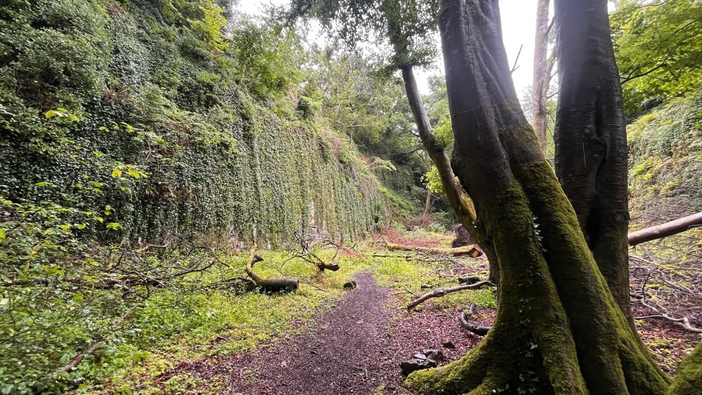
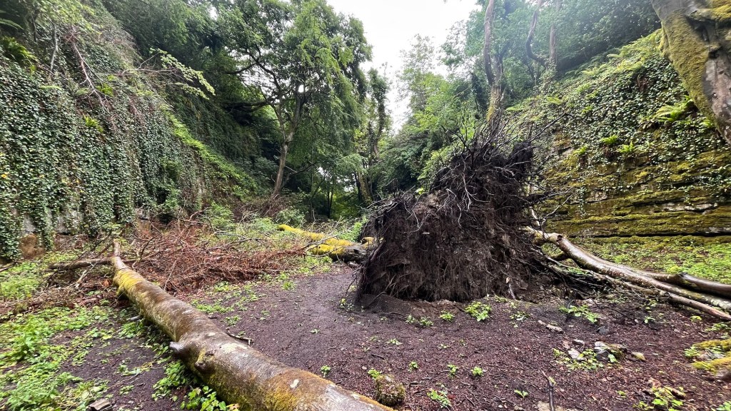
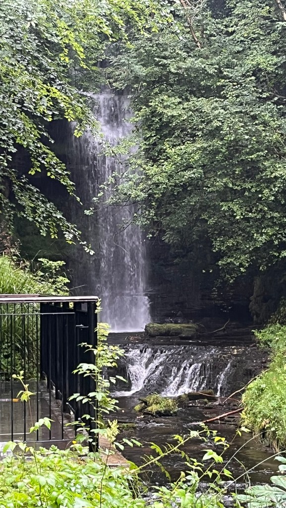
Finally about 11, we shut The Van door and head off for a walk. We head to the far corner to the campsite’s entrance intending to find a small track leading to the main road. Alas, once there, we discovered we couldn’t go that way (it wasn’t an official footpath) so after a little deliberation, decided to reverse the walk and go in the opposite direction. So we followed a track that turned into sheep fields until we came to the disused railway with its derelict junction box and turned left, plunging us into woodland again. We had to go the long way, passing a huge wall of stone, the remnants of the viaduct crossing the steep sided valley. We dropped down before turning right and following the well marked path. We were hoping to see the Falls marked on the OS map. We passed the stumps of the viaduct’s supporting pillars and figured where we were – under the railway. We carried on, eyes peeled for an elusive deer. The path twisted and turned, steep pulls up before dropping down. Consulting the map we noticed we were off the footpath, but we hadn’t seen any signs or forks in the path taking us lower. We ploughed on, some parts a little tricky – narrow sections, muddy parts, fallen trees taken in recent high winds blocking the path. There were “Private Property – Keep Off” signs nailed to trees at regular intervals. We checked our map again and to our dismay, we had overshot the Falls!! How annoying. We toyed with the idea of retracing our steps to find the missed junction, but looking we realised there wasn’t really a path to the Falls after all – only a little unofficial track that stopped short of them. Perhaps the landowner didn’t want us down there, hence the signs and had actually redirected the path we were on, deliberately. We didn’t fancy going back and then thinking about it, there had been hardly any rain recently so they wouldn’t exactly be gushing and exciting. We decided to give them a miss and carried on.

The forgotten Junction Box CD
Remnants of the viaduct
What’s left of the pillars supporting the viaduct!

We climbed steadily until we popped out onto a wide gravel track and followed that out onto sheep pasture. In the woods, it had got stifling hot and we had shedded our jumpers. Now the wind raced across the fields, cooling us down, the jumpers went back on. We dropped into a small conifer wood before climbing out up to a quiet country lane. About 50 yards further along, a signpost pointed us into a meadow, full of buttercups, trefoils and other flora. We entered a small woodland, the path zig zagging down towards a small stream and a wooden bridge. We decided to stop here to eat our sarnies, crisps and drinks, perching on the stone steps of the bridge. It was a lovely little woodland opening up further downstream and not so hot to invite flying insects to join in with our lunch. Topped up, we tackled the startling steep hill on the other side which flattened out and took us towards a farmyard.

We walked through the farmyard, setting off the farm dog barking frantically behind a gate, thank goodness and picked up a road, passing the huge sewage treatment works that dominated the area. As we walked we noticed a lot of roadkill – baby rabbits mainly. It was a road to a farm with hardly any traffic so how did these creatures die? We presumed that birds of prey had caught them or maybe a fox – they weren’t squashed. We counted at least 6 in a small stretch of road – had there had been a bunnicide? It was all very odd.

Eventually we came up to the main road, still musing the cause of mass bunny death when we realised we had overshot yet again. There had been a footpath on our right that dropped down to a bridge that crossed a stream (we had even commented on the bridge and why it was there) but there had been electric fencing all the way along the track – there seemed no way to this bridge apart from straddling the fencing and hoping not to receive a hefty shock in areas where one shouldn’t receive them. Luckily there was another footpath on the other side of the road (we didn’t fancy walking along the main road which was busy and with no path – we would end up like one of those bunnies). Looking at the map, we worked out we could do a loop behind the hamlet of Lartington which would hopefully have a pavement which would get us to the next footpath safely – a bit of loop, but hey, we weren’t in a rush.

Well, it turned out to be a bit of a bonus. We came across yet another part of the railway, this time just the pillars of a missing bridge taking the railway over our path. We clambered up onto the railway and there was a path on it, probably used by the locals. We dropped back down, noticing a yellow sign telling us that “these animals bite”. There was a broken down wire fencing on the edge of adjacent woodland, so we wondered what animals lurked that regularly nibbled passing walkers. With our senses heightened, our pace picked up slightly as we expected a herd of hungry velociraptors to burst out behind a tree and give our backside a nip. It was a bit unnerving, to be honest.

We eventually dropped down onto a paved driveway leading to Lartington Hall and its associated lodges and buildings. We wandered to the main road, distracted for about 20 minutes by a rather stunning graveyard. Not exactly heaving with headstones, it was impressive. The entrance was adorned with tall pillars with statues on top, a clutch of elegant and detailed gravestones and a large building at the end with a glasshouse on top. We read a couple of the stones before looking at this building which turned out to be the chapel. Unable to go inside, we peered through a slit to see inside. It seemed large chunks of carved stonework had collapsed onto the altar, but it looked in good condition overall. It was quite wonderful and hoped that wasn’t being neglected. We wandered around respectfully, both noting that we loved wandering around graveyards and churches – they are so full of history, local stories and just fascinating. We wandered out down to the village, delighted that our hunch of a pavement was realised and strolled along the village with our necks at right angles as we goggled at the beautiful old cottages and houses, well kept gardens and so typically English and timeless. We agreed we liked Lartington.

Entrance and chapel at Lartington

We found our footpath and wandered through knee high grass to a sheep field, before rejoining the disused railway. We noted that it must of been a substantial line as it was wide enough for two tracks side by side. The tracks were no longer, covered by dusty grey gravel as it crunched under our feet. We had come full circle. We picked up the path and fields that took us back to the campsite, stopping briefly to pat and feed a handsome brown horse some grass that he seems to appreciate. Back at the campsite we rewarded ourselves two Magnum ice creams from the campsite shop and sat on The Van steps, watching a recently arrival set up home. We had done a respectable 7 miles to add to the 6 miles of yesterday. The sun tried to peek through the cloud – there were breaks of blue sky.

Later as we settled down for tea the weather did what it had been threatening to do the last two days. The cloud dissipated and the sun had the full sky to itself. We parked ourselves in its full glare, soaking its warmth properly before the sun went to bed for the night. Really nice to sit outside and not feel cold. We clinked wine glasses to celebrate the sun making a welcomed appearance and the final evening of a great, but too short road trip. Tomorrow we would go to the Bowes Museum in Barnard Castle before slowly heading home. 😞

The old railway line now disused.

Barnard Castle Day Two

Well, had a decent night sleep and it looked sunny. We rose slowly, had a cuppa and a chocolate biscuit(s) before getting ready. Then breakfast of croissants and jam and finally a plan. We would walk to Barnard Castle itself and check out the town centre.

https://en.m.wikipedia.org/wiki/Barnard_Castle

The weather forecast said it would be 14 degrees so jumpers and a coat were adorned as we set off down the track we came up yesterday. As we walked down, we got shelter from the cooling winds and then sun came out and we were soon shedding clothing. We followed the distinct footpath signs provided by the equestrian centre, scooting around the edge of it and following a grassy path between two horse fields before plunging into the woodland. Here we discovered an information board declaring it to be a nature reserve. We followed the path, checking on the app when paths forked in various directions and dropped down to the stream and across a bridge. The path continued along, the woodland thick with trees in full leaf. Distance squeals of children and yapping dogs broke the silence – it was just enchanting.

Finally we were burped out onto a main road which we scuttled across to some steps and a bridge spanning the River Tees. A covered pipeline went down the middle and at the end were two Victorian turrets on either side. It was obviously the remnants of a stone bridge, now replaced by a sturdy metal structure which had been there itself for sometime with rust and many layers of paint. The river was reasonably wide and majestic, lined with the woodland. We branched right and headed to the Castle and town centre, stopping briefly at an ornate seating area declaring a Roman road and past industry. We carried on past the vast ugly utilitarian concrete weir and towards the Castle. We were soon on the grassy apron in front of the castle with good views. It’s owned by English Heritage and had an entrance fee. We erred on that and just poked our noses through the entrance. It’s now a ruin but still very impressive. We headed towards the High Street a few yards away and wandered around the shops.

https://www.english-heritage.org.uk/visit/places/barnard-castle/

We walked down one side and then the other. It’s in a L shape. We peered in shops as it started to feel quite warm and we started to regret the jumpers. There were lots of independent shops and the main drag was quite handsome with the odd national chain burdening Barnard with their ugly corporate signage. There should be a law that shop signage should be fit into their surroundings and not cause offence. One particular shop was particularly garish and really needed a stick of dynamite, but overall it was quite charming. Of course, the traffic was appalling and cars parked everywhere, but we wandered around happily. We stopped at a lovely cafe and sat outside to people watch and Daughter could watch a bride getting married in the church opposite. We decided to get some tea and hunted down a little deli just on the edge of the High Street. A brief visit to a supermarket (urgh) to get the last bits and then we decided to head home.

We found another route home and headed down a side road lined with stone terrace houses which led to the cricket ground. On the far side was a grand house with floor to ceiling windows and we remarked how many times a stray cricket ball came close to smashing one of those! We walked up a path to this house which had long range views across the cricket ground, the town and the distance hills beyond. We watched the cricket match for a little while, even toying with the idea of going back down and having a drink in the pavilion, but we changed our minds walking briefly through suburbia before plunging back into the woodland. I was beginning to really love Barnard just for its endless woods! It was just gorgeous. We followed well defined paths under a canopy of leaves meeting the odd person. It was so quiet to such an extent that we looked down a side path and saw a beautiful deer staring back at us in as much surprise as we were. Daughter scrabbled for her phone camera, but he was publicity shy and disappeared into the undergrowth before she was ready. But it was lovely to see the deer properly and not just his white backside.

We carried on, finally popping out by the main road again and crossing over. We retraced our steps through the woods, bobbing back by the horse fields. We found a shortcut to the campsite – peeling off the track to a stile which dropped us at the back of the campsite so we had a good chance to check out our fellow campers. The wind had got up and it was feeling cool again. We had taken our awning down this morning fearing that with the strong gusts, it would get damaged, so on our return we decided to put up the windbreak instead. For years we had a colourful stripey affair with four posts that you whacked with a hammer and it was erected. We upgraded last year with one a bit more technical with a manual to match. Today was its third outing. We amused our neighbours for at least an hour as we figured out the various poles, straps and clips, but with a flourish and only a couple of collapses, we had it up! Feeling accomplished we opened up a bottle of wine to celebrate and huddled behind our newly erected shield. It was distinctly chilly (it’s only June). Finally we headed into The Van to make tea, drink more wine and chill. It had been a lovely day and Barnard Castle a rather pleasant place to visit seemingly surrounded by endless woodland. Perfect.

Barnard Castle Day One

Second daughter and I decided to hang out together and planned a road trip in The Van for a few days, basing ourselves near Barnard Castle.

So straight after work on a warm Friday afternoon, we headed north and east, arriving at the Caravan and Camping site about a mile outside Barnard. We were met by a cheerful chap who used his bicycle to escort us to our pitch. We parked up and began to nest – roof popped up, electric plugged in and a well earned celebratory cuppa. We wrestled with our new awning – we briefly got it the wrong way round and hoped our fellow campers weren’t watching in amusement. The sunny day of this morning had now clouded over and threatened rain (it had rained on the way up), but was still relatively warm. We decided to go for a walk before tea and consulting our Ordnance Survey app, deduced a circular route in the nearby woods. So off we strolled, out of the campsite and down the track. Soon we was taking a left down a farm track towards a farmhouse, when a big bouncy brown hound came across the large lawn, barking at us. As we wandered further down, he came over towards us though stopping at a polite distance to continue his barking. It was almost he was a big brave dog, but not brave enough to get really close which we appreciated. As we worked our way through the yard, he followed us still barking as if he was escorting us off his property and making sure we did. There was no vicious about him, just a dog doing his duty which he did rather well.

We crossed a field of buttercups and thistles (ouch), over a stile and dropped down onto a steep valley full of trees. It seemed quite ancient and timeless, dropping down to a large pebble strewn stream. We followed the narrow path between the undergrowth, admiring this pretty woodland. It was so quiet. The path went up and down, contouring the edge of the steep slope, with benches dotted here and there so you could stop to catch your breath and admire the trees, fauna and flora. A large tree had fallen across the valley and looked like a bridge. Daughter decided to traverse it, but only got so far before she chickened out as it got narrower and the ground dropped away. We carried on walking, across little bridges, little ridges, the path twisting and turning. It was almost Lord of the Rings territory, a mystical beauty.

We pulled up a particularly steep bit, when there was a loud crashing sound and the Daughter yelped in surprise before giggling. A squirrel scampered up through the undergrowth as Daughter explained that it had literally fallen out of the tree and hit the ground with a heavy thump before running off in deepest embarrassment. It was Squirrel Central here so no doubt there was a large group of his mates have a good laugh at his misfortune and would rib him for days about it.

The path bent round so we could head back to the campsite. It was riddled with footpaths here. Again we wandered along before coming to stepping stones across the stream. As we paused, there was a rustle in the undergrowth which wasn’t our accident prone squirrel, but a deer. We caught its back end as it scampered further into the woodland – we kept our eyes peeled, but we never saw it. We walked up the steep hill and popped out into a field with horses. It seemed to be Horse City with all the nearby fields having horses grazing. We followed the signs and headed towards another farmyard which was in fact the local equestrian centre. We negotiated our way around here (they had diverted the route, evidently fed up with people wandering through the centre of their yard) and found the long straight tarmacked road back to the campsite. Dark, brooding clouds gathered in the distance as we opened a celebratory bottle of wine and prepared a simple tea. We sat under our new awning, people watching fellow campers, as we ate and planned the following day. Maybe a waddle to Barnard town. It tried to gently rain and with it cooling off, we retreated inside, made the bed and watched a film. A perfect start to our stay!