
We woke at 5:30 to a lovely morning. It was our last day of walking, the last day of pulling on boots, packing our rucksacks, snuffling biscuits. We had a nervous energy today as we had an schedule to keep – the tide was due in around 1:30pm, cutting Lindisfarne off with the mainland and with a hotel booked on the island tonight, we couldn’t dilly dally.
We met in the breakfast room at 8am and had breakfast by the window. We spotted Pepsi and Shirley eating their breakfast quietly – we were sure they were still hobbling. We went back to our rooms, gathered our stuff together and got a lift back to Fenwick village store.
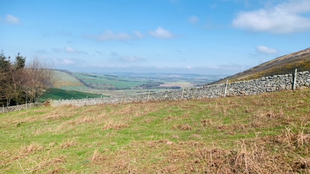
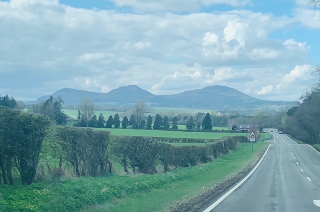
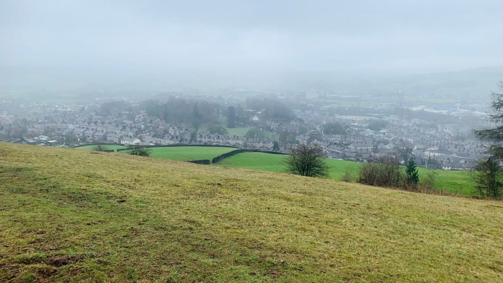
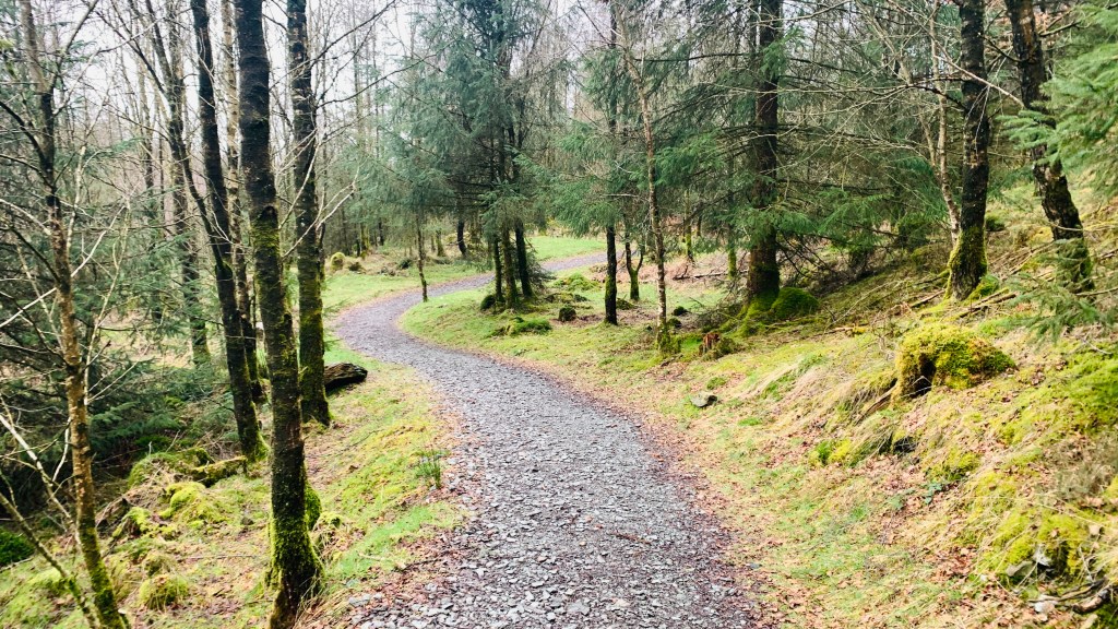
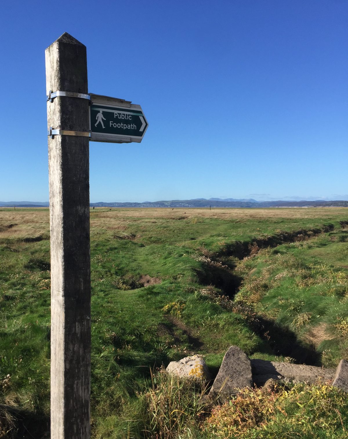
We set off eastward on the main village road and soon came up against to the Great North Road, the A1. This could be interesting, dodging thundering lorries and speeding cars across two lanes so we approached it with some trepidation. In reality, it was relatively easy – about a minute of waiting when both lanes were clear and we casually strolled across. We dropped down to some houses and then took a footpath across several fields, the sea in the distance. Lindisfarne was getting closer and closer. It was relatively flat and an easy ramble. It was quite warm too and we started to shed coats and fleeces, though still blowy. We came up to the East Coast Railway Line, the major rail link between London and Scotland, where we had to phone the signalman, using the phone booth by the path to ask for permission to cross. He told us to wait as a train was coming, so we waited for a couple of minutes before an Intercity passenger train came whistling through. We waved at it as if we were the Railway Children and then had to call the signalman again who confirmed that we could now cross. Our next crossing would be the sands!


We had a few more fields to cross before finally dropping on the beach, by a line of huge concrete squares set there to deter a potential German invasion back in World War II. Across the damp sands was Lindisfarne and to the right, hugging the corner of the island was the hamlet of Holy Island, our final destination. We wandered to the road and joined the causeway that took vehicles across to Lindisfarne. We shared the narrow roadway with a constant stream of tourist traffic passing very close to us until we had a chance to jump down onto the sands. A row of poles running across the sands showed walkers the safest way across – it had always been our plan to traverse this route to end our epic walk rather than jostling with cars on the causeway. We quickly and excitedly undid our shoelaces and pulled off our boots and socks, startling our feet as they hit the sands – we started to walk, but this section was a bit gloopy, our feet sinking into black sand, oozing between our toes, making us slip and slide. This isn’t what we expected, but after a few more steps, we hit firmer sand and we were off, striding purposely to the finishing line.
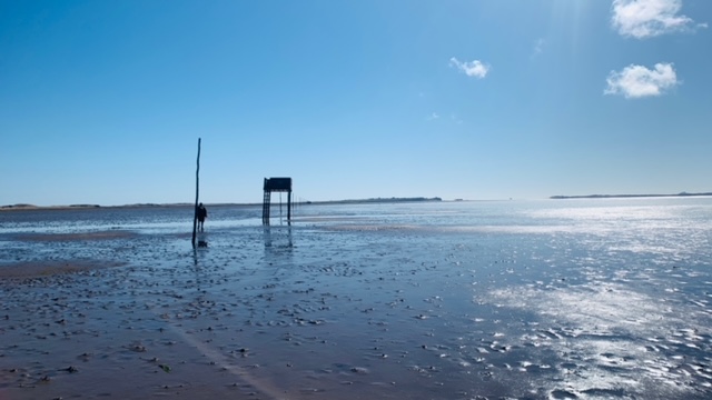
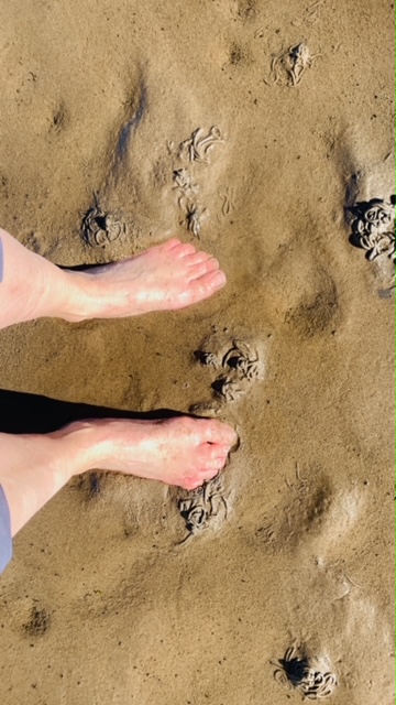
It was the best two mile walk I think I have ever done. Boots in hand, we strolled across – walking through water, through sand, admiring the views of the mainland shimmering in the sun and seeing Holy Island getting closer. It had a spiritual feel about it. We walked separately, all three of us in our own little worlds, enjoying the last miles of this fantastic walk, soaking up the last moments. It was just the perfect ending.

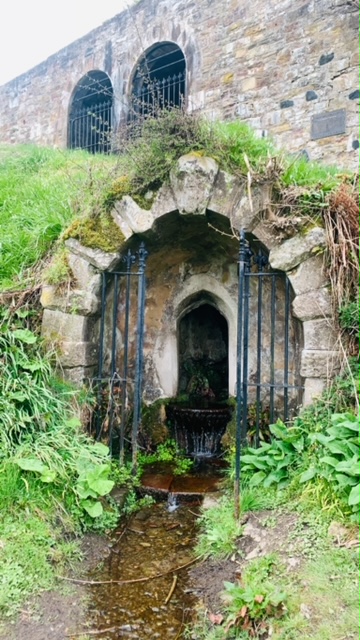
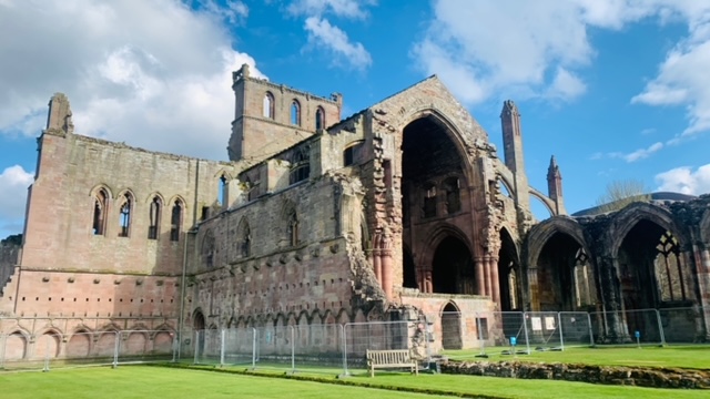
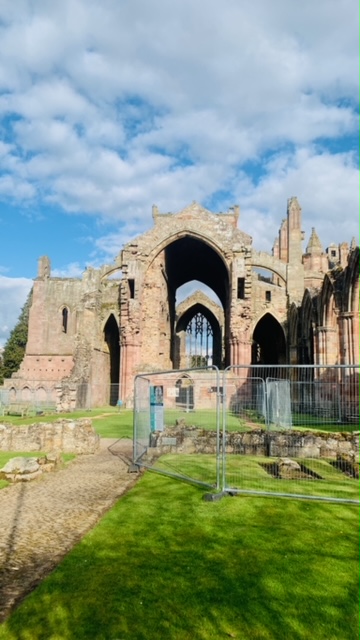
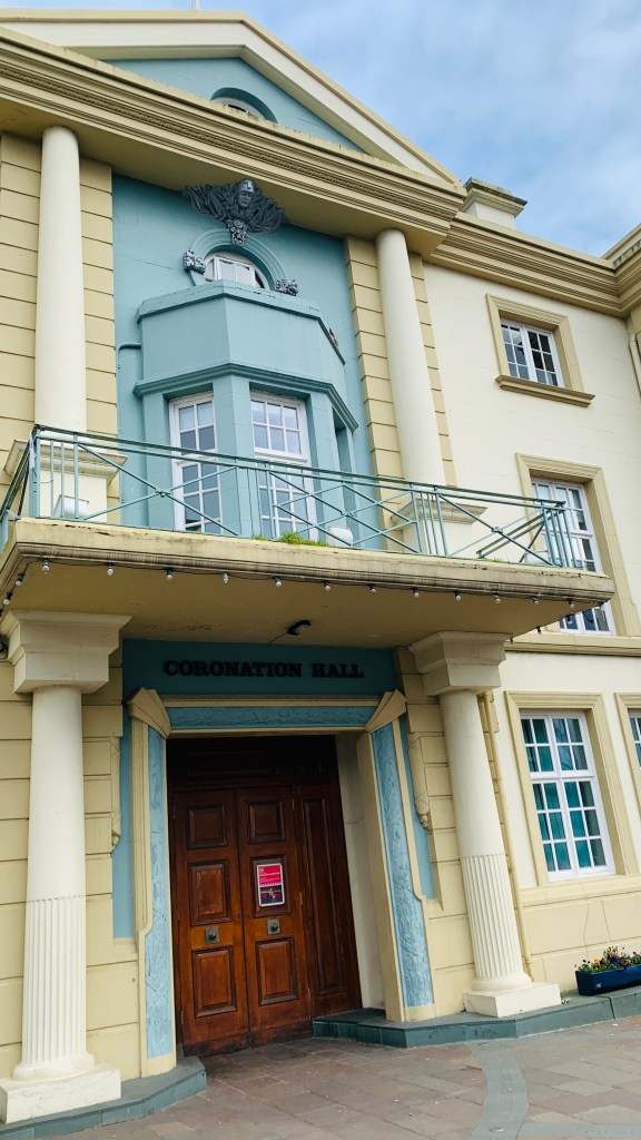
Apart from finding a rather gloopy bit in the middle that Hubby and I managed to find and spent a considerable amount trying to rid our legs of black slimy gunge that refused to be washed off, the end of this fantastic walk across the sand soon came up as sand dunes and tufty grass loomed up. We had made it and what a fantastic way of arriving on Lindisfarne. We whooped loudly in celebration startling some nearby tourists and hugged each other. Behind us the vehicles were still piling onto the island. We dried our feet and rubbed the sand off before stuffing them back into our boots for the final stretch of road walking. We fell into conversation with a local walking guide and asked if there was an official end for St Cuthbert’s Walk like on Hadrian’s Wall. Apparently not but he offered a couple of spots where we could commemorate the moment in our little way. We joined the crowds of tourists shuffling down the road to the village centre and found a cafe serving coffee in a walled garden. We found a sunny spot to sip our drinks – watching hordes of people, many with dogs on leads. It was a bit overwhelming to suddenly find ourselves thrown back in the thick of humanity. We went to find our hotel – on the way we found a cross surrounded by railings and decided to make it that our official end. We toasted our achievement and walked into The Manor Hotel – it was just past midday.

The girl behind the bar curtly told us we couldn’t check in until 2pm as per the email sent to us (the transfer company got that) and we retreated, wondering where we could eat. We tried the two or three hostelries but they weren’t ticking our box. We wandered into the Lindisfarne Mead, a large shop dedicated to selling Mead and various other alcoholic beverages as well as other tourist tat to the masses. Thwarted by the lack of an official end, we thought we might be able to acquire a St Cuthbert’s memento. All we found, in a desperate corner, were some grey t-shirts with a St Cuthbert’s logo on the front and a map of the route on the back, vastly overpriced (I suppose if you have a limited trading time, you make the most of it) and all one size. Obviously, St Cuthbert’s Walk wasn’t high on Lindisfarne’s tourist agenda.
Our stomachs reminded us that we were still looking for nourishment and we ended up in a cafe ordering takeaway sandwiches, not wanting to sit inside. While we waited for our food, we spotted Pepsi and Shirley getting up from a table and heading towards us. We smiled, said hello and asked if they had done the St Cuthbert’s Walk. They fell into a brief conversation with us as we compared notes about the walk – Pepsi looked positively relieved. We wished each other safe journeys and for the last time, Pepsi and Shirley walked out of our lives.
We decided to walk down to the beach to eat lunch and as we made our way through the village, felt a distinct change in the air – the relaxed jovial atmosphere was replaced by a fidgety tension, subtle glances of watches and nervous nudging of browsing partners “are we nearly finished?” “what’s the time?” “we need to be getting back to the car y’know”. The streets were draining of tourists, heading with a hint of urgency back to the car park, everybody on a schedule. The tide was due.
We went down to the beach overlooking the mainland where Cuthbert, growing weary of his hectic life, took to another little island across the way for some solitude, reflection and some time to himself. We fancied that after a few hours with the bustling crowds. We had a good view of the causeway too, full of cars heading back. We sat there for ages, devouring our lunch watching the exodus. It was coming up to 2pm and though most cars had gone, there were still the odd motorist racing along trying to beat the tide before it consumed the causeway for the next 8 hours. There were numerous warnings and signs, but apparently people still got caught out. We had no sympathy.
After a while, bored with watching the cars, we decided to go and check in, so we could enjoy the rest of the afternoon. We went back into the village and it was totally empty, spookily empty as if some unseen apocalypse had befallen the island. It was like a ghost town. The shops, which had been heaving, were now firmly shut, scuppering our plan to get icecreams. It was one extreme to another and was rather weird. We went back to our hotel where we met the girl again and she took us to the reception area. Yes, she had our rooms – one under Sis’s name and one for Paul Docker. Who? We looked at each other with alarm – was there a booking mistake and Hubby and I didn’t have a room? This could be bad. Sensing our rising panic, the girl who was now a lot friendlier and helpful, went off to double check. A black guy turned up and waited behind us – was he Paul Docker? Would we have to wrestle the room keys with him? The girl returned telling us that they were definitely our rooms and we legged it upstairs before anybody changed their minds. Apparently the black guy didn’t having hotel reservation and we wondered what he would do, now stranded on the island til early evening.

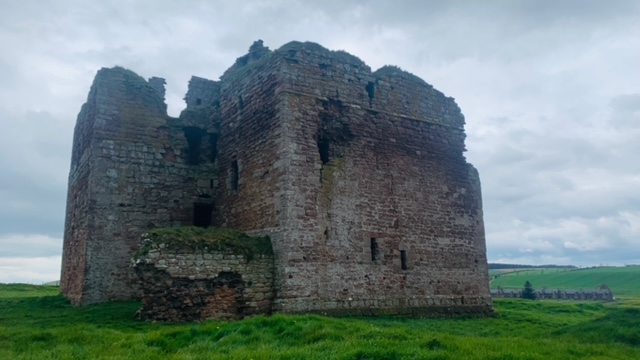
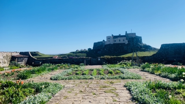
Our rooms were pleasant enough though the shower door only opened half way as the loo was in the way and it clunked against the bowl. (During the night, the toilet roll holder would part company with the wall too). We had to squeeze in – thank goodness we weren’t very chubby. With a whole afternoon free, we waddled down to the Castle and found Gertrude Jekyll’s Walled Garden perched on an incline opposite the castle, with nothing else around it – we didn’t know anything about Gertrude, but her garden was lovely, sheltered from the wind, a pleasant suntrap and so we sat there and reflected on our achievement. Our fitness apps told us that we had clocked up 70 miles (it’s suppose to be 62.5)and we had covered that distance in 4.5 days – we weren’t young people anymore, suffering from the usual aches and pains of daily life, but here we were, feeling fitter than we had been for a while, feeling very proud and accomplished, our bodies and feet not complaining too much. We were quite impressed with ourselves. Our families back home had been tracking our progress and cheered us on everyday – now they sent us congratulatory messages, telling us how proud they were of us. We had every right to feel proud.
https://en.wikipedia.org/wiki/Gertrude_Jekyll
But as we sat there we had mixed emotions – we didn’t want this adventure to stop, feeling we could walk further, sad it was ending, but with the sun on our faces, we were, deep down, tired of walking too. The journey had been special, fun and magical, great to hang out with each other, which had been lovely – we didn’t get many chances to spend so much time together. We were very happy, not having a care in the world at that particular moment and wished it could continue, but we were missing our families and our cats and our dogs and wanted to go home and share our adventures. But this would always be a special spot in our memories.
We meandered back to our hotel, through the sleeping village. We were still amazed at the transformation from lunchtime. It was a strange feeling to have a whole island to ourselves as if we were the only humans left after an alien invasion. After a nap and packing away our walking gear, we met Sis downstairs for a pre-dinner drink and our last evening meal. We watched the girl who checked us in early – she was now manning the bar and serving meals to other people staying on the island overnight, amongst many other tasks. She seemed to be the only staff member in the hotel, holding it altogether. No wonder she was a bit short with us when we rocked up too early. She showed us to our table, explaining everything we needed to know and then returned to take our order. Sis had some questions which the girl answered and displayed a quick and wicked sense of humour with an easy laugh. We were liking her very much and as the evening wore on, we fell into conversation with her, discovering she had been on duty most of the day and her expected 12 hour shift would turn into more like 15. She was joined by a chap, who was equally charging around like a headless chicken. They introduced us to their new chef who was starting the next day, leaning nonchalantly on a bar stool, beer in hand. They explained that getting staff was a tortuous affair, the last two people they had hired had been sacked within the week for stealing. We were aghast! There were no words – you secure a job and then steal from your employer. It seemed that nobody wanted to work in hospitality with its erratic and unsocial hours, and the likes of these two wonderful, hardworking selfless people end up working ridiculous hours.
We spotted the black chap chatting to some other diners in the corner. He had obviously secured himself a room here. We had overeaten again, our eyes bigger than our bellies, but the food had been delicious and it was our last night too. Hey, lets go out with a bang – we had even ordered a bottle of Prosecco.
Here’s to St Cuthbert and his long distance walk!
After that, we said goodnight to the lovely staff of the Manor Hotel and took ourselves off to bed. We didn’t need a lot of rocking…………..