We had slept fitfully. Another different bed. The sun shone through the curtains as we drank our tea and nibbled the hotel biscuits in bed. Then we prepared for the day. Flasks of hot tea, bottles of water, snacks and packing the rucksack. Checking the weather apps. Another glorious day.
Over breakfast, we checked our general health. It would become part of the morning routine. Aches, pains, blisters? The breakfast was okay, but the Premier Inn has spoilt us with its extensive array of breakfast products and this morning, we found it limited. But we managed to fill ourselves up that would hopefully last us til lunchtime.
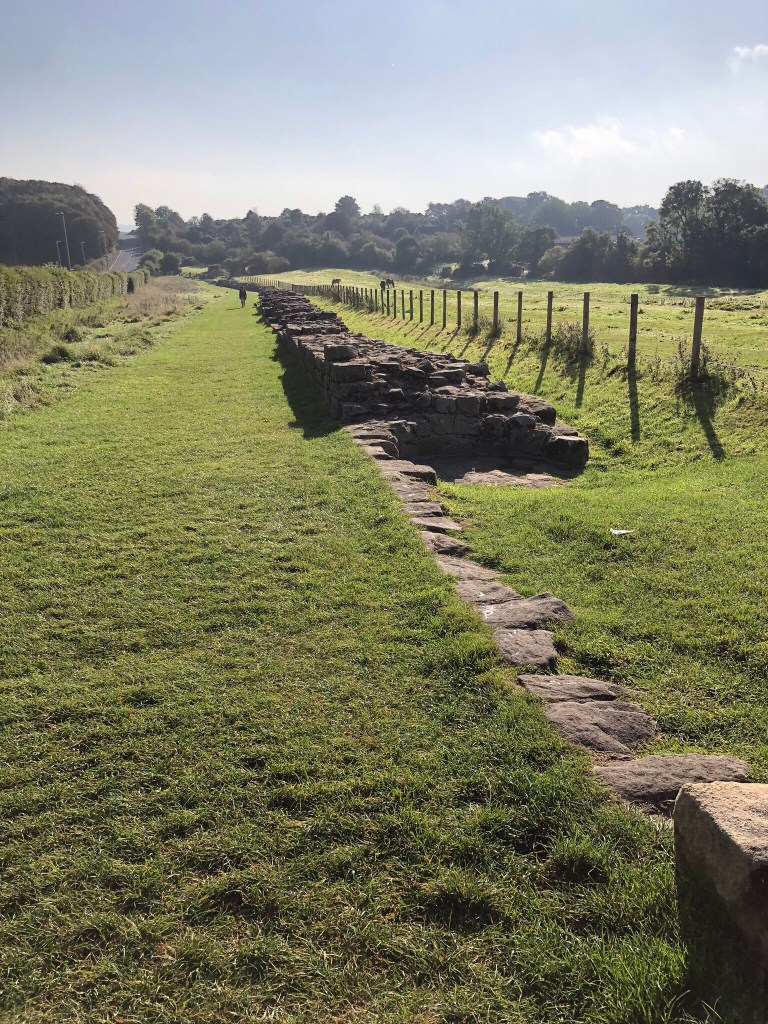
We got our rucksacks. We had ordered a taxi to take us back to Heddon-on-the-Wall and the exactly same spot where we stopped last night. It wasn’t cheating. We took a selfie to remind us in later years, how we managed to miss a hotel and set off. We headed first, to the edge of the village and the first glimpse of the Wall. A long stretch of stone and mortar heading gently down a slope in a field. It didn’t seem real that 1800 years earlier, Roman centurions had lived and worked here in arduous conditions and we stood there, chatting to a dog walker as cars whizzed by on the main road and an housing estate abutted the field.
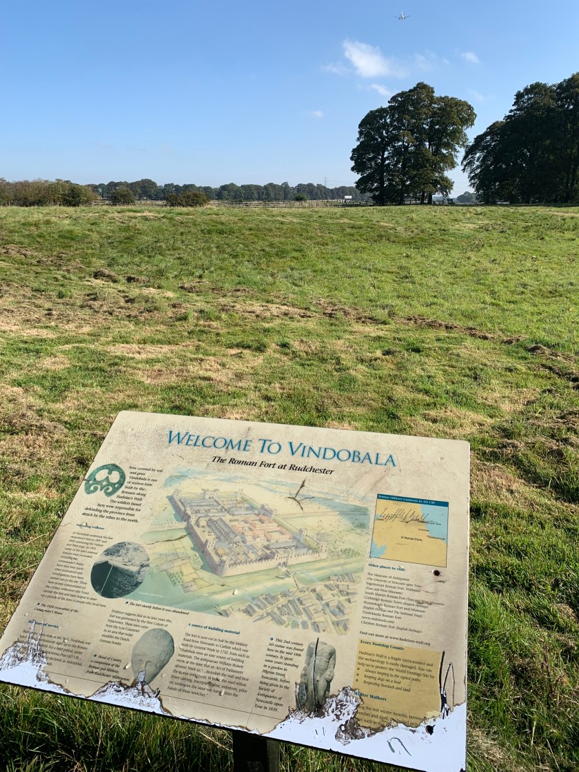
We said our goodbyes to owner and dog and walked through the village to the military road that took us towards our next destination. It was long and straight, houses on one side and countryside on the other. We crossed over the A69, a busy dual carriageway and dropped into a field. The sun got warmer and we shed our jumpers. We were gradually climbing. We walked fields, clambered over stiles, went through gates. We came across an isolated information board describing a long buried Roman tower in the middle of a field. We chatted to another couple who were hiking to Newcastle with their little terrier dog. We walked alongside the military road, a typical straight Roman road, now the B6318 where cars whizzed by constantly. We kept crossing this road, but always walked next door to it. There was good reason as this was Hadrians Wall. Over the centuries, various roads have been built over the foundations. The Wall itself had been robbed of its stones by the locals to build their houses and walls for their livestock many centuries ago. There was no physical wall to see, but you started to get an inkling of how a strategic master plan it was in its day. You could see for miles. We could see the Vallum, the main deep ditch that formed the outer defences of Hadrian’s Wall and other ditches that were part of the structure, so you could get a picture into your head of how it looked. It was a shame the wall had been lost, but our ancestors had no idea of history like we do now and anyway, building a house and shelter for your animals and hay were top priority in those days. Survival was top of the list. And as there was no building merchant lorries around to do a delivery – you used what was at hand – and the Romans had (very conveniently) left a very large stone wall to help yourself to!
We walked at a good pace, through an arable landscape dotted with haystacks. The sky was blue, the fields were yellow. There were great views to be seen – gentle rolling countryside. Aeroplanes from nearby Newcastle airport flew over us. We still hadn’t escaped city life completely. We stopped for tea and a mouthful of nuts and fruit. Soon a large reservoir appeared in the distance and we wandered down. Here we stopped for quite a while as we didn’t have far to go now – it was just after midday and too early to check in. So we loitered here, enjoying the warm sun on our backs.
We continued on, passing through little hamlet of houses called Harlow Hill sitting beside this busy road – it was the first sign of habitation since Heddon-on-the-Wall some 4 miles away. Finally we rock up to our next overnight stop – the Robin Hood Hotel, sitting alone on a long stretch of straight road. We were far too early so we wandered down the road to a farm that had diversified with little retail outlets and a very welcomed cafe. We sat outside, easing our walking boots off and letting our feet see some sunlight. We enjoyed sandwiches and a coffee as we studied our maps. We had done just 6 miles, which really should of been nearer 9 had we started from Newburn. A new obsession rose its head as we now compared how many steps we had taken, how many miles we had walked and how many flights of stairs we had climbed via our iPhones and watches. It was a game of Top Trumps.
Fulfilled, we sauntered back to the hotel and checked in. We had a lovely room that overlooked the car park, the main road and the vast vista of Northumbrian countryside. We showered, clambered into fresh clothes, and relaxed. There was a lovely window seat to watch patrons of the pub come and go. The Robin Hood Inn was surprising popular considering it was miles from anywhere and a steady stream of customers pulled in.
Later we went downstairs to the bar, armed with our travel books and maps and sat drinking beer and cider. We discussed today’s aches and pains. We ordered food and enjoyed a really lovely meal. The best yet. It started a page in our travel log to rate our plate for breakfasts and evening meals as well as the actual accommodation. Our eyes were bigger than our bellies and we overindulged. But we needed all the calories and energy we could get – well that was our excuse. Eventually we went back upstairs, sorted out our rucksacks and laid out clothes for tomorrow. It has been a relatively easy day – tomorrow was a good 10 miles to Wall. The beds were soft and deep, the duvets thick and cosy and we were soon gently snoring.
After days of overcast cloudy weather, the sun shines and the skies are blue.
I’m trying to incorporate a dog walk with some errands. Finally I decide to stretch our legs along the Leeds Liverpool Canal from Rodley to Apperley Bridge in Leeds.
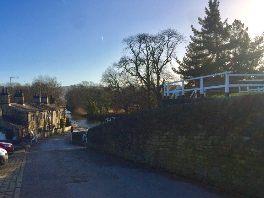
The Dog and I drive there after our jobs. We pull off the outer ring road at Rodley and park up near the canal. There’s limited parking, but it’s free. We find one of the last spots and wander to the canal side, where a long line of canal boats are moored. On one side, it’s open fields, on my side there’s a clutch of houses and a small cafe operating out of a stone shed, alas closed today.
The start of the walk at Rodley
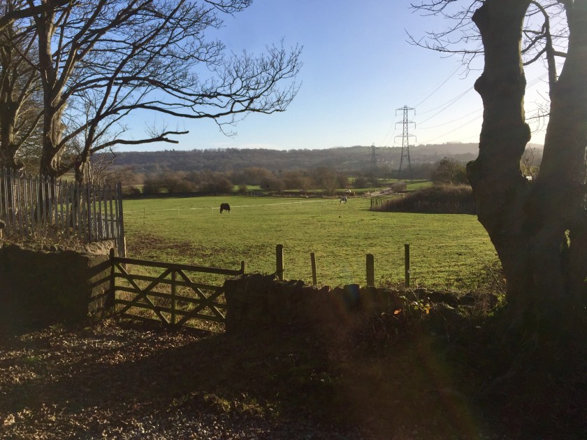
So off we set, the Dog dashing up ahead and me peering into the canal boats. There are a couple of really pretty, well cared for boats today – all clean and shiny. We follow the path towards Apperley Bridge, leaving the housing behind and the open valley of the River Aire. The valley is a classic lesson in physical geography – a railway, the canal, the River Aire and electricity pylons marching in between, only the road is missing, sitting on the hill above. Workmen are on the railway and there’s a plaintive bleeping alarm sounding across the fields which increases as a train approaches, warning the workers to clear the line. Then once it’s safe again, the alarm returns to its sedate bleeping. It follows us up the valley.
We go through a wooded part, The Dog running ahead, trying to find the little ramps that let her paddle in the water. No swimming today. There’s a brisk wind and it’s cold. Despite this, there are quite a few people walking, jogging and cycling along. I keep an eye out for cyclists as The Dog is off lead. Cyclists come in many forms – the worst being young men and the Mamils (middle aged men in Lycra). The former ride fast because they can, the latter think they’re still young bucks, racing the sprint finish of the Tour de France. Either group owns a bell or a tongue. They are upon you before you realise, whizzing past, not a hint of slowing down. “Watch out, there’s a dog…….” I splutter after them. Then there’s the women and older man, sedately cycling or at least slowing down, tinkling their bells or calling out gently. Most of the time I’ve spotted most of the cyclists coming and have The Dog under control long before they arrive, getting the odd thanks in appreciation as they pass. There seems an inordinate amount of them today, a small handful ignoring cycling etiquette when sharing with pedestrians.
We’re on the edge of suburbia, though you wouldn’t know it, the houses, shops and industry hidden from view above us. To our right the Leeds suburbs of Rawdon and Guiseley; behind the woods on our left, Calverley and the conurbation of Bradford. This is the valley taking trains to Morecambe, Lancaster, Manchester and other northern cities, the valley of fields and woods I mention in my blogs, that venture deep into Leeds before succumbing to warehouses and city life. We pop out of the trees, back into fields and distance woods. The railway comes close to the path here and we see the railway guys working on the rails. Two adults swans glide majestically on the canal, a respectful distance from their teenage cygnets, all stubby and brown. The youngsters are losing their ugly duckling persona, their white feathers overtaking their fluffy brown down, transforming into graceful birds. The Dog ignores them, after being being hissed at and pricks her ears up at an oncoming train, before giving it a half hearted chase.
The sun is warm in the sheltered parts, but the wind is eye wateringly cold and I’m walking into it. We enter the outskirts of Apperley Bridge, on the edge of Bradford. It seems full of modern housing and this past year or two, estates have been popping up all over. The only good thing, is they have been built on former factory and warehouse sites, but the whole area seems a mass of identikit houses as far as the eye can see. We pass under the main road connecting Leeds and Bradford, pass the marina and across another road. Here a huddle of stone cottages overlook a vast double lock, together with the Canal and River Trust offices, probably once the lock keepers cottages. We peer into the murky depths of the lock, look into the open door of the Canal and River Trust offices – nothing exciting – and carry on where we’re soon back into fields and farmland.
We walk a bit further, up past a farm abutting the towpath, full of equestrian paddocks and stables. They have diversified with a little cafe, but the last few times I walked up this far, they have been firmly shut. Today was the same. I’m not sure if my timing is awful or they have shut up shop permanently. I hope they haven’t and will be open again. For once I am organised with money on me for refreshments, but I’m thwarted from having a warming mug of coffee (and maybe a slice of fruit cake). It’s so dispiriting when you work yourself up for coffee and cake, and denied at the last moment. Sighing The Dog and I wandered up to where the railway bridges cross the canal and took stock.
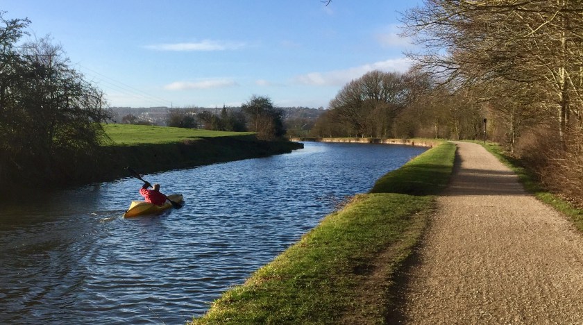
I would of liked to walk further, but then you have to walk back. So we turned tail and sauntered back whence we came. The wind was in our backs and the sun shone. There were all sorts of people out – mums with prams, elderly couples holding hands, friends chatting – we all smiled and said hello to each other. The Dog galloped after ducks in the water and woofed at them. A canoeist paddled slowly up towards Apperley Bridge – what a lovely way to travel, under your own steam. The railwaymen had repaired the track and disappeared together with their annoying beeping alarm. It was a glorious day.
The cattle crossing
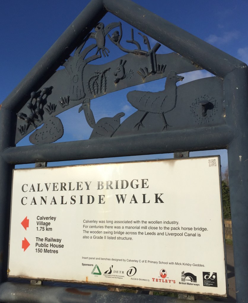
We sauntered back towards Rodley, passing the swing bridge which allows the local farmer get his cows from one side of the canal to the other for milking, before the houses began again and we neared the car. I hoped, with the sun out and plenty of people, the little stone shed cafe might have opened, but alas its picnic tables were empty and the door firmly shut. I looked at The Dog – she looked tired. It was past lunchtime and we had walked probably at least four miles if not more. I wanted a sandwich and a cup of tea, so pleased with ourselves we headed off home!
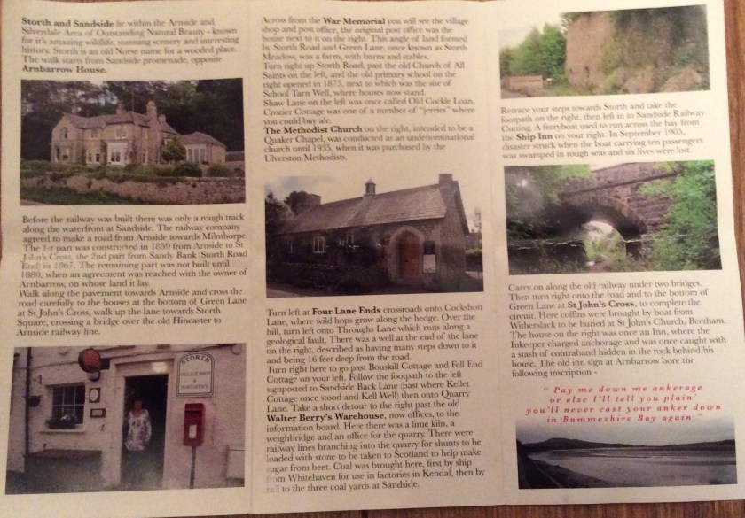
I was having a tidy the other day and found in a box, a leaflet about a walk around Storth, not far from Arnside. It pricked my interest. It was a 2.5 mile walk with points of interest highlighted and a detailed itinerary, so I put it one side for a future walk.
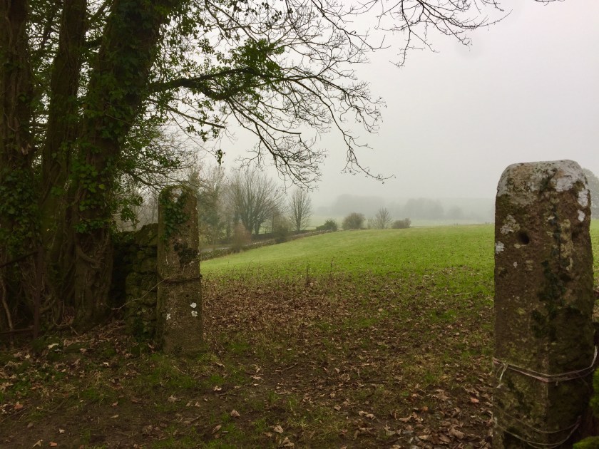
I didn’t have to wait long as hubby, me and The Dog set off a few days later on a misty overcast day. By the time we arrived by the shore of the River Kent, the mist was more like fog and you couldn’t see the other side of the river. We parked on the roadside, The Dog getting terribly excited, eager to leap out onto the sandy banks and have a run.
A rather misty day with no views whatsoever
We organised ourselves, denying our dog her sand run as the tide was coming in and there was a steep drop to the beach and wandered along the pavement, towards the village of Storth. There was a group of fishermen fishing, with their rods leaning against the railings waiting for a catch. We weaved ourselves through them, with hubby falling into conversation with one of them. We paused for a minute or two until hubby caught up with us, chuckling. The fisherman had offered us flat fish (if he caught any) to take home. Hubby had sort of said okay, but also made excuses of “we might not come back this way” – the thought of having to gut and fillet the damned things was something neither of us really relished.
We crossed the road, and walked up the road into Storth. We passed over the old disused Hincaster – Arnside railway line, now converted into a path and peered over the parapet. We continued on into the centre – it’s a small village with a little post office and shop, the old chapel and school converted into private homes and other old buildings. At one time, there had been a a flurry of bungalow building, as there seemed to be a sizeable estate edging out into the countryside. It gave the place an air of tranquility, a sort of sedate, genteel feeling. A nice place where people went to retire.
We got to the crossroads on the edge of the village and turned left, following the road into the surrounding countryside. It was damp and mizzly. I was starting to regret leaving my waterproof back home – it wasn’t drizzling when we left. So we marched on, following the route, but we hadn’t gone far when we were instructed to do a left. Two and a half miles isn’t long in our world, so studying our map, we decided to extend our walk and continued up the road on a long slow incline and make our own route up. The hill got the old heart pumping and we had a good pace. There seemed to be a myriad of footpaths and bridleways heading off on either side – it seemed a walker’s paradise. This area needed further investigation!
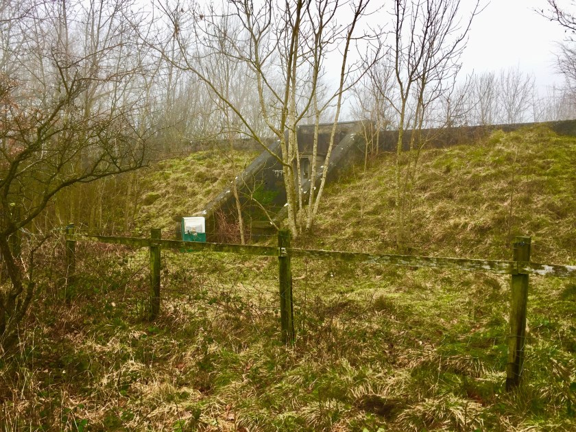
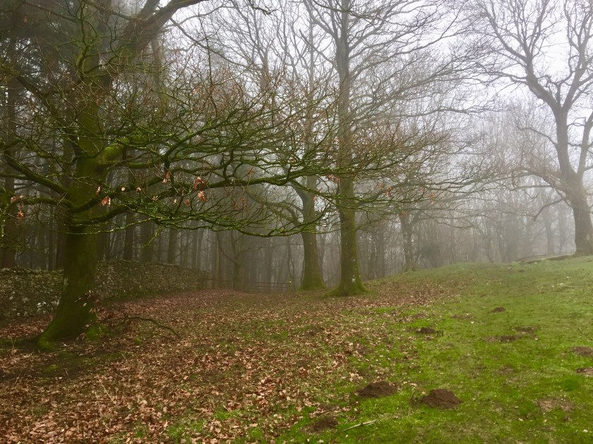
Finally at the top, we took a path left into the woods and unleashed the dog. A sign pinned to a tree notified us that red squirrels had been spotted in the woods and that we should report any further sightings. On a day like this, they’re probably curled up snugly in their nests, but we were quietly delighted. The poor old red squirrel has been repelled for many years by the non native grey squirrel and has only a handful of strongholds namely in Northumbria and Formby on the west coast (to name two of the sites) remain. It was lovely to find that they were establishing themselves here. We carried on through the trees, turning left and upwards. The mist seemed to get thicker. As we approached the top, we came across a mound with a concrete door imbedded in its side. We looked at our map, but couldn’t figure out what it could be for. Initially we thought it was a dam for a reservoir, but there was no lake. Our imaginations started to run away with us as it looked like an old nuclear bunker, but around here? Later after a little bit of Googling, we discovered its true purpose. It’s apparently a holding tank for water, that’s been pumped up to the village. The link below had a little information on it – it’s called Haverbrack Tank!
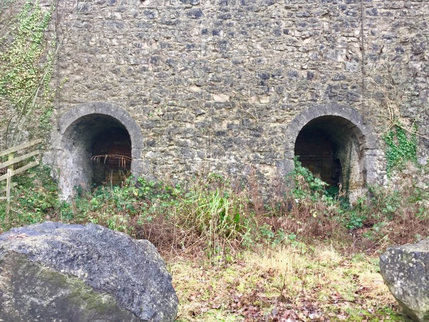
After our little diversion we dropped down through fields and footpaths, towards the main coastal road again. Any viewpoints or scenic vistas were not to be had today, the fog was in for the day. A path took us parallel with the main road, saving us walking along it and then dropped us on a tarmac back road, behind a unusually shaped office complex. We followed this, walking behind apartment blocks and a stone yard before coming up to the quarry, which mined asphalt. A tall stone wall had two kilns built into it, though disused.
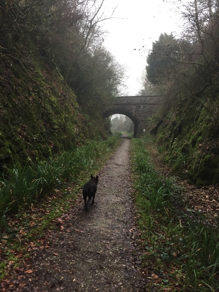
We carried on along the road, admiring the smart offices that had been converted from an old mill or warehouse. It was nice to see an old building looked after so well. Then we took another path right and dropped onto the disused railway line and wandered along the deep cutting. The railway line was built in 1876 between Hincaster and Arnside to serve the industry there, but lasted less than 70 years. The effort to blast their way through solid rock and to build towering bridges to lay a railway line was incredible. It seemed they had no choice, as there was no room on the shoreline for another transport system. If they had known it would only last 70 years, they probably wouldn’t of bothered, but we had the pleasure of marvelling at their work, especially the bridges spanning across the line – as usual beautiful stone work and lined with engineering bricks in a herring bone, they’re a work of art themselves. Today, a prefabricated concrete span would be installed within days, totally at odds with its surroundings. I was pleased that these architectural treasures remain.
We wandered along this stretch of line beyond Storth until it brought us out onto the main coast road. It wasn’t a particularly long section, but pleasant. We walked back towards Storth, along the road until the pavement started on the other side and we quickly crossed. 
We came across our fisherman friend again and was relieved to discover that he hadn’t landed any fish at all, so he couldn’t fulfil his promise to us. But we ended up chatting to him for quite a while, so much so that The Dog sat down and waited patiently while we sorted the world out with him. After a while, feeling the damp chill penetrating, we bade him goodbye and wandered back to the car.
On the walk we had waddled past The Ship pub overlooking the estuary and had a waft of chips hit our noses. We started to feel hungry, having an urge to devour a chip butty at Arnside. Back at the car, we took a final look at the map to find an alternative way home (we can never do A to B and back to A – we always throw in a magical mystery tour on our days out) and spotted a couple of cafes. That pricked up our ears and so we headed to nearby Beetham and hopefully a little tearoom.
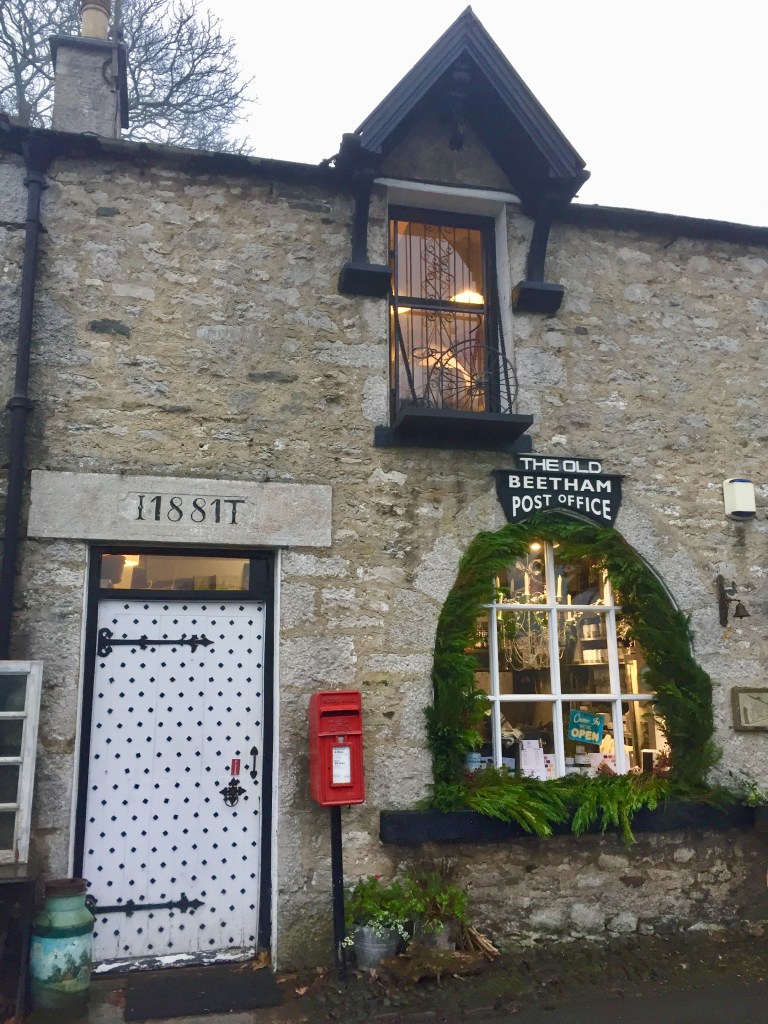
So through the fog and drizzle, we drove a few miles cross country until we came across the extremely enchanting and tiny village of Beetham, just off the A6. We pulled up outside a little shop with a tearoom sign above it, but couldn’t tell if it was open or not. We were on a tiny lane, so decided to check out where we could park. After a little recce of the surrounding village and another potential cafe, we voted to go back to the little shop cum tearoom (after checking it was open and it let dogs in).
We entered the little shop, and thought we had time travelled. It was an old fashioned shop of bygone years, quirky and delightful. It had timeless charm about it. I was enchanted, mentally making a list of people I could bring here who would love it. It had all the day to day essentials but on one wall, it had several shelves full of specialist paints for distressing furniture – it was highly unusual. The rest of the shop was full of antiquities and higgedly piggly. We went through the back of the shop, up some narrow stairs and bobbed into the cafe. It had half a dozen tables, with a roaring wood fire and full of odds and ends – roasting forks, old fashioned jewellery, pictures and other pieces. It was fascinating and just up our street. It was cosy, had heaps of character and as we found out, wonderful food too. We decided on a quick sandwich with a vague plan of visiting our local pub back home for an evening meal. That plan was soon scuppered as the plate appeared – sandwiches, a cup of crisps, coleslaw, couscous and a salad. Even the drinks came up with a little square of cake in the saucer. It was delicious. The Dog sat under the table, her head resting on my lap, her doleful eyes pleading for me to feed this poor neglected underfed hound. She did get several chunks of ham from my sandwich. The cake stand was also equally seductive and resistance was futile. We succumbed to home made apple, cinnamon and walnut cake and a slice of tea loaf with Lancashire cheddar cheese. Naughty, but extremely nice.
Very happy and very full, we left reluctantly back into the gloom, deciding that a quick walk around the village was required to get the stomach digesting. We found a route that went around the edge of the village, following a path that dropped behind the large paper mill on the edge of the village. Here we can across the Heron Centre, closed for the winter. Information boards informed us that it was a renovated water mill and museum, harnessing the powers of the River Bela to power the original corn mill.
We needed to come back to Beetham to check the Heron Corn Mill our and sample more food at the little tearooms. Stupidly, I forgot to take photos of the Corn Mill, so you will have to check out the links above to find out more. On the opposite river bank was the huge local paper mill, seemingly big, noisy and ugly compared to little Beetham. A noticeboard on the A6 gave a brief history of the site – there has always been two mills on either side of the river, the paper mill starting life as a corn mill until in 1788, when it became a paper mill and has remained so ever since. It must be a big local employer for the area which is beneficial, but it was a little jarring against the village. There were bits of the original stone buildings, but a lot of it had been added on and rendered in the standard brown pebble dash which made it look forlorn and drab. But at the end of the day it was a working mill, not a tourist attraction so I wandered off to admire the river that ran down the side of the mill instead noting that kingfishers could be seen here in the summer which pleased me very much!
With the evening closing in, we headed off back to our little home, pleased with our wanderings and little finds. We would definitely be back to check out those other footpaths and the Heron Corn Mill when it opened in February. A great little day!
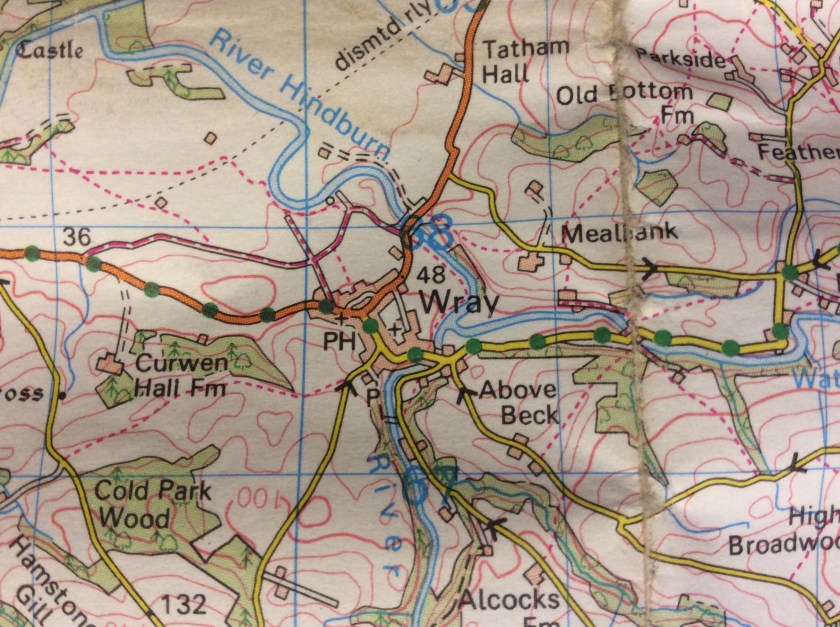
Today, The Dog and I decided to check out Wray in Lancashire.
We often drive through this pretty little village on our way to Lancaster and the coast, though we have been known to visit the little garden centre and cafe at Bridge House as well as the Scarecrow Festival in May. So this afternoon, we gave it a bit more attention.
I parked up in the aforementioned Bridge House and wandered around the garden centre, poked my nose into the little shop and promised myself a coffee and cake after our walk. We went onto the street, crossed the bridge and dropped down by the river. The Dog galloped straight to the river and stood in it. It’s just above freezing. She wanted a stick thrown so she could swim after it, but it wasn’t going to happen, it’s far too cold – I walked off and her pricked up ears dropped in disappointment. It didn’t last, she soon overtook me and bounded along the path.
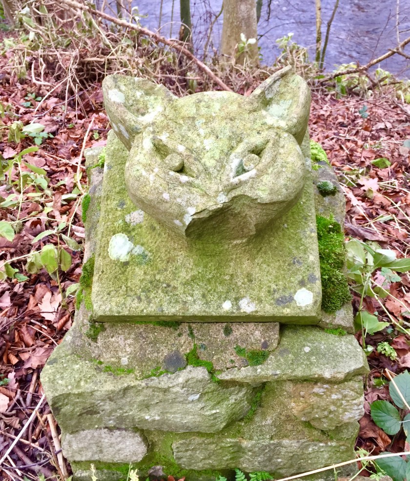
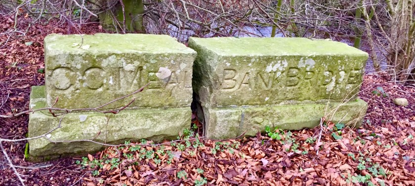
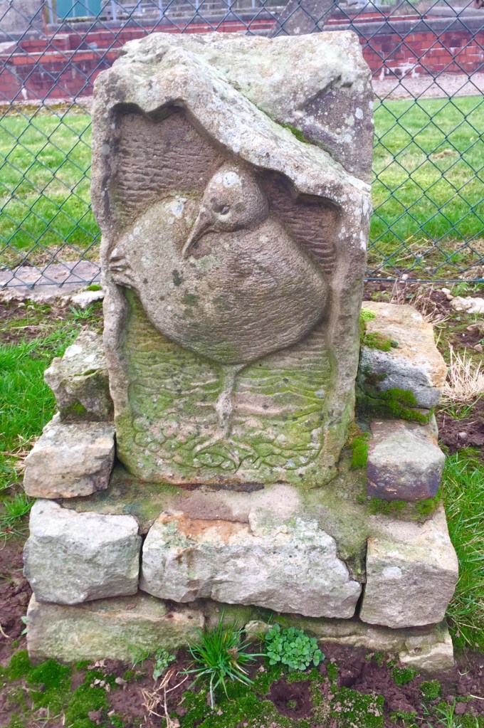
We soon came to a gate into a field of sheep, so The Dog went back on lead and we walked together, following the river Hindburn. We passed the Environment Agency’s flow monitoring station and then towards the main road. Here we paused as I had spotted a couple of stone slabs – one marked Meal Bank Bridge and the other with a cat like head carving.
It’s a fox rather than a cat…….
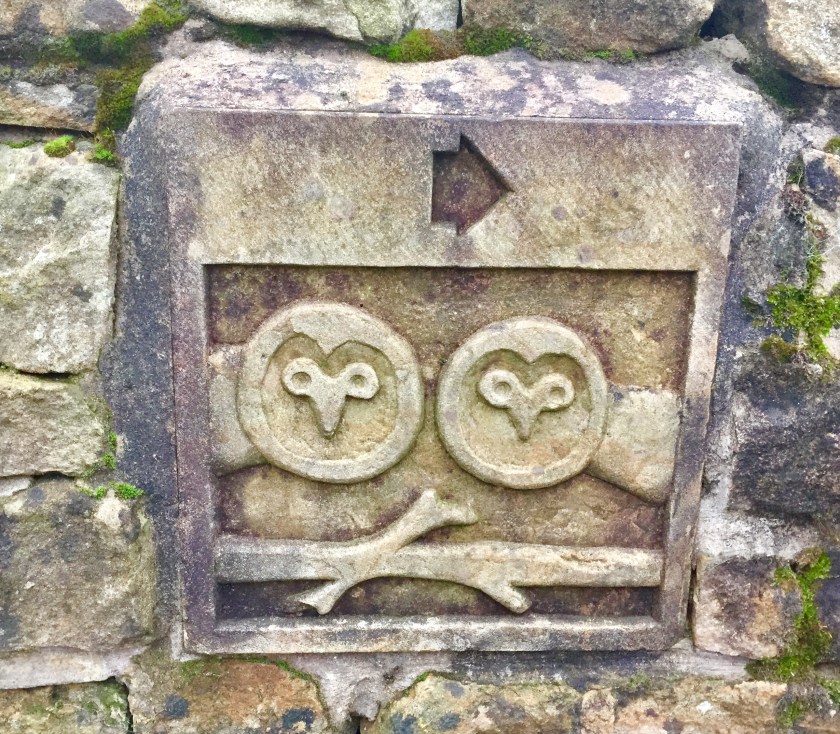
I was intrigued and looked for clues. I had a little pamphlet from the Forest Of Bowland about Wray that mentioned that visitors could “follow the carved stone way markers with imagesdepicting the local landscape and wildlife. The images were designed by the local schoolchildren…….” but there was no further information of how many and whereabouts they were on the route I was following. I also spotted daffodils starting to sprout under some trees which I was surprised at – it’s was early January, far too early. But we had had a very mild Christmas so all the plants think it’s spring. I crossed the road determined to Google about the stones later.
I found this later at home about the Meal Bank Bridge. It was one of the many bridges lost in the great flood of 1967.
We followed a muddy bridleway between two fields away from the village and let The Dog have a run. We approached the sewerage works by the river and discovered yet another stone carving. The Dog discovered another path. We followed it, but it just led to the river and a dead end so we retraced our steps. I hadn’t planned to deviate, but we found another path on the other side of the water works and we followed that through a couple of fields, found a track that led us back towards the village. We found more stone carvings.
We wandered back into the Main Street. I wanted to walk further, so we branched right up towards the school. It’s a tiny little school – they have an admission of 7 children per year and about 4 teachers plus the Head. How wonderful is that. Its made up of the village children and children from the surrounding farms. It had a lovely plaque over its door too.
o
Our school dates back to 1684 when it was founded by Captain Richard Pooley. Richard Pooley followed a successful career as a soldier of the Parliamentarian army under Oliver Cromwell, and after being made a Captain by Cromwell at the Battle of Worcester he returned home to Wray. On his death he left £200 for the endowment of a free school for his village. A local farm was purchased, the income from which was invested and used to build the school and to pay a teacher to provide an education for the children of the village. The school was rebuilt in 1885 retaining many original features.
An annexe was completed in 2001 funded by money raised by the school and village community. Upstairs there are two large rooms for teaching Upper & Lower Juniors, while downstairs there is a large room for teaching Infants and a hall used by infants for teaching and play. The village hall (Wray Institute) is used for PE, and the school has a large playing field in the centre of the village which is used for sports.
I stood looking at the school with its tiny front playground, wandering around the side road to the front entrance and another play area, wondering what it’s like to be a pupil there – instead of having 30 classmates, you had half of that or less. I carried on with our walk, down a little footpath and towards the River Roeburn that flows into the Hindburn. It’s like a little gorge. On the road, houses cling to the sides, their gardens disappearing towards the river. It’s here that I spot a lovely little sign.
We head back into the village and to the Bridge House cafe for a mug of coffee and a choice of cake. It’s a lovely, cosy little cafe with friendly chatty staff. Today, I chose a lemon and orange cake which was infinitely better than the courgette and avocado offering.
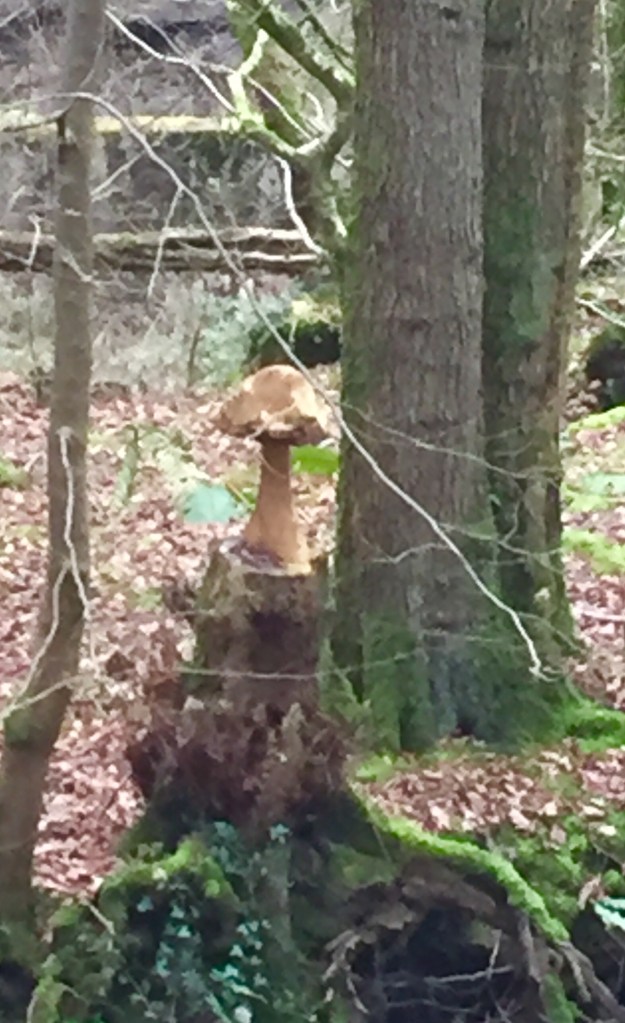
I spotted this wood carving in the woods by the Roeburn river – it seemed to be in a private area so I didn’t get close. Seems that a tree was felled and someone has carved the fungi on the top. I just love coming across these little unexpected pieces of art work, wondering why they have created. It made me smile.
We had another wander along the Main Street, primarily because I wanted a photo of it. The picture doesn’t do it justice and the cars spoil it, but it’s really charming in real life.
I also took photos of the other carvings as I came across them. There were probably more, but I didn’t see them.
After a week of Christmas overindulgence and slothness, The Dog and I were desperate for a very long walk and space. So we headed to Arnside Knott.
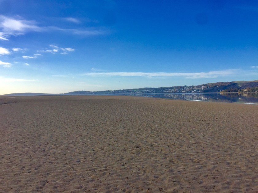
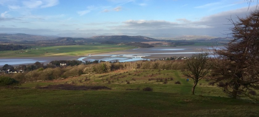
We’ve been to Arnside before, sitting at the mouth of the River Kent, usually wandering the shoreline, but today we incorporated The Knott, a nearby hillside with stunning views of the Cumbrian countryside and beyond.
The morning started with a thick frost covering everything and a thin watery cloud. We headed off mid morning, driving cross country. Down one particular road, we passed a sign attached to a telephone pole which said “Think Horses!” It was a warning sign for fellow road users, but the way it was written made me think, “Yep, I’m thinking horses – a tall four legged animal of many colours, but mainly brown and we ride them…………”
We rolled into Arnside and parked in our usual spot, overlooking the estuary. It was quite busy despite today being the first day back to work for many workers after the Christmas break, but the kids weren’t back to school yet so probably there were still lots of people enjoying another week off. The Dog bounded onto the beach in sheer delight – she had had too many short walks and on leash lately while her humans had been too busy celebrating, suffering from the after effects and from illness and now she was free! I caught up with her, noting how still the water was – it was like a millpond. It was beautiful. We wandered along the shore, walking towards Morecambe Bay. There were quite a few people out, doing the same as us – getting some air. Fishermen sat fishing on the waters edge despite the biting cold, waiting for the fish to bite.
We followed the estuary towards the sea and wandered around the headland into Morecambe Bay itself. The cloud had broken up and there was blue sky above us. It was very chilly, but the colours were stunning. We came off the beach here and entered a campsite perched on the edge, but hidden from view. This is a really quirky static caravan site. Most British static caravan sites are very regimented with the metal homes set in lines in a field, with a little verandah, a space alongside to park a car and lots of rules, like no ball games, keep dogs on leads, no noise after 10pm, etc. It’s all very manicured and controlled. This one is totally higgily piggily – set in a wood, the vans sat at different angles, squeezed between the trees on the hillside, all at different heights. They also had their own little plot of land around their caravan which they could do what they like with, so there was a mixture of fencing and bushes surrounding lawns and gardens. It was like home from home. It felt all rather strange walking through it but I quite liked the individuality of it all. It felt very relaxed and the only rule I came across was “please pick up after your dog” tacked onto a tree trunk which was probably aimed at passing interlopers like me. I could stay here.
We walked to the entrance of the caravan park where, to our delight, we found the cafe open. I called in and bought a slice of courgette and avocado cake. Don’t ask me why I bought it when there were flapjacks, Bakewell tarts and scones beckoning me, but it being New Year, I thought I would try and be a little bit good and have at least two of the “Five A Day” fruit and vegetables recommended by the health authorities. I took it outside where The Dog was waiting – she took a great deal of interest in my purchase. We kind of shared it. It was nice, it tasted alright though the cream inside was a bit much. It just didn’t get me hankering for another slice like a piece of flapjack would. But it filled a hole and would keep me going. We wiped/licked our faces and sauntered towards the Knott.
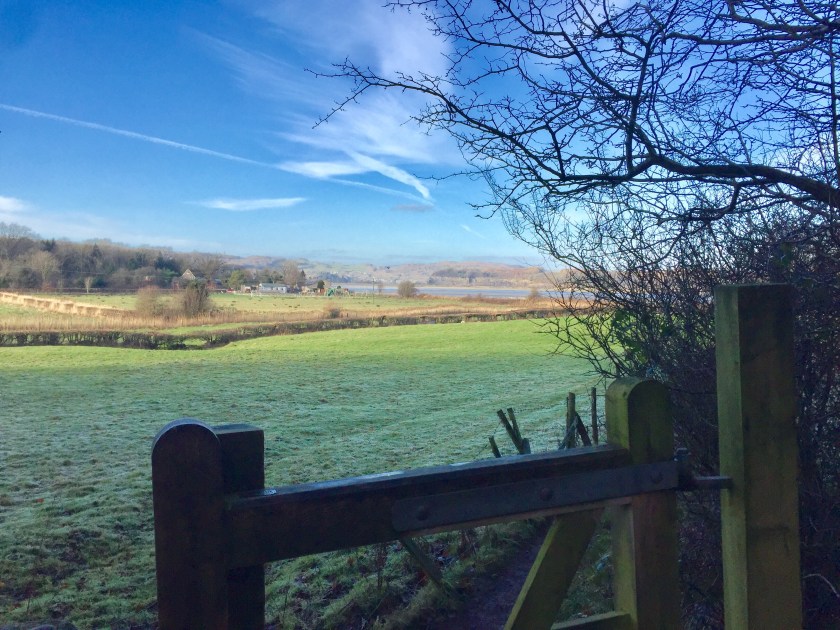
The Knott overlooks the little village of Arnside, a rising eminence of some 159 metres high and under the custodianship of the National Trust. From the cafe, we followed the concrete track to the road and on the S bend, took the footpath on the right hand side, crossing the field between two fences. The Dog did her usual stupid stiff legged gait and solitary bark, her way of pretending to round up the sheep in the adjacent field. This bunch were obviously used to so called big brave dogs, lifting their heads chewing slowly in bored interest before returning to nibble more grass. We came up to another gate, entered woodland and the dog concentrated her energy on chasing imaginary squirrels. The path wound upwards on a steady incline – there were numerous side paths too which looked interesting, but we heading to the top, so we kept to the rising path. Finally we came across a sign post and after some thought, we chose the left one marked Arnside. Some 100 yards later we came to another gate and realising that the path was just contouring, we bore immediately right, up a small path alongside the stone wall. The path turned into gravel and got steeper. The Dog found a thin path on her left and started to follow it. My dog has always walked ahead of us, despite many years of trying to get her to walk with us. She seems happy in her own little world, doing her own thing, away from us. She always has to be first to gates, stiles, doors, but she also has this uncanny knack of taking the right route. Today was no exception as she paused patiently until I came round to her way of thinking. Trustingly I followed her which turned into alarm. The path veered startling upwards which in its own right wasn’t too bad, but it was made up of small shingly stones, the type that freely move as you tread on them. I hoped my trainers had good grip. I just didn’t want to be taking three steps up and skidding down four, getting hot, sweaty and swearing a lot in frustration. The Dog, with her in built four paw drive, leapt up the trail and then showing off, bounded back down, proving how cumbersome two legs can be. A family with two young children were coming down, gingerly, hoping they wouldn’t slip and bring someone down with them. It would be just an embarrassing, painful fall on the bum and the child then refusing to take another step unless dad put them on his shoulders, which you could see, would be the last resort.
My boots did their job and I plodded steadily upwards. It was a short climb of no more than 200 yards at most, but I stopped a couple of times to admire the emerging views above the tree cover. It was just stunning.
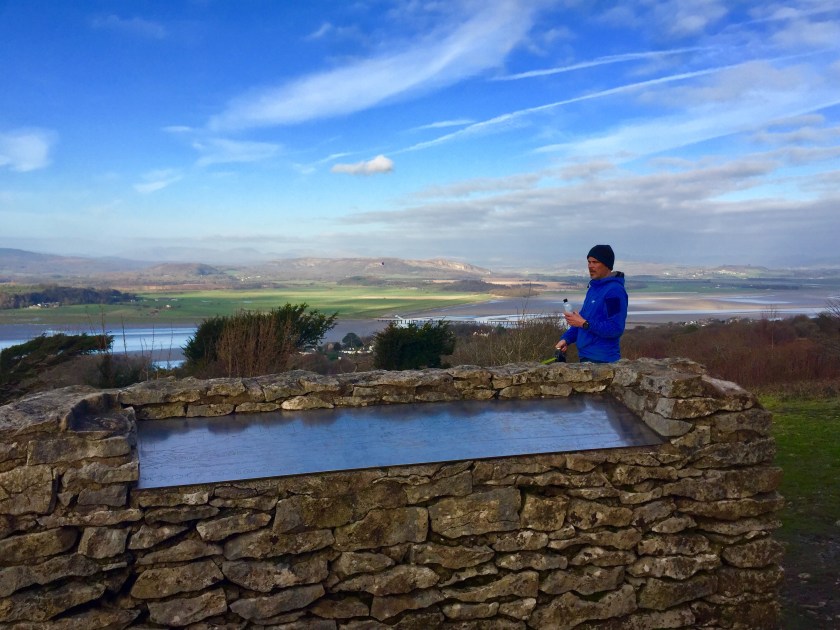
We reached the viewpoint which gave us a proper breather and to take in the spectacular views. A three sided wall had been built by some kindly organisations and inset with a metal plate, engraved with a silhouette of the landscape.. As it faced the Lake District, this was most of the peaks and fells and each one was marked with its name and height. It was fascinating to tie the two together to pinpoint their location – Old Man of Coniston, Helvellyn, the Langdales. Even Skiddaw, the Wainwright fell looming over the northern Lakes town of Keswick, some 40 miles north was marked and could be located with the naked eye.
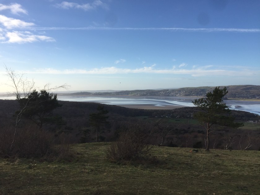
The Dog and I headed further up – a more leisurely slope towards the summit. The woods dropped away on one side, revealing the south side of the Knott with views across towards Silverdale, Morecambe, Heysham and on a good day, even Blackpool Tower. We came across the trig point, denoting the highest point of the Knott. We both touched it, because we could. There was no view here as the trees were too tall. Instead I read the little plaque on the side of the trig and was delighted to see that the Arnside Ramblers had taken it to their hearts and adopted it around 1997. It was a day of obscure and quirky signage. Usually benches and other public furniture is usually sponsored or donated by an organisation or group, but I had never seen one adopted before. It seemed that this particular trig had been left out from all the sponsoring and donating of its fellow trigs, so feeling sorry for it, it got adopted as if it was a cat or a dog, I thought it rather whimsical and so typical of the British. It also struck me that the Ramblers couldn’t remember exactly when they adopted it, citing sometime around 1997. If it was 1897, I could understand the records being a bit fuzzy, but 1997? It was only 21 years ago. I wanted to meet this group that went around adopting trigs but couldn’t remember when, but then I thought maybe the engraver had lost the little note with all the details on and embarrassed, decided to hedge his bets with “circa 1997”. Anyway I just loved the idea in every way and spent a few minutes deciding on what public item I could adopt.
After my musings and The Dog getting impatient with my blank staring (a quick sharp bark brought me out of my reverie) we started to descend. We followed the path which led to a wooden swing gate into a large wide field and plodded downwards to another woodland. We followed the woodland path until houses loomed through the trees and we popped out onto a private road with large prosperous houses, which allowed me to indulge in my favourite habit of staring into them. However they had such massive front gardens, I was rather thwarted, so I admired their gabled ends and fancy frontages instead which were rather splendid. We were obviously in the part of Arnside where the rich merchants lived when it was a busy and prosperous port, with their views across the estuary. We dropped down onto the main road, meandering our way back to the promenade. The Dog ran back onto the beach and paddled in the water, looking happy again. We just sauntered around the shoreline and the adjacent shops, taking in the glorious day, stopping to chat to fellow dog owners. It was just so pretty, the colours subtly changing as the afternoon wore on. We didn’t want to go home.
We had another little wander along the rivers edge before heading back to the car and retracing our steps. On our way back, I saw yet another sign that got me thinking. It was a name sign that most hamlets, villages, towns or any cluster of buildings have to introduce themselves to the passing traveller. Usually there’s an added note on the sign like “Carnforth welcomes careful drivers” or “Carnforth, please drive carefully. However, under this village name, the parish councillors had chosen “a thankful village” for their message to the world. I wondered what they had been thankful for – dinner? That it wasn’t raining? That me and my dog had passed thoughtfully through their village? You could give thanks for countless of things. I decided it would make a brilliant game for those endless, tedious car journeys to Aunt Mabel’s. “Skipton is thankful for………….Leicester is thankful for……….. Later, I thanked that little village as I played my newly invented car game all the way home!
Today I’m travelling by train on the Leeds Morecambe line, a journey I’ve done many times and always enjoy. I love train journeys watching the world whizz by and the ever changing scenery.
I had to catch a train into Leeds and was pleased to note that Northern Rail who run this line have upgraded its trains. Usually a dilapidated diesel rumbles in, but today a reasonably brand new one eased into the station. Bright, clean, well lit and carpeted which was a bonus, it was a very good start.
I changed trains in Leeds, grabbing a coffee as I waited on the chilly platform. I studied Leeds jagged skyline, new office buildings jostling for prominence, while older, more stately buildings and churches peeked in between. Trains pulled in as I admired how the whole rail system works, the myriad of tracks, overhead wires and gantries. It has its own kind of weird metallic beauty.
The train waiting for me was sadly a two carriage sprinter of indiscernible age, designed from bus/coach frames. I realised where the old stock went – on this line. They were evidently second hand stock, but in reality had probably been passed through many southern train companies before arriving in the North (we get all their casts off). They must of been at least 40 years old and it showed.
The driver appeared and started it up, diesel fumes spewing from an exhaust. He let it run for 10 minutes, probably trying to warm the damn thing up. Finally the doors opened and I sat on a hard seat, it’s material cover fraying. It was like sitting in a long tin box with windows.
The train crawled out down the Aire valley, the warehouses and industry giving way to winter trees and cold landscape. We’re still deep in Leeds suburbs but it’s almost countryside. I just love that this part hasn’t been developed. Finally the valley opens further and there’s long distance views of suburbs, villages and country.
We whizz past stations, it’s a cold, misty, overcast day. People wrapped in thick coats, scarves and hats, huddled waiting for their trains. We stop at Shipley and Keighley and other stations, in between filled with the housing estates, low level industry and warehouses, supermarkets, chimneys and factories interspersed with fields with grazing sheep. It’s a disorganised messy mish mash as the 21st century life encroaches on years of farming and agriculture. Gradually it all reverses with more and more fields and the occasional pocket of industrial units and housing. Past Steeton and Silsden, the valley broadens our further as we head towards Skipton. Today the long distance views are subdued by the mist and general dullness of the day. Fields are flooded from recent heavy rain where rivers and streams have burst their banks.
We slide into Skipton, past rows and rows of terrace housing. The sun tries to push through the gloom. I like Skipton station as it still maintains its Victorian heritage with a glass canopy over its platform, ornate iron girders holding it all up, painted in red and cream. All stations should be like this – just timeless.
Now we’re out in proper countryside, all rolling hills, farms and pretty villages. The train has developed an inexplicable draught so now I have one very chilly leg. I’ll be glad to get off this wretched train. Not the best.
A few months ago, a friend of mine brought to my attention an unusual fact about the Leeds Morecambe line, which ever since I’ve wanted to thump him for it. The line splits at Settle and up to that point, it’s a smooth, quiet ride. Then we apparently change over onto older tracks which clackety clack and judder for the rest of the journey. Had never noticed it before, but now it just bugs me!
The sun has bullied its way out and a weak watery sunshine lightens the misty fells. The countryside just gets better as we travel on the edge of the Yorkshire Dales. It’s been a lovely train journey despite the different temperatures flowing around my legs for most of the journey and I get off feeling very content with the world. Beats travelling by car any day.
High winds, lashing rain and a pretty miserable start to the day. Yuk.
The Dog, Youngest Daughter and me had some errands to run and squeezed a dog walk up in Hunger Hills woods in north Leeds during a break in the stormy weather. The Dog chased the odd squirrel that was doing some late foraging as we followed the paths, the clouds ominous above us, the wind bending the tree branches and making the fallen leaves chase each other. As we crossed a field, the weather closed in, the rain horizontal, coming in waves. We scuttled back into the woods and sheltered behind holly bushes and tree trunks. The wind picked up and we lost sight of trees across the way. We looked at each other with the same question – let’s abandon this walk and head back for a warm cuppa.
Of course, as always happens, we had several seasons in a matter of hours. The dark clouds, with their drenching rain gave way to clear blue skies, the sun shone and the wind dropped. Youngest Daughter needed to be somewhere a couple of miles away. The Dog and I jumped into the car with her with the intention of walking back.
We parked up in a street of terrace housing and I found the footpath at the end of the road. The Dog and I strolled up over a cobble path, into a back road surrounded by trees. One of those many hidden paths that criss cross Leeds that needs to be followed and checked out. We followed the tarmacked path up, discovering a large house with high fencing and imposing gates. It took us by surprise – just an odd place to build a lovely house. We twisted and turned slightly and followed a path on the edge of a small housing estate, their gardens backing onto the path so I enjoyed my favourite hobby of having a good look. It was a real hotch potch of gardens, pockets of land and people’s extensions to their properties. Soon the path bent and we found ourselves on the outer Leeds ring road.
We crossed it with ease and cut through more suburbia before dropping down towards Clayton Woods. We followed the lane down to the dog kennels and into the wood proper. Well defined paths took us south, past the horse pastures and under the railway bridge. A little sprinter train rattled above us, getting The Dog excited. She has a thing about trains. At railway stations, as they approach, she starts barking at trains as if they’re going to run away from her, startling fellow passengers. I smile wanly as I can’t stop her and people are hoping we’re not going to board. But once on, she sits next to me, not exactly happy, but tolerating it, watching in silence. At Hest Bank, she chases the trains that hurtle through the junction there and today her ears pricked up, she looked up with excitement and ran around trying to catch a glimpse of it.
In the centre of Clayton Woods is a huge disused quarry, surrounded by woodland. Apparently sandstone was extracted from here from about the 1930’s, it’s peak between the 1950’s and 1980’s when it was abandoned for no apparent reason. The quarry became very overgrown and was happily being reclaimed by nature, when a development company bought the land in the mid 2000’s with big plans for residential and commercial use and the development of a brand new railway station and parking. There was initial stripping back of the overgrowth in preparation for building, but for the last 13 years nothing has happened. The flowers, plants, trees and creatures are gradually, once again taking it back and now it’s becoming an important site for newts, interesting flora and fauna and archaeological interest. The link below gives a fascinating insight to the area.
We wandered past the two big ponds, apparently very deep at 18 feet deep and stocked with mainly with carp. There’s usually a fisherman or two there. They were also part of the quarry work too.
The Dog and I clambered up the steep path, the trees devoid of their leaves – silver birch and beeches are dominant here. We walked to the edge of the quarry and peered down. It is still quite bare from the stripping back revealing old collapsed buildings and foundations. It’s used by bikers and dog walkers mainly and is quite desolate, an alien landscape though as I said, nature is steadily stealing it back.
It would be great if it was left to nature and become a nature reserve. Travelling from the west, the quarry is a big ugly scar in the middle of the woodland. It sounds like that it could be developed at any time, though there are several factors against that happening. There were plans to build a new railway station with parking as the original station, just half a mile up the road is inadequate. The station itself is perfectly fine, but with it just being in the metropolitan area, the rail fares into Leeds are considerably cheaper. Therefore commuters drive their cars from outside the area, park up and continue their journey into the city. But there’s only a little station car park, so all the local residential roads end up being clogged with parked cars all day and it’s causes mayhem. Even the pub next door has had to fit car parking machines charging £10 to park to put off workers from dumping their vehicles there all day, taking up car spaces for the pub’s patrons. The quarry would be a perfect solution, but to what detriment. It’s a difficult one and one that Leeds City Council still contemplates.
With the sun sitting low in the sky, we continue our wandering around the periphery of the quarry, peeking occasionally over its edge. It’s been a glorious afternoon, the wind has dropped and there’s a little warmth. A vast contrast from this morning’s dismal weather. We walk through the woodland where the trees are more spaced out, the floor carpeted with their leaf debris, The Dog on alert for the scampering squirrel, so much easier to spot here. The sun is setting, the downside of winter. Dark gloomy mornings, a beautiful brief respite before being lost to the encroaching twilight at 4 o’clock. The days are so short now, no time for leisurely strolls, of investigating and studying or watching. Soon The Dog and I are back, as the dark creeps in, curtains are closed, fires lit, the heating cranked up and we curl up for the evening………..
The day was bright and blustery and needed our full attention.
The Dog and I headed out to the village of Bramhope, just north of Leeds with the intention of walking out east into the countryside. We parked the car on a road on the outskirts, full of detached handsome houses and prim hedges and with a Ordnance Survey map in hand, strolled off down an adjacent street.
It was relatively mild, but the wind was strong. The sun shone between the big clouds, some threatening rain. We had already seen rainbows. We walked down a quiet lane, lined with houses, me indulging in my favourite hobby of having a good gawp into each property, wondering who lived there and their tastes in decoration. It’s amazing my neck isn’t at a permanent 90 degree angle. Most houses were quite modest, but suddenly in between a house and a bungalow, set back in its own vast acreage was house more suited on a country estate. It was monolithic in size and totally at odds with its surroundings. I walked many yards with my neck twisted and mouth agape, wondering how much furniture you would need to fill it and how you would call your family for dinner, as scattered as they would be in such vastness, when suddenly we were back to modest detached houses and gardens. It was such surprising interlude that I spent many minutes shaking my head in amazement.
The lane and houses now came to an end and narrowed into a small footpath towards a stile. Now we were out in the country and fields of sheep. We followed the well marked paths, admiring the big sky and the last of the autumn colours. A red kite – a bird of prey rather than an actual kite – hovered over us, looking for food. A breeding programme at nearby Harewood House has consolidated their presence in Leeds and further afield and its very common to see them flying and swooping low over residential areas, their forked tails making them easily identifiable. They are scavenger birds, so spend their time looking for dead creatures to eat. Smaller birds like crows will gang up on them and chase them off in competition for resources so there are some fascinating aerial dog fights. They are very beautiful graceful birds and I just love observing them.
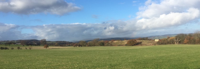
We were now following a ridge, overlooking the Wharfe Valley. There were amazing views to be had along its length – from the west at Ilkley and down to the east towards York. We stopped many times to admire the stunning scenery which I never tire of.
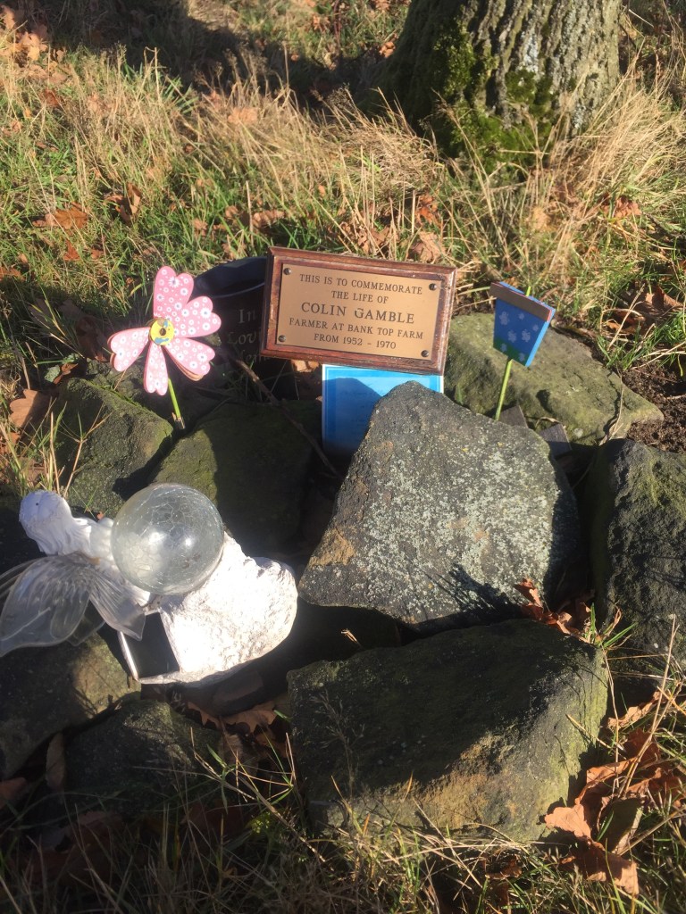
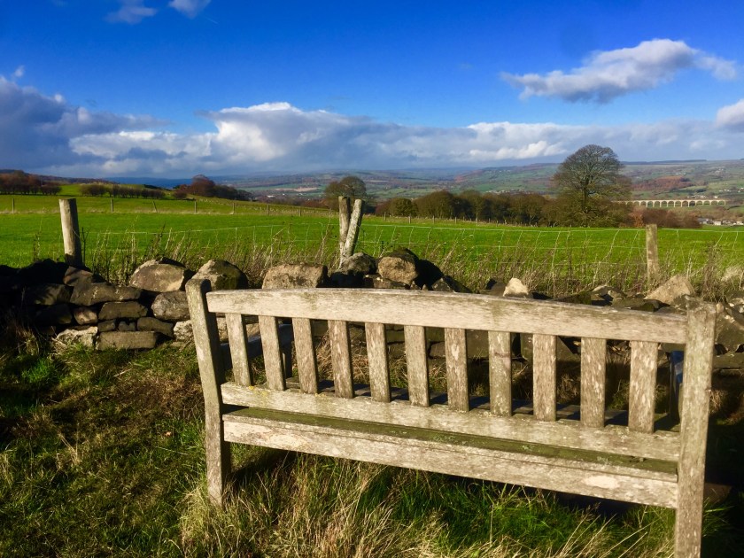
It was here we came across this lovely bench, making me wish I had bough some sandwiches and a warming flask of tea. It was definitely a lovely spot for lunch. A few feet away, was a small personally made memorial, a circle of stones, to a local farmer, obviously still cared for. Here it was, down this tiny footpath, isolated and totally unexpected – a bench and a memorial. Perhaps it was the farmer’s favourite view and he had spent many hours here. It was certainly the only bench on the entire walk. It was just very sweet.
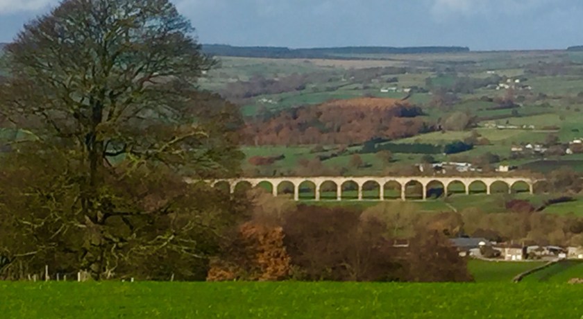
We continued on, the Leeds Harrogate railway viaduct looming into view across the valley and in the sunshine, was very striking. A beautiful piece of architecture in a beautiful part of the world. Today it just stood out, its arches majestically striding across the valley. Lovely.
We finally dropped onto a road, crossed it and continued down a wide driveway opposite, past a large group of buildings. I let The Dog off lead with the path enclosed which she was grateful for. We contoured along the ridge, then the path dropped down towards a scruffy farmyard, full of old rusting cars, farm machinery and other abandoned implements. God bless farmers and all the hard work and hours they put in, but why are their farmyards more akin to scrap metal yards? Farmers seem to have this obsession to hoard almost anything in the belief that one day, it will come in handy. I think it could be a man thing. Hubby can be a bit like that – there’s bits that I would happily chuck, but he prevents me with “one day, that might come in useful” and on occasion, it does (much to my despair) and I get a smug and timely reminder from a very happy hubby. But I have to scratch my head sometimes to when a dilapidated old tractor with its wheels missing and taken over by weeds will ever become useful again………..
We branch off here and head up the hill across more fields of sheep and negotiating stiles. The Dog is fairly nifty, jumping over them despite her advancing age, though sometimes she misjudges it and makes a real dog’s dinner of it. She sort of lands as if that was her intention and ignores my laughter and snide remarks. A few years ago, we went on a big group walk with friends and their four legged companions and all of them admired our dog’s agility over various stiles, including ladder stiles. The other hounds were a motley collection of terriers, spaniels and a particularly large, boisterous Golden Retriever and not one of them could jump over a stile (apart from one Collie who learnt over the course of the walk, how to jump stiles by watching our pooch). They just stood there looking baffled. All of them had to be lifted over by their owners, including the enormous Retriever who was like a sack of potatoes. Very heavy and awkward to handle. He was also extremely wet and muddy and nobody really wanted to deal with him. It took at least four people to manhandle him over, while he just looked serene and majestic, as if he was royalty. The humans dropped their shaggy cargo, staggering away, blathered and dishevelled. The Retriever remained indifferent to our encouragement to at least show some interest in negotiating the stiles and was lifted many times. I think we banned him from any later walks or chose stile-less expeditions…..
The hill flattened out as we continued. We dropped down to another road and through another farmyard. There were two farm dogs wandering around, which make me a bit nervous. They can be guard dogs and not appreciate strangers and other dogs entering their property. These two seemed friendly enough and the farmer was around, so I was happy. It was here we needed to find another path to get us back to Bramhope, which I initially couldn’t find, only realising that it was probably back in the farmyard after I had ventured onto a narrow lane looking for a sign. We returned sheepishly back to the farm, hoping that we’d find the new path quickly before the farmer saw us blundering around on his land and we wouldn’t have the embarrassment of asking him for directions.
Luckily two other walkers were coming towards us to confirm our bearings and we set off confidently. The Dog who usually has to be first to stiles, started to hang back, letting me clamber over first. I was a bit baffled by this. She then loitered behind the adjacent gate. It then suddenly struck me that she was probably hankering for me to open the gate for her, saving her leaping over the stile. The Little Madam! I told her in no uncertain terms that I refused to bend to her demands and stalked off. She soon followed me. Honestly, the cheek of it!
We entered another field full of sheep, who scattered as we neared them. The Dog was pretty good ignoring them and walked by my side, on her lead, but still the sheep scampered causing little stampedes as they spooked their neighbours. Then, one particular sheep looked up, stood its ground, stamping its forelegs belligerently. I was quite surprised at its audacity. It remained there, watching us pass with its beady eyes, it’s feet still drumming on the grass, refusing to gallop off. I hadn’t come across a sheep with such bravado and was half expecting it to charge at us and butt us (thankfully it didn’t have horns). I sort of adopted a funny sideways trot to protect my backside from a possible attack. What a wuss, but this animal looked like it meant business. Thankfully, it just followed us with its eyes with a look of “and don’t come through my field again!”
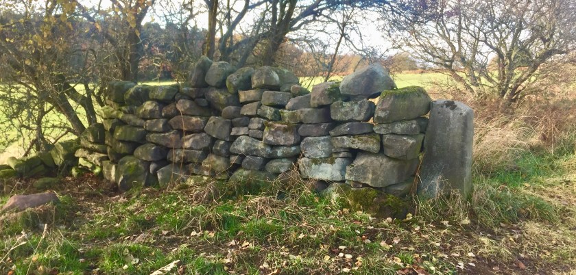
The last remaining piece of a dry stone wall. That’s all that’s left!
We came back to our first original road, but further down as I was following a circular walk on the map. I turned left towards a little lane that led to a group of buildings as per the map. I was a little baffled as there wasn’t the usual footpath sign at the entrance, so I double checked my map, which confirmed it to be a footpath. So I followed it down, pausing to take a photo of the edge of Leeds and Leeds Bradford airport with its planes all lined up ready for passengers in the distance, and then looked for any little signs or clues for the path as we headed to the cluster of buildings. To cut a long story short, the group of buildings turned out to be private houses, converted from a farm and its associated outbuildings and we must of spent at least 10 minutes stalking around, looking more and more suspicious, as we failed to locate the path. We traipsed up and down, peering at walls and fences, down the sides of the houses looking for an obvious continuation of our walk. We followed one track which just led to an electric gate and a private garden beyond. Frustrated, I studied the map, I even googled it. We did another investigation, inadvertently crossing a private lawn and blundering into a garden looking for a stile. By now, I was seriously thinking it looked like I was casing the joint for a burglary, I was probably appearing on various CCTVs and expected the wail of police sirens to be bearing down on us at any moment. Vexed, I declared to The Dog that we would have to give up and walk up the road to join the first path we had walked, something I didn’t really relish as it was a road with no pavements, and cars hurtled down it. We retraced our steps back to the busy lane, still looking for the reclusive signs and even did a brief trot down the road to check if there was another possible path I has missed. Thwarted, we started our road walk, when at the entrance of the track we had just left, pinned to a tree and very faded and definitely not very prominent, was a little sign declaring the footpath had been diverted, but lacked any further information as to exactly where. Muttering under my breath, frustrated with the residents there for having the footpath diverted and not advertising it very well, we stomped off. About 100 yards down the road, a well marked footpath sign stood, tall and proud, marking the new diverted route. Pleased not to have to walk down the road anymore, we happily strolled down it, when I suddenly started to realise that my map was pretty old and dog eared, and therefore not very up to date (which was proved later back home). Oops. I suddenly felt rather foolish and embarrassed at my hissy fit as I quickened my step, head hung in shame, making a mental note to choose my navigational aids more carefully next time……
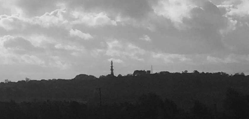
The edge of Leeds city.
The telecommunications tower you can see on the horizon is a well known landmark in Leeds and can be seen for miles around. It is probably one of the highest points in Leeds with the nearby airport being the highest in England. The airport can be closed on very windy days and planes do come in sideways, battling with side winds. Pilots usually slam down their planes on normal days, so it’s with trepidation when you hear the captain inform you that it’s a bit breezy in Leeds…..
We finally crossed our final sheep field, happy to find civilisation again, The Dog tried to chase her last sheep before we joined the main road that runs through Bramhope and trek back to the car. We peel off down the road to where the car is parked and I have a final chance of peering into people’s houses. It’s been a great little walk and we’ve been gone a good two hours or more. I think it’s time for some lunch and a hot cup of tea back home!
After a couple of days of short walks and lots of loitering, The Dog was demanding a good 2 hour walk. So we did.
We headed to the Bull Beck car park, east of Caton in Lancashire. We’ve done this walk many times, especially during winter as you’re guaranteed not to get blathered in mud and The Dog doesn’t need a shower when we get back.
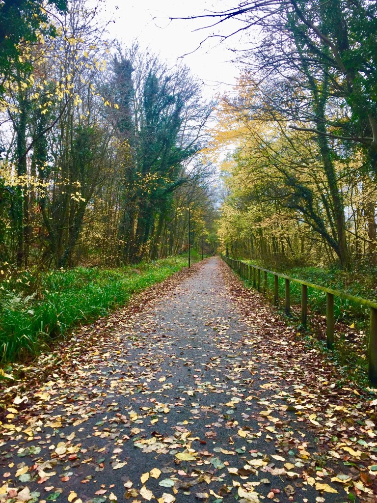
We crossed the road and dropped down on the Millennium Path which runs into the centre of Lancaster. The path is carpeted with leaves as a gentle breeze relieves the trees of their golden foliage. Many trees still hang on grimly, defying the finger of winter. The Dog and I enjoyed the final beauty of autumn along this pretty path.
It’s a pleasant walk, despite The Dog deciding that she knows better than me and decides to develop Selective Hearing Syndrome. A couple of tracks pass over the path and though I’ve only seen one vehicle on them, I always make The Dog stop. That takes a lot of “wait” “here” and “you bloody dog” for her to finally stop completely (she does slow down, but ambles for you to catch up, rather than wait). However, it’s been a life long unbreakable habit of hers to defy you in very subtle ways. When she eventually waits and you’re beside her, one paw will gradually move forward and then really pushing the boundaries, the other paw will follow. She just can’t help herself. Crossly, I shout at her “Well, don’t complain to me when you get run over” as if she’ll ever take that onboard. We then end up in a battle of wills which to a passing onlooker, looks very hilarious. Me, spluttering and spitting feathers, The Dog watching me with indifference, waiting for me to shut up. She kind of concedes briefly, but the cycle soon repeats.
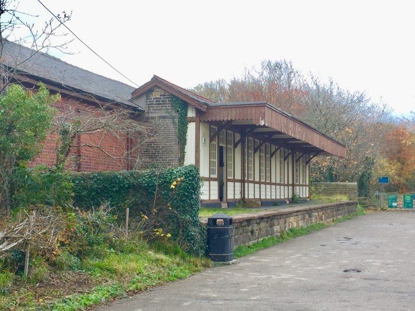
Finally, we manage to cross these tracks, with me giving The Dog a lengthy lecture on “if only you’d do the first time………..” while she’s more interested in looking out for squirrels. It looks like I’m berating myself. We walk past Woody’s, a little kiosk that serves stonking bacon sarnies and mugs of steaming hot tea if you’re that way inclined and continued to the village of Halton. As we near where we turn right to cross the bridge, we come across the old station building (above). The path lies on the old train line, cruelly lopped by Dr Beeching in the 1960s, when many railways lines were decommissioned and lost. Many have been turned into walking and cycling paths and many of the stations remain standing, usually as private houses. I’ve always fancied buying this one and converting it into a cafe and restaurant, as it’s in a perfect spot, but alas, the lack of funds and no experience in the catering industry keeps it as an outlandish dream. As we walk past, an ancient car with canoes lashed to its roof pulls up and burps out 4 youths. One of them, brandishing keys opens the door of the building and goes inside and I hear a garage door being opened on the side. It’s obviously a storage place. In a way, I’m pleased it’s being used and not being neglected, but I still think it would make a cracking little cafe…….
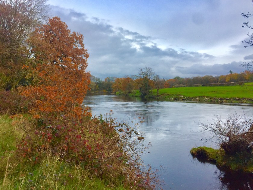
We cross the narrow iron bridge across the River Lune, a third of it marked out for pedestrians and the other two thirds allows a single car to cross it, so you have to take turns crossing it. One car passes us with confidence, but a following car creeps across, making me and The Dog stare. A little old lady, her nose almost touching the windscreen, gingerly steers her vehicle with a terrified look on her face. It’s a touch worrying that she’s still driving – she didn’t fill me with confidence at all. She was driving so slowly that The Dog and I nearly made a race out of it.
Halton is a funny place. Separated from Lancaster by the nearby M6, it’s a commuter village, with a pretty centre of old cottages and houses, but it’s periphery is a complete haphazard of development. It seems to be split in two – the old centre, then a gap of greenery and then a 1960’s housing estate stuck out on the edge. Now the town planners are busy filling in the green middle bit, but badly in my view. There’s a modern housing estate by the river that looks like it’s been plonked there (it’s a very nice estate, don’t get me wrong) but the fields surrounding it, look earmarked (and ideal) for further building. But alas, another development has started, but on the edge of the village instead of the middle. I just despair for Halton and its residents. They seem to be always fighting developments. I imagine from the air, the village looks like a splat. Not compact and tidy, but stretched and messy. You can imagine them inviting the planning bureaucrats of this country to seminars here titled “How not to develop a village” or “How to make a complete dog’s dinner of a pretty hamlet”, it’s so haphazard. The town planners and other faceless governmental penpushers have a lot to answer for here.
Leaving Halton behind, we walk along the rivers edge and enter a woodland before approaching the road again. The Dog is eager for a swim, but it’s cold today and the river is flowing fast. I can imagine her being swept away to Lancaster. She concedes to paddling and wading in up to her chest, under the guise of requiring a drink.
We cross the road and enter the sheep field, where I put The Dog’s lead on. As you know, she’s part Collie so I never let her roam the fields if there’s livestock nearby and with the mood she’s in today, well it’s not worth thinking about. Strangely she chooses to ignore most of them, though she does lunge at a couple who dare to gallop in front of her. In between she contents herself with snacking on their poo, a disgusting habit which many fellow dog owners must frown upon – though better than rolling in it. Apparently I read somewhere that it’s actually good for their digestive systems – something to do with proteins. Personally I prefer snacking on scones with lashings of cream and jam, washed down with a large mug of tea.
We drop down by Woody’s (I didn’t take the opportunity to snack here as I had stupidly left my purse at home) and instead of following the Millennium Path back to the car, dropped back down to the river (much to my dog’s delight) and wandered through the fields. It had been quite overcast and I had my waterproof on. Of course it didn’t rain and the sun weakly tried to push through the clouds, it’s summer power lost for the year. But it was bright and pleasant enough.
Towards the end of the walk, with the car about 10 minutes away, we came across a group of bulls chewing cud by the gate that we needed to walk through. I didn’t fancy retracing my steps to avoid them as it was a very long way back. With The Dog on a very short lead, I boldly walked towards them, hoping that they found grass more interesting than me. My back up plan was to unleash The Dog and leg it if they did. Thankfully they ignored us and let us pass unmolested. Sighing with relief, we then came across a gang of sheep blocking the farm track. Of course, they were all nervous and then one ran past us and then rest followed on masse. The Dog got all excited, I got all flustered and the sheep got all skittish. It was all happening here. With a final defiant bark at their disappearing backsides, The Dog regained her composure and normal service was resumed. We strolled back to the car without incident, except The Dog did her reluctant “I’m not jumping in the boot” act for a couple of minutes before we headed back for a warming cuppa and a blazing fire.
The weather had changed. A cold snap had dropped snow on the east of the country, plummeting temperatures to 5/6 C degrees, but giving us big blue sunny skies and an urge to go walking.
We headed out past Leathley and towards Norwood. We parked up at Stainburn Moor and instead of walking through the woods there, we strolled down the main road towards Beckwithshaw, dicing with traffic until we came to the entrance of Yorkshire Water’s Scargill Reservoir.
As we went through the gate, there was a vast panoramic view across the Vale of York and to the Hambleton Hills and North York Moors. We walked down the tarmacked road like a pair of Michelin Men, with several layers on, hats, muffled scarves and gloves. The east wind cut across the vale with nothing to stop it apart from two puny humans and a black dog. Then at the most exposed bit, it started to rain, from where I don’t know. It was sunny for heavens sake and I looked at the clouds which didn’t seem that particularly threatening. Of course, I didn’t have a waterproof coat and I hoped it would soon scoot past and not give me a drenching.
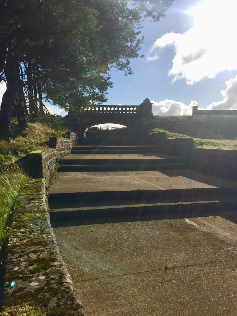
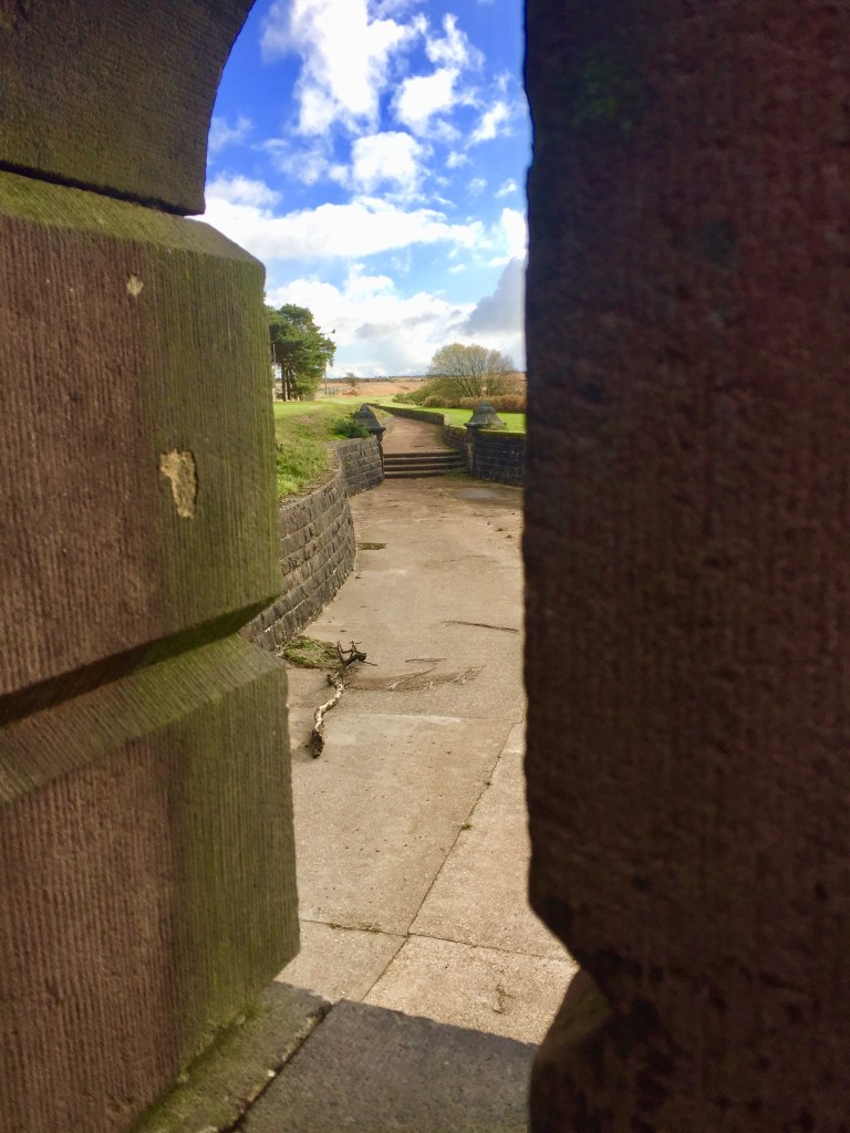
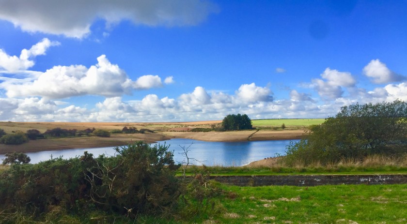
We past some derelict wooden huts, stood isolated in a vast empty space and followed the vanishing point of the road. Eventually we came across large sheds and a Victorian house converted into offices for Yorkshire Water. Opposite was the Reservoir, surrounded by ornate stone bridges, parapets and channels. We stood admiring the beautiful stonework, the hard work and thoughtfulness that had gone into creating such an environment, but where nobody really came. So typically Victorian. Today, it would be built quickly and efficiently with brutal concrete and total blandness.
Yorkshire Water offices at Scargill ReservoirJust love the the intricate detail on the bridge
We dropped down into a wooded valley, where The Dog got rather excited as a grouse leapt out of the undergrowth, startling her and not doing much for us either. She went straight into pheasant alert and pounced into the bracken, flushing out more birds. Luckily she was on her lead and didn’t get very far, but her ears were pricked and her nose was firmly sniffing the ground as she excitedly zigzagged across the path.
Finally, a barred gate with stern warnings of “No Public Access” made us turn right and up through a sheep field, where The Dog tried to round up the grazing sheep, but again thwarted by her leash. We wandered through a farm yard, down a lane and across a cow field. Another pretty footpath through woodland and past the Beaver Dyke Reservoir and further along to the smaller John of Gaunt Reservoir.
We wandered up another field and then got a little bit lost. A clearly marked footpath would lead us further away from the car and a lengthy road walk which we didn’t fancy. We tried to find another path, but it seemed to go through a bog. We did contemplate crossing a field and hoping to get out the other side, but there was no guarantee of a gate to clamber over. Reluctantly we turned around and retraced our steps the way we came. It was pleasant to see the walk the other way round.
Wind turbines high on the hillScargill Reservoir on our return
As we walked up the long track back to the road, we admired the huge skies with amazing clouds. Huge billowing clouds, building up tall with anvil tops. They hung over the North York Moors, disgorging rain. Above us, the skies are deep blue, but with their own grey/white clouds as far as you can see and a dark threatening one hung over Leeds.
Big skies over YorkshireThe “golf balls” of Menwith Surveillance Station
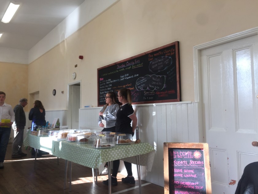
We get back to the car. It’s past 2pm and our stomachs are letting us know that we have failed to nourish them. With nothing tempting back home, we decided to seek out food. Then we had a lightbulb moment. Near Swinsty Reservoir, there’s a little village hall which opens its doors occasionally and has coffee mornings. So we drive a couple of miles to the Fewston Parochial Hall, hoping it would be open. To our delight, it was, but everybody else had the same idea as us and it looked busy. We abandoned the car on the lane and wandered up. We had been to this place before after stumbling across it one day while walking around Swinsty a few years ago. We went inside – it was heaving -and dithered as the choice was quite extensive considering it was just the locals homebaking from a small kitchen. Eventually we chose jacket potato with beans which, when it arrived was adorned with crisps and a little salad which was fresh (how many times has a salad appeared as a side and looked like an afterthought?). We washed it down with a cuppa, as young teenaged boys wearing ties, delivered the food and fussed over our well being. We shared the trestle table with another couple, who nodded their appreciation of the food. The cakes were particularly inviting and needed to be tasted, so a huge chunk of lemon drizzle cake (made that very morning by a woman who arrived from holiday in early hours and had sacrificed her extra hours with the clocks going back to bake it) and a generous slab of marble cake was ordered and consumed with relish.
Fewston Parochial Hall turned into a cafe for the day.
Apparently, as we found out, the Hall is turned into a cafe every last Sunday of the month. The hall seems to sit on its own on a hill with lovely views across to Swinsty, surrounded by scattered cottages and the little hamlet of Fewston. It’s just wonderful – proceeds go to local charities and organisations, and the local people prepare all the food, the youngsters run the front of house and its very popular. Simple plain, but delicious food served in a English village hall. Just so quintessentially British. Just love it.
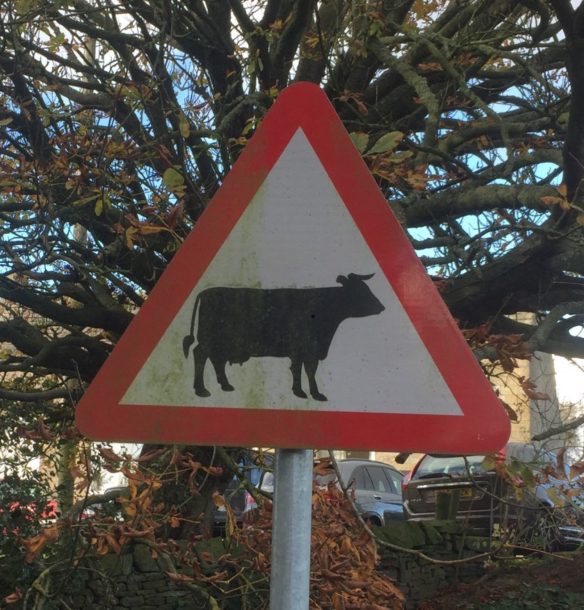
And as we waddled back to the car, our bellies more than satisfied, I spotted this road sign. I don’t why I took a photo of it, but I just love the detail of the cow – the inclusion of both horns and udders. It’s just brilliant, a little bit of that Victorian detail and thoughtfulness on a modern invention. That just made me smile.
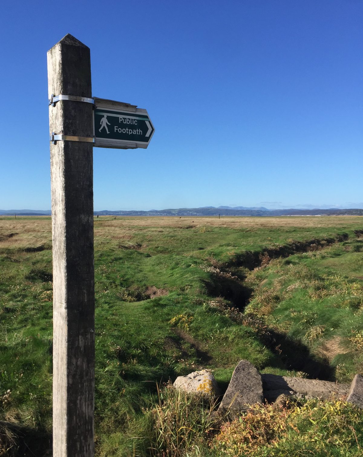
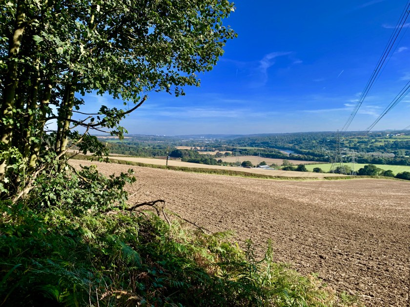



 We carried on along the road, admiring the smart offices that had been converted from an old mill or warehouse. It was nice to see an old building looked after so well. Then we took another path right and dropped onto the disused railway line and wandered along the deep cutting. The railway line was built in 1876 between Hincaster and Arnside to serve the industry there, but lasted less than 70 years. The effort to blast their way through solid rock and to build towering bridges to lay a railway line was incredible. It seemed they had no choice, as there was no room on the shoreline for another transport system. If they had known it would only last 70 years, they probably wouldn’t of bothered, but we had the pleasure of marvelling at their work, especially the bridges spanning across the line – as usual beautiful stone work and lined with engineering bricks in a herring bone, they’re a work of art themselves. Today, a prefabricated concrete span would be installed within days, totally at odds with its surroundings. I was pleased that these architectural treasures remain.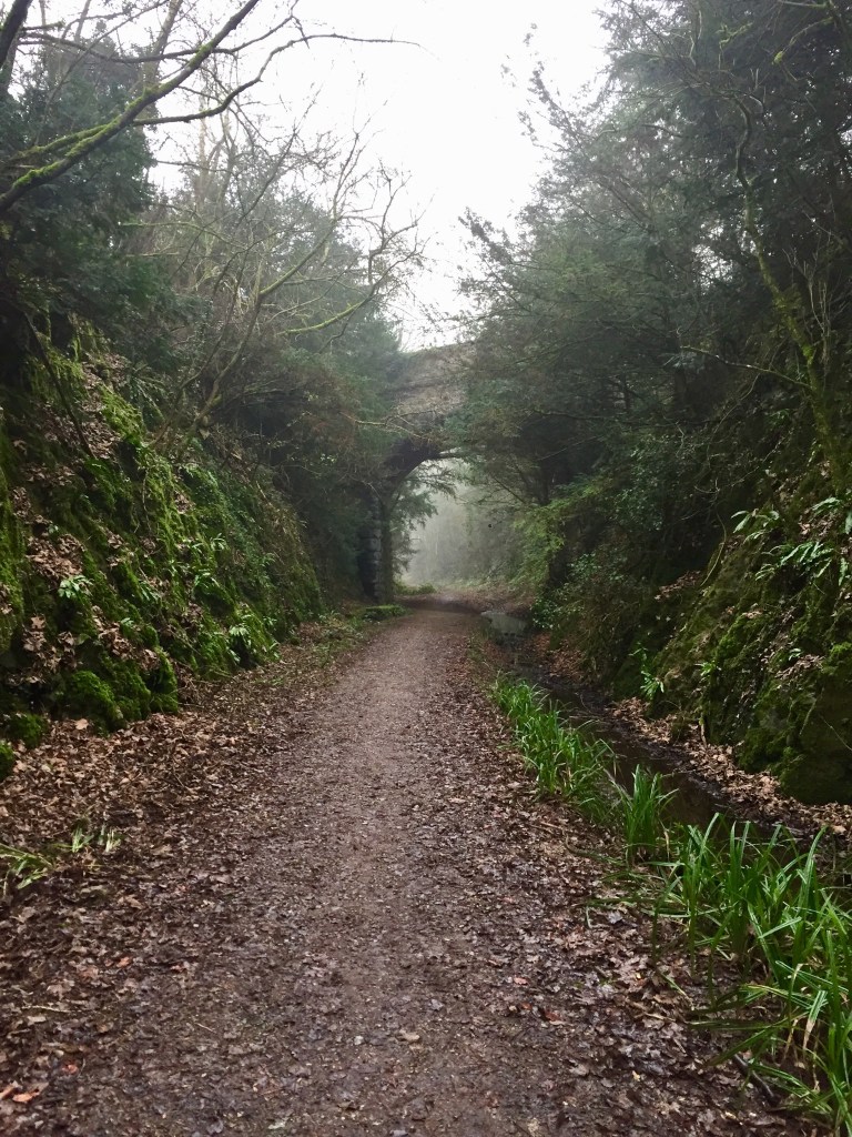

 o
o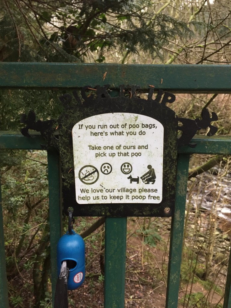







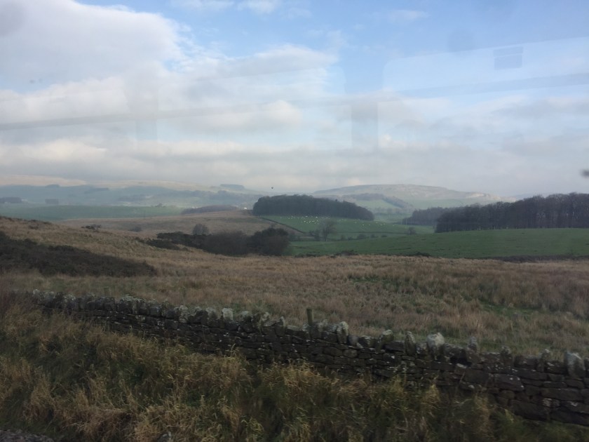
 Now we’re out in proper countryside, all rolling hills, farms and pretty villages. The train has developed an inexplicable draught so now I have one very chilly leg. I’ll be glad to get off this wretched train. Not the best.








 apathtosomewhere